Guest, Sign inJoin

Post to Portersville

We’ll email a one-tap link to publish your post. No password, and nothing is public until you click it.
Already a member? Sign in
–Not graded
History · Portersville

Portersville’s post office opened in 1826, and 24% of its homes were built before 1940

Below: 2 old photos and papers, maps from 1908 on, and the census since 1850.

1826first post office
0on the National Register
24%homes built before 1940
2old photos & papers
From Portersville’s archive · credits on each photo
Quick answers

How Portersville began

When was Portersville founded?

1826

The Portersville post office opened in 1826, the earliest record of the town by name.

First census: 240 in 18502020 census: 231200 years
Founding year: the first Portersville post office (Blevins & Helbock, CC0).The full story ↓

What stands out about Portersville’s past

Read from the archive, the National Register and the record. The page puts what stands out first.

★ What stands out · Help out

Start Portersville’s collection

The first neighbors to add old photos shape how Portersville’s history is told.

Decades since 1900 with photos
00s10s20s30s40s50s60s70s80s90s
1 of 10 decades. The empty ones are waiting for someone’s album.
People over time

Portersville, census by census

01002003001850190019502000Peak: 344

Peaked at 344 in 1960; 231 people lived here in 2020.

17 censuses, 1850–2020.

U.S. Census Bureau decennial counts, from the census table on Portersville’s Wikipedia page.

On the map

Portersville on the map, 1908 to 1990

Every edition of the U.S. Geological Survey’s map of Portersville. Tap a year, or press play to watch the town change.

Portersville on the 1908 USGS mapPortersville on the 1910 USGS mapPortersville on the 1961 USGS mapPortersville on the 1970 USGS mapPortersville on the 1990 USGS map1908Zelienople sheet · 1:62,500

U.S. Geological Survey historical topographic maps (public domain), via Esri’s collection of the scans. The red ring marks the center of Portersville.

The story

How Portersville came to be

From Wikipedia’s history of Portersville.

Read it all →

The area that would become Portersville was originally settled in the early 19th century as part of Muddy Creek Township in Butler County, Pennsylvania.

The first recorded village name was Stewartsville, likely named after the first settler, Robert S. Stewart, who arrived in 1796. His son, Robert Stewart, was born in the village on September 15, 1808. Robert Stewart would later lay out the land in 1828, when several settlers constituted the borough, including Thomas Christy, James Stewart, John Stewart, Thomas Brandon, Dr. Cowden, James Cowden, and Robert Craig with their families.

Text from Wikipedia, licensed CC BY-SA 4.0.

From the old history books

What they wrote about Portersville, 1895–1927

Passages that mention Portersville, cut from the printed page as they were published.

Portersville, in Muddycreek Township, was made a post office in March, 1826. Robert Stewart was the first settler in this place, coming in 1796. In 1814, enterprising men began to look for business sites, and that year Thompson McCosh opened his cabinet making shop here. The first merchant was Robe…
History of Butler County Pennsylvania1927 · page 564Read the page →
Read the text

Portersville, in Muddycreek Township, was made a post office in March, 1826. Robert Stewart was the first settler in this place, coming in 1796. In 1814, enterprising men began to look for business sites, and that year Thompson McCosh opened his cabinet making shop here. The first merchant was Robert Craig, who established a store here in 1829. In 1831, John W. Riddle started a wagon and furniture factory, utilizing steam as power. Portersville was incorporated as a borough December 16, 1844, and re-named in honor of

Text read by machine from the scan; it may contain errors.
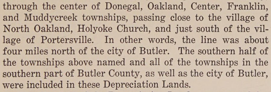
through the center of Donegal, Oakland, Center, Franklin, and Muddycreek townships, passing close to the village of North Oakland, Holyoke Church, and just south of the village of Portersville. In other words, the line was about four miles north of the city of Butler. The southern half of the towns…
History of Butler County Pennsylvania1927 · page 259Read the page →
Read the text

through the center of Donegal, Oakland, Center, Franklin, and Muddycreek townships, passing close to the village of North Oakland, Holyoke Church, and just south of the village of Portersville. In other words, the line was about four miles north of the city of Butler. The southern half of the townships above named and all of the townships in the southern part of Butler County, as well as the city of Butler, were included in these Depreciation Lands.

Text read by machine from the scan; it may contain errors.
terians of this vicinity. A quarter of a century elapsed, however, before a resident pastor was appointed. Rev. Thomas Ilanna came in 1858, but four years alter joined the United Presbyterian church. Rev. J. C. Smith, who was installed in 1863, remained until 1890, or five years alter the society a…
History of Butler County, Pennsylvania.1895 · page 608Read the page →
Read the text

terians of this vicinity. A quarter of a century elapsed, however, before a resident pastor was appointed. Rev. Thomas Ilanna came in 1858, but four years alter joined the United Presbyterian church. Rev. J. C. Smith, who was installed in 1863, remained until 1890, or five years alter the society at Portersville disbanded. When Mr. Ilanna came, the old building formerly occupied by the Seceder church was purchased and dedicated by the Covenanters. A. F. Kennedy was then, as he still is, the clerk of the session, while he, with Joseph Kennedy, Matthew Stewart, Thomas 1 Hair, Thomas Spear. John Love and Thomas Wilson,

Text read by machine from the scan; it may contain errors.

Scans and text from the Internet Archive. Books published in 1930 or earlier, which are in the public domain.

Timeline

Portersville, 1826 to 1960

Woven from the archive, old maps, post office records, the National Register and the people born here.

  1. 19th century
  2. 1826Post officeThe Portersville post office opens
  3. 1880In the archive1940 Census Enumeration District Maps - Pennsylvania - Butler County - Muddycreek - ED 10…
  4. 20th century
  5. 1908On the mapFirst mapped by the U.S. Geological Survey
  6. 1923In the archivePortersville PA United Presby PHS506
  7. 1960CensusPopulation peaks at 344
By decade

Portersville, decade by decade

2 decades in the archive, from the 1880s to the 1920s. Scroll each row; tap a photo for its story.

1890s–1910snothing yet
Nothing in the archives for these yearsWeddings on Main Street, storms, parades, school pictures, the old store. If it’s in your family album, it belongs here.
Add from your album
1930s–1990snothing yet
Nothing in the archives for these yearsWeddings on Main Street, storms, parades, school pictures, the old store. If it’s in your family album, it belongs here.
Add from your album
Then & now

Stand where they stood

No then-and-now pairs yet. Take a photo from the same spot as an old one and they appear here side by side.

1940 Census Enumeration District Maps - Pennsylvania - Butler County - Muddycreek - ED 10-68
Retake this view1940 Census Enumeration District Maps - Pennsylvania - Butler County - Muddycreek - ED 10-68, 1880

Find the spot, match the angle, and add your photo. It becomes the first then-and-now pair on Portersville’s page.

Retake this view · +15
Famous people

Famous people close to Portersville

Nobody well known was born in Portersville itself, so here are the best known from just nearby.

See all →

Questions about Portersville’s history

What year was Portersville founded?

The Portersville post office opened in 1826, the earliest record of the town by name (U.S. post office records).

Memory lane

What the archives can’t tell you, neighbors can.

Town Square →
Start a conversation
Sources

Where this page comes from

Founding dates: Wikidata, Wikipedia, the U.S. post office records of Blevins & Helbock (CC0) and the Census. Homes by year built: Census ACS 2020–24. National Register of Historic Places: National Park Service (list of May 22, 2026). Old photos, postcards and papers: Wikimedia Commons, the Library of Congress and other public archives, credited on each item’s page. Maps: U.S. Geological Survey historical topographic maps (via Esri) and Sanborn fire-insurance maps (Library of Congress). History text and census tables: Wikipedia (CC BY-SA 4.0). Places that used to be: USGS Geographic Names Information System (2021). How TownRatings grades history →

From Wikimedia Commons (6), Wikipedia, U.S. Geological Survey historical maps, U.S. Census counts (via Wikipedia), the US Post Offices dataset (Blevins & Helbock), the USGS Geographic Names Information System and old county and town histories (Internet Archive). Archive images are copied here with their credits and licenses, shown on each photo’s page. Refreshed monthly.