OhiopylePA
A town of 36, settled in 1868.
Is Ohiopyle a good place to live?
24% of residents live below the poverty line in Ohiopyle, against 7.6% in Pennsylvania’s towns and 9.6% across U.S. towns. No town among the 1,036 in Pennsylvania we compare has a higher median age than Ohiopyle. 94% of the land in Ohiopyle is conserved, above both Pennsylvania’s towns (8.2%) and U.S. towns (4.3%). The biggest place to walk is Ohiopyle State Park, 298 acres with 1.9 miles of trail. Ohiopyle has fewer than 1,000 residents, too few for fair grades; the figures below are still real.
36 people, and everyone knows the way
In a town this size, neighbors are the best guide. Ask them anything.
Fallingwater and 17 more within 40 miles
Museums, parks, gardens and other places to visit around Ohiopyle. Close and well known come first.
 Big draw3 mi MuseumFallingwater
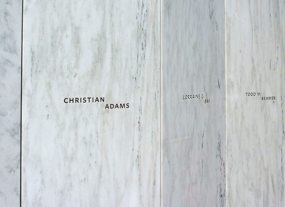 Big draw33 mi National MemorialFlight 93 National Memorial286K visitors a year
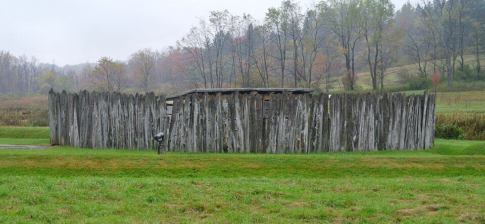 6 mi National BattlefieldFort Necessity National Battlefield226K visitors a year
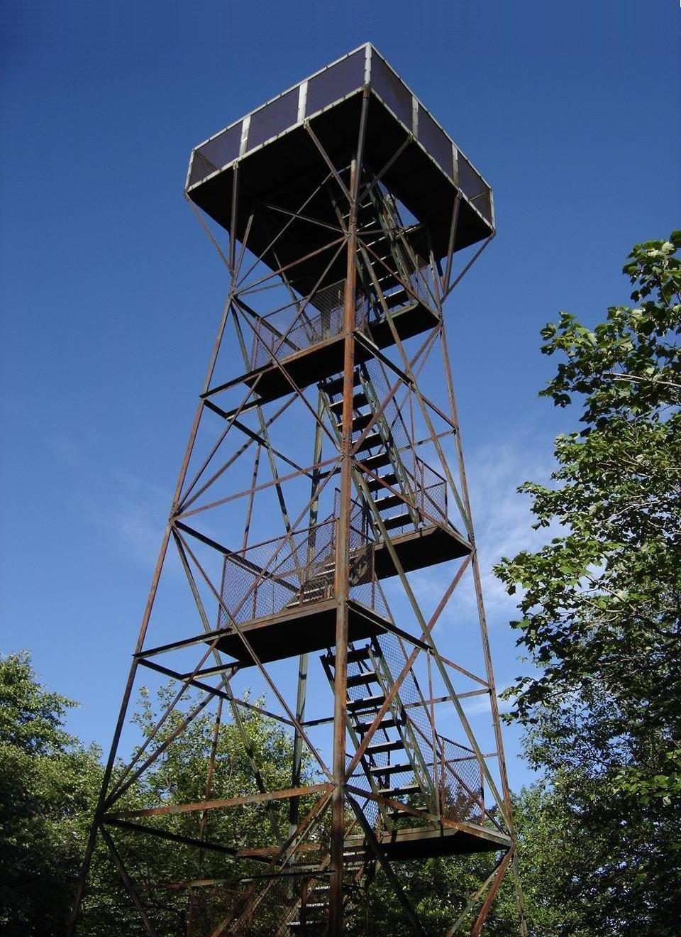 18 mi MountainMount Davis
 29 mi Stadium & arenaMountaineer Field at Milan Puskar Stadium
 25 mi LakeDeep Creek Lake
Photo credits
Fallingwater: Carol M. Highsmith, Public domain · Flight 93 National Memorial: James Steakley, CC BY-SA 3.0 · Fort Necessity National Battlefield: Wilson44691, CC0 · Mount Davis: Wikiuser100, CC BY-SA 3.0 · Mountaineer Field at Milan Puskar Stadium: Quintin Soloviev, CC BY 4.0 · Deep Creek Lake: Gohens84, CC BY-SA 3.0


Moving to Ohiopyle: who provides what
Who provides power, water and the rest in Ohiopyle, and how to reach them.
EPA SDWIS (Oct 9, 2026) · HIFLD + EIA-861 2025 · Census 2020 ZCTAs · NCES 2024–25 · registration: vote.gov, updated Nov 18, 2024.
The data
Ordered by what stands out in Ohiopyle.
In Ohiopyle, trail density runs higher than in the typical Pennsylvania or U.S. town
Across 3 parks and preserves: 5.0 miles of trail.
| Biggest places to walk | Trails | Acres |
|---|---|---|
| 1. Ferncliff Peninsula Natural Area | 3 mi | 113 |
| 2. Ohiopyle State Park | 1.9 mi | 298 |
| 3. Stewart on the Green | — | 1 |
Trails & parks © OpenStreetMap contributors · Conserved land: USGS PAD-US
Ohiopyle has a low natural-hazard risk, chiefly from inland flooding
Ohiopyle’s natural-hazard score from FEMA is 26 of 100. Of the losses FEMA expects here, 86% come from inland flooding and 5% from tornadoes. Expected storm and flood damage is lower than in nearly three quarters of U.S. communities.
FEMA National Risk Index · OpenFEMA
In Ohiopyle, expect snowy winters and pleasant summers
In July, afternoons reach 82°; in January, nights fall to 20°, and about 61 inches of snow falls in a winter.
Typical low → high °F
NOAA U.S. Climate Normals, 1991–2020
How healthy Ohiopyle is
23% of Ohiopyle adults say their health is fair or poor. CDC measures, 26 in all: Ohiopyle beats Pennsylvania on 1 and trails on 11. In Ohiopyle, 16% of adults report frequent physical distress, and 39% have high blood pressure.
| Ohiopyle | Pennsylvania towns | U.S. towns | |
|---|---|---|---|
| Smoke cigarettes (CDC PLACES) | 20% | 17% | 14% |
| Frequent physical distress (CDC PLACES) | 16% | 14% | 14% |
| High blood pressure (CDC PLACES) | 39% | 34% | 35% |
| Diabetes (CDC PLACES) | 14% | 11% | 12% |
| What stands out | Ohiopyle | PA |
|---|---|---|
| More adults treating high blood pressure | 82.8% | 79.2% |
| More adults with COPD | 11.3% | 7.7% |
CDC PLACES 2025 · modeled estimates for adults · CMS · HRSA
Everything we know about Ohiopyle
Colleges nearby
1 within 15 miles of the center of Ohiopyle
College town 24 of every 100 Ohiopyle residents are enrolled in college, against 6 across Pennsylvania.
5 miles of trails in Ohiopyle
94.3% of the town is conserved land, across 3 parks and preserves.
About Ohiopyle
Borough in Pennsylvania, United States
Ohiopyle is a borough in Fayette County, Pennsylvania, United States. The population was 38 at the 2020 census. While Ohiopyle has a tiny year-round population, it is often filled with tourists on the weekend, who come for the outdoor recreation opportunities at the surrounding Ohiopyle State Park, as well as the Great Allegheny Passage bicycle trail, which connects with the Chesapeake and Ohio Canal towpath trail to form a continuous 335-mile off-road trail from Pittsburgh, Pennsylvania, to Washington, D.C. The borough of Ohiopyle is served by the Uniontown Area School District.
From Wikipedia, licensed CC BY-SA 4.0 · facts via Wikidata (CC0)
- Established
- 1868
- Area
- 0.5 sq mi
- Elevation
- 1,217 ft
- ZIP code
- 15470
Questions about Ohiopyle
Short answers, built from the data on this page.
Is Ohiopyle, PA a good place to live?
Ohiopyle has fewer than 1,000 residents, too few for fair grades; the figures below are still real.