Newtown dates to 1684, and 59% of its homes were built before 1940
Among the most historic 1% of U.S. towns. What drives it
3 places in town are on the National Register, among them a historic district with 393 buildings. Below: 6 old photos and papers, maps from 1909 on, and the census since 1850.
Founding year: Wikidata; Wikipedia’s history section gives the same year.The full story ↓
History grade
What drives Newtown’s History grade
On its age, its old homes and the National Register, Newtown is among the most historic 1% of U.S. towns. All 3 inputs put Newtown near the top nationally; its share of homes from before 1940 ranks highest.
A+
HistoryA character grade: shown, never part of Newtown’s overall grade.
Pennsylvania towns list about as much on the Register as the country (a typical Pennsylvania town has 2.1 per 10,000 residents, the U.S. 2.4), so Newtown’s 1,879 sits above most of its state (99% of Pennsylvania towns have fewer) while its 418 historic buildings outnumber those of 97% of U.S. towns.
How sure. Graded on any two of the three inputs instead, the letter would still be A+. The pre-1940 share is a Census survey estimate (±7.9 points). Two sources give 1684.
Founding year: Wikidata (other dates in Quick answers). Homes: Census ACS 2020–24. National Register: National Park Service, May 2026 list; each listing counted once (boundary changes and added documentation belong to their listing), and a historic district counts its contributing buildings. How TownRatings grades history →
What stands out about Newtown’s past
Read from the archive, the National Register and the record. The page puts what stands out first.
Newtown was founded by William Penn in 1684. Newtown was one of several towns that William Penn organized around Philadelphia to provide country homes for city residents and to support farming communities.
It was the county seat of Bucks County, Pennsylvania, from 1726 until 1813, when it was replaced by a more central Doylestown. After his December 26, 1776, morning march to Trenton, and before the Battle of Princeton, Continental Army commander-in-chief George Washington made his headquarters in Newtown.
Passages that mention Newtown, cut from the printed page as they were published.
The history of Bucks County, Pennsylvania1876 · page 248Read the page →
Read the text
Newtown was incorporated in 1838. There have been several newspapers printed there during the present century, but none earlier. Among these were the Bucks County Bee, in 1802, Farmers' Gazette and Backs County liegister, in 1805, The Star of Freedom, 1S17, Newtown Journal, 1842, Newtown Gazette, 1857, and the Newtown Enterprise, in 1868, the youngest, and only living of all the newspapers established there, the others having gone, one by one, to that undiscovered country, the last resting-place of de-
Text read by machine from the scan; it may contain errors.
The history of Bucks County, Pennsylvania1876 · page 674Read the page →
Read the text
Newtown, John Hough, who owned a considerable tract of land about the Turk, laid out the plan of a town, and offered it for the seat of justice. The plat extended north from the Turk tavern to the head of the mill-pond, with squares laid out on each side of the Easton road, with intersecting streets every few hundred feet, one crossing the mill-race just below the breast of the dam and running toward Newtown. Sites for the "court," "office," and "gaol" are marked on the ridge near Thomas Doyle's house, the first two on the
Text read by machine from the scan; it may contain errors.
Scans and text from the Internet Archive. Books published in 1930 or earlier, which are in the public domain.
By decade
Newtown, decade by decade
3 decades in the archive, from the 1880s to the 1900s. Scroll each row; tap a photo for its story.
Nothing in the archives for these yearsWeddings on Main Street, storms, parades, school pictures, the old store. If it’s in your family album, it belongs here.
Every edition of the U.S. Geological Survey’s map of Newtown. Tap a year, or press play to watch the town change.
1944Langhorne sheet · 1:24,000
U.S. Geological Survey historical topographic maps (public domain), via Esri’s collection of the scans. The red ring marks the center of Newtown.
Every building
Newtown, building by building, 1909–1915
Fire insurance maps drew every building, what it was made of and what it was used for, so insurers could price the risk of fire. Pick a year, then a sheet.
In 1684, according to Wikidata and Wikipedia’s history of the town. the census of 1850 counted 580 people here.
How does Newtown rank for history?
Newtown is among the most historic 1% of U.S. towns. The History grade combines the town’s founding era, the share of homes built before 1940 and its National Register listings. It’s a character grade, so it isn’t part of the overall grade. How it works.
What is on the National Register in Newtown?
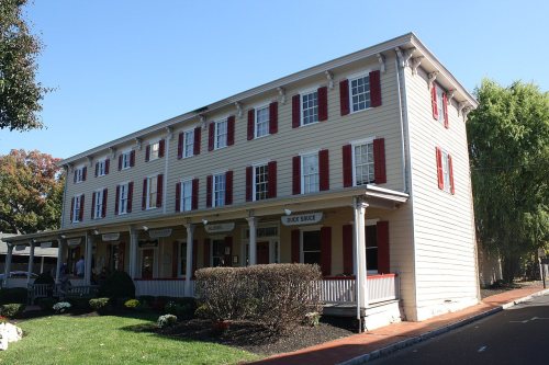
Three places: the Newtown Friends Meetinghouse and Cemetery (listed 1977), the Half-Moon Inn (1977) and the Newtown Historic District (1979).
How old are the homes in Newtown?
59% of Newtown’s homes were built before 1940 (Census estimate, ±7.9 points), against a typical 18% for a Pennsylvania town; the median home was built in 1938.
Founding dates: Wikidata, Wikipedia, the U.S. post office records of Blevins & Helbock (CC0) and the Census. Homes by year built: Census ACS 2020–24. National Register of Historic Places: National Park Service (list of May 22, 2026). Old photos, postcards and papers: Wikimedia Commons, the Library of Congress and other public archives, credited on each item’s page. Maps: U.S. Geological Survey historical topographic maps (via Esri) and Sanborn fire-insurance maps (Library of Congress). History text and census tables: Wikipedia (CC BY-SA 4.0). Places that used to be: USGS Geographic Names Information System (2021).
From Wikimedia Commons (6), the National Register of Historic Places (3), Wikipedia, Wikidata and Wikipedia for famous people, U.S. Geological Survey historical maps, U.S. Census counts (via Wikipedia), the USGS Geographic Names Information System, Sanborn fire insurance maps (Library of Congress) and old county and town histories (Internet Archive). Archive images are copied here with their credits and licenses, shown on each photo’s page. Refreshed monthly.




 1892
 1893
 1893


