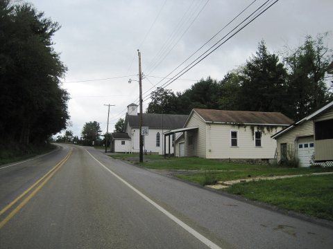
Photo: Mr. Matté (if there is an issue with this image, contact me using this image's Commons talk page, my Commons user talk page, or my English Wikipedia user talk page; I'll know about it a lot faster) · CC BY-SA 4.0
Quick answers
How Newburg began
When was Newburg founded?
1880
Newburg first appears in the census in 1880.
First census: 184 in 18802020 census: 82146 years
Founding year: the first census.
What stands out about Newburg’s past
Read from the archive, the National Register and the record. The page puts what stands out first.
Peaked at 354 in 1890; 82 people lived here in 2020.
15 censuses, 1880–2020.
U.S. Census Bureau decennial counts, from the census table on Newburg’s Wikipedia page.
On the map
Newburg on the map, 1903 to 1971
Every edition of the U.S. Geological Survey’s map of Newburg. Tap a year, or press play to watch the town change.
1903Curwensville sheet · 1:62,500
U.S. Geological Survey historical topographic maps (public domain), via Esri’s collection of the scans. The red ring marks the center of Newburg.
The story so far
Newburg, in brief
Wikipedia doesn’t have a history of Newburg yet. The photos, dates and memories neighbors add here are how it gets written.
Newburg (also known as La Jose) is a borough in Clearfield County, Pennsylvania, United States. The population was 82 at the 2020 census.
Its first post office opened in 1880. Between the 2010 and 2020 censuses its population fell from 92 to 82 (-11%).
Intro from Wikipedia. Population: U.S. Census Bureau.
From the old history books
What they wrote about Newburg in 1887
Passages that mention Newburg, cut from the printed page as they were published.
History of Clearfield County, Pennsylvania1887 · page 498Read the page →
Read the text
Clearfield county, to Punxsutawney, in Jefferson county, by the Clearfield and Jefferson Railroad Company, the first railroad was constructed in Chest township in 1887. It passes through the extreme northern end of the township, and at the village of Newburg, one of the old towns of the township, has sprung up a flourishing town. From the southern boundary, through the whole length of the township, and to the northwestern corner flows Chest Creek, which has its source in Clearfield township, Cambria county. Situated on this creek were some of the oldest lumber camps in the county. The creek
Text read by machine from the scan; it may contain errors.
History of Clearfield County Pennsylvania1887 · page 498Read the page →
Read the text
Clearfield county, to Punxsutawney, in Jefferson county, by the Clearfield and Jefferson Railroad Company, the first railroad was constructed in Chest township in 1887. It passes through the extreme northern end of the township, and at the village of Newburg, one of the old towns of the township, has sprung up a flourishing town. From the southern boundary, through the whole length of the township, and to the northwestern corner flows Chest Creek, which has its source in Clearfield township, Cambria county. Situated on this creek were some of the oldest lumber camps in the county. The creek
Text read by machine from the scan; it may contain errors.
History of Clearfield County, Pennsylvania1887 · page 104Read the page →
Read the text
(1880) constructed into the upper part of this county, near the line between Geulich and Beccaria ; thence generally northwest, touching Utahville ; thence west to Coalport and northwest to Irvona. A further extension was made in 1886, from Irvona by way of Whitmer and Wilson Runs to Newburg, and thence down Chest Creek to its mouth at Mahafifey. A further extension, to be known as the Clearfield and Jefferson Railroad, is to be made in the near future. It will extend from Mahaffey up the West Branch and across to Punxsutawney, in Jefferson county, tapping the rich coal and coke country in
Text read by machine from the scan; it may contain errors.
History of Clearfield County Pennsylvania1887 · page 104Read the page →
Read the text
(1880) constructed into the upper part of this county, near the line between Geulich and Beccaria; thence generally northwest, touching Utahville; thence west to Coalport and northwest to Irvona. A further extension was made in 1886, from Irvona by way of Whitmer and Wilson Runs to Newburg, and thence down Chest Creek to its mouth at Mahaffey. A further extension, to be known as the Clearfield and Jefferson Railroad, is to be made in the near future. It will extend from Mahaffey up the West Branch and across to Punxsutawney, in Jefferson county, tapping the rich coal and coke country in
Text read by machine from the scan; it may contain errors.
Scans and text from the Internet Archive. Books published in 1930 or earlier, which are in the public domain.
Timeline
Newburg, 1887 to 1903
Woven from the archive, old maps, post office records, the National Register and the people born here.
Founding dates: Wikidata, Wikipedia, the U.S. post office records of Blevins & Helbock (CC0) and the Census. Homes by year built: Census ACS 2020–24. National Register of Historic Places: National Park Service (list of May 22, 2026). Old photos, postcards and papers: Wikimedia Commons, the Library of Congress and other public archives, credited on each item’s page. Maps: U.S. Geological Survey historical topographic maps (via Esri) and Sanborn fire-insurance maps (Library of Congress). History text and census tables: Wikipedia (CC BY-SA 4.0). Places that used to be: USGS Geographic Names Information System (2021). How TownRatings grades history →
From Wikimedia Commons (7), U.S. Geological Survey historical maps, U.S. Census counts (via Wikipedia), the US Post Offices dataset (Blevins & Helbock), the USGS Geographic Names Information System and old county and town histories (Internet Archive). Archive images are copied here with their credits and licenses, shown on each photo’s page. Refreshed monthly.


 2024
 2024
 2024
 2024
 2024
 2024
 2024


