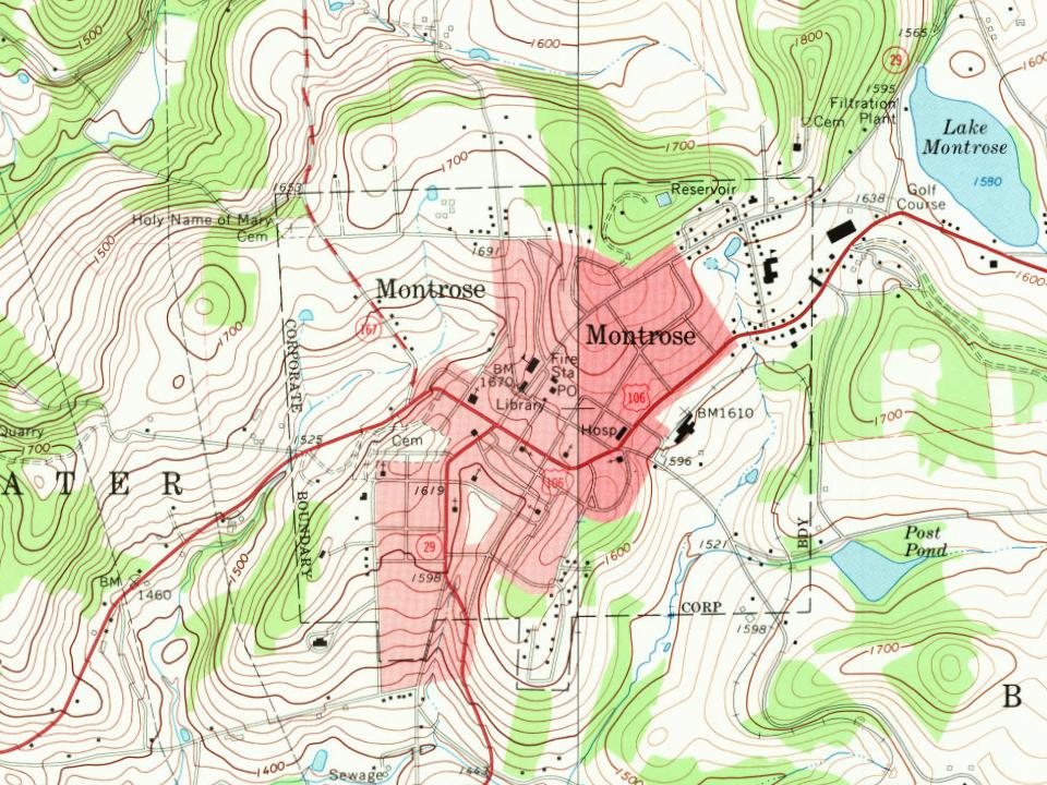
Montrose dates to 1812, and 50% of its homes were built before 1940
Among the most historic 1% of U.S. towns. What drives it
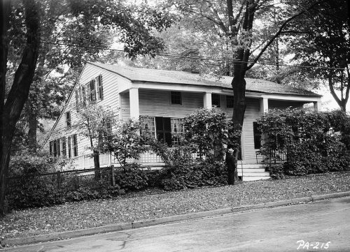
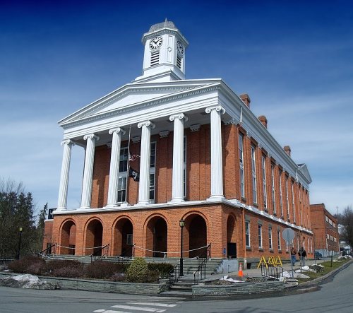
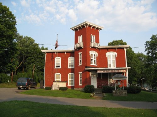
4 places in town are on the National Register, among them a historic district with 384 buildings. Below: 3 old photos and papers, maps from 1943 on, and the census since 1830.
Founding year: Wikidata. First post office: 1818.The full story ↓
History grade
What drives Montrose’s History grade
On its age, its old homes and the National Register, Montrose is among the most historic 1% of U.S. towns. All 3 inputs are above most U.S. towns; its share of homes from before 1940 ranks highest and its age lowest.
A+
HistoryA character grade: shown, never part of Montrose’s overall grade.
Pennsylvania towns list about as much on the Register as the country (a typical Pennsylvania town has 2.1 per 10,000 residents, the U.S. 2.4), so Montrose’s 2,579 sits above most of its state (100% of Pennsylvania towns have fewer) while its 390 historic buildings outnumber those of 96% of U.S. towns.
How sure. Graded on any two of the three inputs instead, the letter would still be A+. The pre-1940 share is a Census survey estimate (±9.7 points). Two sources give 1812.
Founding year: Wikidata (other dates in Quick answers). Homes: Census ACS 2020–24. National Register: National Park Service, May 2026 list; each listing counted once (boundary changes and added documentation belong to their listing), and a historic district counts its contributing buildings. How TownRatings grades history →
What stands out about Montrose’s past
Read from the archive, the National Register and the record. The page puts what stands out first.
Montrose was laid out in 1812 in an area of Pennsylvania historically associated with the Indigenous Susquehannock people. The first non-Indigenous settler in 1800 was a Revolutionary War officer, Captain Bartlett Hinds, who traveled from Long Island, NY with his stepson, Isaac Post. Upon seeing the area's natural beauty and potential, he returned to NY to bring his family to Pennsylvania. Among other settlers were the descendants of Sir Peter Warren, Knight Vice Admiral on England's Royal Fleet. Upon retirement, he was given the land by grateful American soldiers.
Passages that mention Montrose, cut from the printed page as they were published.
Centennial history of Susquehanna County, Pennsylvania1887 · page 59Read the page →
Read the text
Proposed Railroad Routes out of Montrose.— As early as 1868 the subject of an outlet from Montrose began to be agitated by leading citizens of the borough and county and men influential in railroad circles outside of the county. Judge Asa Packer, then president of the Lehigh Valley Railroad, proposed to the projectors of a railroad running from
Text read by machine from the scan; it may contain errors.
Centennial history of Susquehanna County, Pennsylvania1887 · page 60Read the page →
Read the text
the engineer, Felix Ansart, Jr., reported to the president that he had located, marked and determined a route for a railroad from Tunkhannock, in the county of "Wyoming, to Montrose, in the county of Susquehanna, the line running from the depot of the Pennsylvania and Xew York Canal and Railroad Company, at Tunkhannock, to Marcy's Pond, thence along the
Text read by machine from the scan; it may contain errors.
History of Susquehanna County, Pennsylvania1873 · page 310Read the page →
Read the text
The plank road, or its later substitute, has proved of immense service to East Bridgewater ; the farmers send over it large quantities of butter every season to Montrose Depot, for the New York markets. At its junction with the road to Brooklyn, the East Bridgewater post-office was established in 1868.
Text read by machine from the scan; it may contain errors.
History of Susquehanna County, Pennsylvania. from a period preceding its settlement to recent times, including the annals and geography of each township... Also a sketch of woman's work in the county for the United States sanitary commission, and a list o1873 · page 310Read the page →
Read the text
The plank road, or its later substitute, has proved of immense service to East Bridgewater ; the farmers send over it large quantities of butter every season to Montrose Depot, for the New York markets. At its junction with the road to Brooklyn, the East Bridgewater post-office was established in 1868.
Text read by machine from the scan; it may contain errors.
Scans and text from the Internet Archive. Books published in 1930 or earlier, which are in the public domain.
Timeline
Montrose, 1812 to 1960
Woven from the archive, old maps, post office records, the National Register and the people born here.
Nothing in the archives for these yearsWeddings on Main Street, storms, parades, school pictures, the old store. If it’s in your family album, it belongs here.
In 1812, according to Wikidata. Montrose’s post office opened in 1818, and the census of 1830 counted 415 people here.
How does Montrose rank for history?
Montrose is among the most historic 1% of U.S. towns. The History grade combines the town’s founding era, the share of homes built before 1940 and its National Register listings. It’s a character grade, so it isn’t part of the overall grade. How it works.
What is on the National Register in Montrose?
4 listings: 3 buildings, among them the Silver Lake Bank (listed 1975, the first), and 1 historic district, the Montrose Historic District, with 384 contributing buildings. 390 historic buildings in all.
How old are the homes in Montrose?
50% of Montrose’s homes were built before 1940 (Census estimate, ±9.7 points), against a typical 18% for a Pennsylvania town; the median home was built in 1938.
Founding dates: Wikidata, Wikipedia, the U.S. post office records of Blevins & Helbock (CC0) and the Census. Homes by year built: Census ACS 2020–24. National Register of Historic Places: National Park Service (list of May 22, 2026). Old photos, postcards and papers: Wikimedia Commons, the Library of Congress and other public archives, credited on each item’s page. Maps: U.S. Geological Survey historical topographic maps (via Esri) and Sanborn fire-insurance maps (Library of Congress). History text and census tables: Wikipedia (CC BY-SA 4.0). Places that used to be: USGS Geographic Names Information System (2021).
From Wikimedia Commons (4), Wikidata (1), the National Register of Historic Places (4), Wikipedia, Wikidata and Wikipedia for famous people, U.S. Geological Survey historical maps, U.S. Census counts (via Wikipedia), the US Post Offices dataset (Blevins & Helbock), the USGS Geographic Names Information System and old county and town histories (Internet Archive). Archive images are copied here with their credits and licenses, shown on each photo’s page. Refreshed monthly.




 1890
 2009