Founding year: Wikidata. First post office: 1830.The full story ↓
History grade
What drives Minersville’s History grade
On its age, its old homes and the National Register, Minersville is more historic than 77% of U.S. towns, #363 of 1,035 in Pennsylvania. Its share of homes from before 1940 holds the grade up; its National Register listings pull it down.
A−
HistoryA character grade: shown, never part of Minersville’s overall grade.
Pennsylvania towns list about as much on the Register as the country (a typical Pennsylvania town has 2.1 per 10,000 residents, the U.S. 2.4), so Minersville’s 0.0 sits below most of its state (25% of Pennsylvania towns have fewer) while its 0 listings outnumber those of 23% of U.S. towns.
NoteThe founding year comes from Wikidata alone; no second source gives 1783.
How sure. Graded on any two of the three inputs instead, the letter would range from B− to A+. The pre-1940 share is a Census survey estimate (±11.2 points).
Founding year: Wikidata (other dates in Quick answers). Homes: Census ACS 2020–24. National Register: National Park Service, May 2026 list; each listing counted once (boundary changes and added documentation belong to their listing), and a historic district counts its contributing buildings. How TownRatings grades history →
What stands out about Minersville’s past
Read from the archive, the National Register and the record. The page puts what stands out first.
In the year 1783, a settler by the name of Adolph Oliver Busch traveled through the valley between the Thomaston Mountains and the Gap Rocks. At this junction, several mountain streams converged where this settler built a log cabin and a sawmill on the west Branch of the Schuylkill River, just below the mouth of Wolf Creek. Shortly thereafter, he built a tavern on the South Side of the Sunbury Trail on the present site of the Saint Michael the Archangel Church.
miner in Schuylkill county, Pa., settling at the village of West West, near Minersville, was promoted to mine boss at the old North America mines near Pottsville, and in the early thirties began mining on his own account, being a successful operator until his death. Moving to Minersville in 1837, he acquired an interest in the Wadesville mines in that vicinity, and was later associated with others in the operation of a colliery at Beaver Meadow and the opening of a new one in Carbon county, where they founded the village of Jeanesville, located over the line in Luzerne county. For a few years ^Ir.
Text read by machine from the scan; it may contain errors.
History of Schuylkill County, Pennsylvania ... including a genealogical and biographical record of many families and persons in the county1907 · page 181Read the page →
Read the text
up the work of engineer in 1880 at the Ashland office of the Coal & Iron Company. He remained with that concern until November, 1892, and then was engaged as superintendent of the colliery of Leisenring & Co., of Minersville. His Minersville position he retained until April, 1894, and the following month assumed his present occupation with the Sheafer estate. His duties are many and varied, including the collecting of rentals, the building, repairing and leasing of houses and making surveys of the collieries
Text read by machine from the scan; it may contain errors.
KEAR. Shortly after the incorporation of Minersville, Schuylkill county, which took place in 1831, the Kears became established in the village, attracted hither by the mines. They emigrated from South Wales, where they had been engaged in mining, the brothers William and Richard Kear arriving first, and their father soon afterwards. Beginning as mine workers, they had the qualifications of experience and industry which soon drew them into the operation of coal workings on their own account, and from that period until the middle seventies, when the Philadelphia & Reading Coal
Text read by machine from the scan; it may contain errors.
Scans and text from the Internet Archive. Books published in 1930 or earlier, which are in the public domain.
Timeline
Minersville, 1783 to 1930
Woven from the archive, old maps, post office records, the National Register and the people born here.
Nothing in the archives for these yearsWeddings on Main Street, storms, parades, school pictures, the old store. If it’s in your family album, it belongs here.
In 1783, according to Wikidata. Minersville’s post office opened in 1830, and the census of 1840 counted 1,265 people here.
How does Minersville rank for history?
Minersville is more historic than 77% of U.S. towns, #363 of 1,035 in Pennsylvania. The History grade combines the town’s founding era, the share of homes built before 1940 and its National Register listings. It’s a character grade, so it isn’t part of the overall grade. How it works.
How old are the homes in Minersville?
60% of Minersville’s homes were built before 1940 (Census estimate, ±11.2 points), against a typical 18% for a Pennsylvania town; the median home was built in 1938.
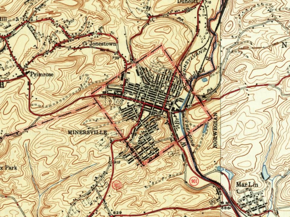
Founding dates: Wikidata, Wikipedia, the U.S. post office records of Blevins & Helbock (CC0) and the Census. Homes by year built: Census ACS 2020–24. National Register of Historic Places: National Park Service (list of May 22, 2026). Old photos, postcards and papers: Wikimedia Commons, the Library of Congress and other public archives, credited on each item’s page. Maps: U.S. Geological Survey historical topographic maps (via Esri) and Sanborn fire-insurance maps (Library of Congress). History text and census tables: Wikipedia (CC BY-SA 4.0). Places that used to be: USGS Geographic Names Information System (2021).
From Wikimedia Commons (12), Wikipedia, Wikidata and Wikipedia for famous people, U.S. Geological Survey historical maps, U.S. Census counts (via Wikipedia), the US Post Offices dataset (Blevins & Helbock), the USGS Geographic Names Information System and old county and town histories (Internet Archive). Archive images are copied here with their credits and licenses, shown on each photo’s page. Refreshed monthly.




 1889
 2015
 2015
 2015
 2015
 2015
 2015
 2015
 2015
 2015
 2014