Meadville dates to 1788, and 39% of its homes were built before 1940
More historic than 96% of U.S. towns · #103 of 1,035 in Pennsylvania. What drives it
7 places in town are on the National Register, among them a historic district with 81 buildings. Below: 6 old photos and papers, maps from 1886 on, and the census since 1810.
Founding year: Wikidata. First post office: 1800.The full story ↓
History grade
What drives Meadville’s History grade
On its age, its old homes and the National Register, Meadville is more historic than 96% of U.S. towns, #103 of 1,035 in Pennsylvania. All 3 inputs are above most U.S. towns; its share of homes from before 1940 ranks highest and its age lowest.
A+
HistoryA character grade: shown, never part of Meadville’s overall grade.
Pennsylvania towns list about as much on the Register as the country (a typical Pennsylvania town has 2.1 per 10,000 residents, the U.S. 2.4), so Meadville’s 69.2 sits above most of its state (87% of Pennsylvania towns have fewer) while its 87 historic buildings outnumber those of 89% of U.S. towns.
NoteThe founding year comes from Wikidata alone; no second source gives 1788.
How sure. Graded on any two of the three inputs instead, the letter would range from A to A+. The pre-1940 share is a Census survey estimate (±6.2 points).
Founding year: Wikidata (other dates in Quick answers). Homes: Census ACS 2020–24. National Register: National Park Service, May 2026 list; each listing counted once (boundary changes and added documentation belong to their listing), and a historic district counts its contributing buildings. How TownRatings grades history →
What stands out about Meadville’s past
Read from the archive, the National Register and the record. The page puts what stands out first.
National Park Service, National Register of Historic Places. Photos from Wikimedia Commons, credited on each place’s page.
Every building
Meadville, building by building, 1886–1922
Fire insurance maps drew every building, what it was made of and what it was used for, so insurers could price the risk of fire. Pick a year, then a sheet.
The Meadville area was the ancestral land of the Eriechronon people until the Iroquois Confederacy forced them out. Having been displaced from their ancestral lands in what is now Eastern Pennsylvania, the Lenape moved into the now unoccupied region. They formed an alliance with the neighboring Seneca, one of the five tribes that made up the Iroquois Confederacy, and other displaced Lenape. Under the leadership of Chief Custaloga, they founded the settlement of Cussewago. Custaloga's name first appeared in western Pennsylvania's history in George Washington's journal of 1754. When Washington arrived in the village of Venango (Fort Machault), Custaloga was in charge of the wampum of his nation. This wampum was a message that was sent to the Six Nations if the French refused to leave the land. Custaloga was the chief of the Munsee or Wolf Clan of Delawares and he also ruled over the Delaw…
Passages that mention Meadville, cut from the printed page as they were published.
history of crawford county, pennsylvania1885 · page 223Read the page →
Read the text
The Meadville Group consists of the Meadville upper shales, Meadville upper limestone, Meadville lower shales, Sharpsville upper sandstone, Meadville lower limestone, Sharpsville lower limestone and Orangeville shales. The Meadville upper shales are bluish-gray, or ashen gray in color, argillaceous atthe top, sandy lower down, sometimes flaggy, but never massive.
Text read by machine from the scan; it may contain errors.
history of crawford county, pennsylvania1885 · page 683Read the page →
Read the text
The only thickly settled region of Vernon Township is that which skirts the eastern boundary and lies contiguous to Meadville; Kerrtown, a village of several hundred people, adjoining and below the lower iron bridge which crosses French Creek into Meadville, was so called in honor of its proprietor.
Text read by machine from the scan; it may contain errors.
Scans and text from the Internet Archive. Books published in 1930 or earlier, which are in the public domain.
Timeline
Meadville, 1788 to 1958
Woven from the archive, old maps, post office records, the National Register and the people born here.
Nothing in the archives for these yearsWeddings on Main Street, storms, parades, school pictures, the old store. If it’s in your family album, it belongs here.
In 1788, according to Wikidata. Meadville’s post office opened in 1800, and the census of 1810 counted 457 people here.
How does Meadville rank for history?
Meadville is more historic than 96% of U.S. towns, #103 of 1,035 in Pennsylvania. The History grade combines the town’s founding era, the share of homes built before 1940 and its National Register listings. It’s a character grade, so it isn’t part of the overall grade. How it works.
What is on the National Register in Meadville?
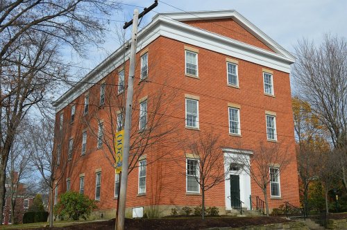
7 listings: 6 buildings, among them the Baldwin-Reynolds House (listed 1974, the first), and 1 historic district, the Meadville Downtown Historic District, with 81 contributing buildings. 87 historic buildings in all.
How old are the homes in Meadville?
39% of Meadville’s homes were built before 1940 (Census estimate, ±6.2 points), against a typical 18% for a Pennsylvania town; the median home was built in 1950.
Founding dates: Wikidata, Wikipedia, the U.S. post office records of Blevins & Helbock (CC0) and the Census. Homes by year built: Census ACS 2020–24. National Register of Historic Places: National Park Service (list of May 22, 2026). Old photos, postcards and papers: Wikimedia Commons, the Library of Congress and other public archives, credited on each item’s page. Maps: U.S. Geological Survey historical topographic maps (via Esri) and Sanborn fire-insurance maps (Library of Congress). History text and census tables: Wikipedia (CC BY-SA 4.0). Places that used to be: USGS Geographic Names Information System (2021).
From Wikimedia Commons (2), the Library of Congress (4), the National Register of Historic Places (7), Wikipedia, Wikidata and Wikipedia for famous people, U.S. Geological Survey historical maps, U.S. Census counts (via Wikipedia), the US Post Offices dataset (Blevins & Helbock), the USGS Geographic Names Information System, Sanborn fire insurance maps (Library of Congress) and old county and town histories (Internet Archive). Archive images are copied here with their credits and licenses, shown on each photo’s page. Refreshed monthly.




 1885
 1905
 1905
 1905


