Wikipedia doesn’t have a history of McKean yet. The photos, dates and memories neighbors add here are how it gets written.
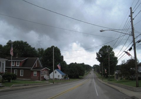
McKean is a borough in Erie County, Pennsylvania. The population was 475 at the time of the 2020 census. It is part of the Erie–Meadville combined statistical area. McKean was known as "Middleboro" until it officially changed its name in 1970.
McKean was established in 1795. Between the 2010 and 2020 censuses its population grew from 388 to 476 (+23%).
Intro from Wikipedia. Population: U.S. Census Bureau.
From the old history books
What they wrote about McKean in 1890
Passages that mention McKean, cut from the printed page as they were published.
History of the counties of McKean, Elk and Forest, Pennsylvania, with biographical selections, including their early settlement and development1890 · page 161Read the page →
Read the text
In 1882 a railroad was built between Coudersport, in Potter county, and Port Allegany, in McKean county, known as the Coudersport & Port Allegany Railroad. The Kinzua Creek Railroad Company was chartered in February, 1890, to build twelve miles of track from Anderson switch, of the Western New York & Pennsylvania Railroad, to the big bridge on the New York, Lake Erie & Western Railroad.
Text read by machine from the scan; it may contain errors.
History of the counties of McKean, Elk, Cameron and Potter, Pennsylvania, with biographical selections1890 · page 626Read the page →
Read the text
Thomas L. Kane was one of the directors of the Philadelphia & Erie Railroad Company. To him is credited the discovery of the low summit of the mountains in McKean county. In 1856 he came to spend the summer at Williamsville, and while there studied the geological structure of the country, and planned the line of the Big Level road as well as of many of the railroads of McKean and Elk counties. The location of the Philadelphia & Erie Railroad, as at ]>resent constructed, has been questioned by a number of engineers. Be this as it may, the present line with its lirst prominent summit at West creek, north
Text read by machine from the scan; it may contain errors.
History of the counties of McKean, Elk and Forest, Pennsylvania, with biographical selections, including their early settlement and development1890 · page 626Read the page →
Read the text
Thomas L. Kane was one of the directors of the Philadelphia & Erie Railroad Company. To him is credited the discovery of the low summit of the mountains in McKean county. In 1856 he came to spend the summer at Williamsville, and while there studied the geological structure of the country, and planned the line of the Big Level road as well as of many of the railroads of McKean and Elkcounties. The location of the Philadelphia & Erie Railroad.
Text read by machine from the scan; it may contain errors.
History of the counties of McKean, Elk, Cameron and Potter, Pennsylvania, with biographical selections1890 · page 161Read the page →
Read the text
In 1SS2 a railroad was built between Coudersport, in Potter county, and Port Allegany, in McKean county, known as the Coudersport & Port Allegany Railroad. The Kinzua Creek Railroad Company was chartered in February, 1890, to build twelve miles of track from Anderson switch, of the Western New York & Pennsylvania Railroad, to the big bridge on the New York, Lake Erie & Western Railroad.
Text read by machine from the scan; it may contain errors.
Scans and text from the Internet Archive. Books published in 1930 or earlier, which are in the public domain.
By decade
McKean, decade by decade
One decade in the archive so far: the 1880s. Scroll each row; tap a photo for its story.
Nothing in the archives for these yearsWeddings on Main Street, storms, parades, school pictures, the old store. If it’s in your family album, it belongs here.
Founding dates: Wikidata, Wikipedia, the U.S. post office records of Blevins & Helbock (CC0) and the Census. Homes by year built: Census ACS 2020–24. National Register of Historic Places: National Park Service (list of May 22, 2026). Old photos, postcards and papers: Wikimedia Commons, the Library of Congress and other public archives, credited on each item’s page. Maps: U.S. Geological Survey historical topographic maps (via Esri) and Sanborn fire-insurance maps (Library of Congress). History text and census tables: Wikipedia (CC BY-SA 4.0). Places that used to be: USGS Geographic Names Information System (2021). How TownRatings grades history →
From Wikimedia Commons (7), the Library of Congress (3), Wikidata and Wikipedia for famous people, U.S. Geological Survey historical maps, U.S. Census counts (via Wikipedia), the US Post Offices dataset (Blevins & Helbock), the USGS Geographic Names Information System and old county and town histories (Internet Archive). Archive images are copied here with their credits and licenses, shown on each photo’s page. Refreshed monthly.


 1880
 Date?
 2024
 2024
 2024
 2024
 2024
 2024
 2024

