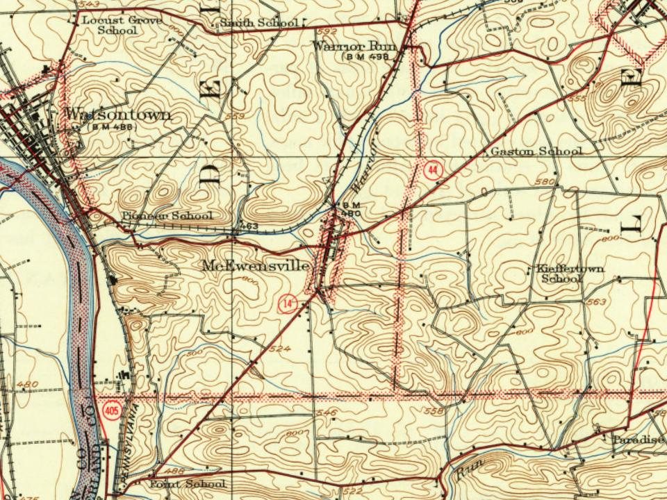
Peaked at 795 in 1960; 293 people lived here in 2020.
17 censuses, 1860–2020.
U.S. Census Bureau decennial counts, from the census table on McEwensville’s Wikipedia page.
The story so far
McEwensville, in brief
Wikipedia doesn’t have a history of McEwensville yet. The photos, dates and memories neighbors add here are how it gets written.
McEwensville is a borough in Northumberland County, Pennsylvania, United States. The population was 298 during the 2020 census.
McEwensville was established in 1825. Between the 2010 and 2020 censuses its population grew from 279 to 293 (+5%).
Intro from Wikipedia. Population: U.S. Census Bureau.
From the old history books
What they wrote about McEwensville in 1891
Passages that mention McEwensville, cut from the printed page as they were published.
History of Northumberland County, Pennsylvania1891 · page 763Read the page →
Read the text
ized by the Rev. George Junkin, whose successors at Milton also preached here; prominent among the membership were the McGuires. Shannons, and Rynearsons. The church edifice was a frame building, and occupied a triangular lot on the farm of Mrs. Eleanor Armstrong. The McEwensville Presbj-terian church was organized in 1842 with eighty-five members, formerly connected with the Warrior Run church, to which its membership returned after disbanding. The church was a substantial brick structure, since sold and removed. The Methodist church at McEwensville, a frame
Text read by machine from the scan; it may contain errors.
History of Northumberland County, Pennsylvania, including its aboriginal history1891 · page 754Read the page →
Read the text
There was for some years a healthful and normal expansion of the village in size, population, and business importance, but with the opening of the Philadelphia and Erie railroad and consequent growth of Watsontovm the prestige of McEwensville began to decline. This was particularly noticeable in the decade ending with 1870. In recent years the borough has derived a renewed impetus from the opening of the Wilkesbarre and Western railroad; it has now some half-dozen stores, a hotel, three manufacturing establishments, four churches, a school building, and a posto£tice. A fertile and populous
Text read by machine from the scan; it may contain errors.
History of Northumberland County, Pennsylvania1891 · page 754Read the page →
Read the text
There was for some yeans a healthful and normal exjiansion of the village in size, population, and business importance, but with the opening of the Philadelphia and Erie railroad and conseqiient growth of Watsonto\vn the prestige of McEwensville began to decline. This was particularly noticeable in the decade ending with 1870. In recent years the borough has derived a renewed impetus from the opening of the Wilkesbarre and Western railroad; it has now some half-dozen stores, a hotel, three manufacturing establishments, four churches, a school building, and a postoffice. A fertile and populous
Text read by machine from the scan; it may contain errors.
Scans and text from the Internet Archive. Books published in 1930 or earlier, which are in the public domain.
Timeline
McEwensville, 1805 to 1960
Woven from the archive, old maps, post office records, the National Register and the people born here.
Founding dates: Wikidata, Wikipedia, the U.S. post office records of Blevins & Helbock (CC0) and the Census. Homes by year built: Census ACS 2020–24. National Register of Historic Places: National Park Service (list of May 22, 2026). Old photos, postcards and papers: Wikimedia Commons, the Library of Congress and other public archives, credited on each item’s page. Maps: U.S. Geological Survey historical topographic maps (via Esri) and Sanborn fire-insurance maps (Library of Congress). History text and census tables: Wikipedia (CC BY-SA 4.0). Places that used to be: USGS Geographic Names Information System (2021). How TownRatings grades history →
From Wikimedia Commons (6), Wikidata and Wikipedia for famous people, U.S. Geological Survey historical maps, U.S. Census counts (via Wikipedia), the US Post Offices dataset (Blevins & Helbock), the USGS Geographic Names Information System and old county and town histories (Internet Archive). Archive images are copied here with their credits and licenses, shown on each photo’s page. Refreshed monthly.


 2012
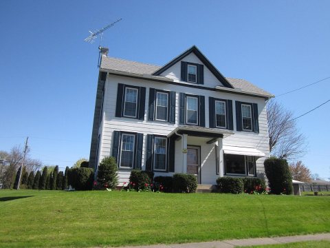 2012
 2012
 2012
 2012
 2012