


The story
Read it all →How Martinsburg came to be
From Wikipedia’s history of Martinsburg.
The community was named after John Martin, a pioneer citizen.
Text from Wikipedia, licensed CC BY-SA 4.0.
Each edition grades its towns against each other only.
 Photo: Doug Kerr · CC BY-SA 2.0
More historic than 71% of U.S. towns. What drives it
Below: 2 old photos and papers, maps from 1902 on, and the census since 1840.
Martinsburg dates its founding to 1815 (Wikidata). The census first counted it in 1840.
More historic than 71% of U.S. towns, on its age, its old homes and the National Register.
On its age, its old homes and the National Register, Martinsburg is more historic than 71% of U.S. towns. Its share of homes from before 1940 holds the grade up; its National Register listings pull it down.
Pennsylvania towns list about as much on the Register as the country (a typical Pennsylvania town has 2.1 per 10,000 residents, the U.S. 2.4), so Martinsburg’s 0.0 sits below most of its state (25% of Pennsylvania towns have fewer) while its 0 listings outnumber those of 23% of U.S. towns.
Founding year: Wikidata (other dates in Quick answers). Homes: Census ACS 2020–24. National Register: National Park Service, May 2026 list; each listing counted once (boundary changes and added documentation belong to their listing), and a historic district counts its contributing buildings. How TownRatings grades history →
Read from the archive, the National Register and the record. The page puts what stands out first.
The first neighbors to add old photos shape how Martinsburg’s history is told.
Every edition of the U.S. Geological Survey’s map of Martinsburg. Tap a year, or press play to watch the town change.

U.S. Geological Survey historical topographic maps (public domain), via Esri’s collection of the scans. The red ring marks the center of Martinsburg.
Woven from the archive, old maps, post office records, the National Register and the people born here.
 In the archiveThe great strike--Blockade of engines at Martinsburg, West Virginia
 Born hereD. Emmert Brumbaugh is born here
 On the mapFirst mapped by the U.S. Geological Survey
 In the archiveLutheran Church - Martinsburg, PA
From Wikipedia’s history of Martinsburg.
The community was named after John Martin, a pioneer citizen.
Text from Wikipedia, licensed CC BY-SA 4.0.
Passages that mention Martinsburg, cut from the printed page as they were published.

About three miles east of Martinsburg, near Clover Creek, is the small village of Frederisckburg, otherwise known as Clover Creek postoffice, southward from the latter place the hamlet known as Millerstown, and in the southeastern part of the township is Henrietta, also a postoffice station, and the terminus of the Morrison’s cove branch of the Penn-
Text read by machine from the scan; it may contain errors.
R. R. from McKee’s Gap to Martinsburg. The completion of the Morrison’s Cove railroad from the Gap to Martinsburg was celebrated by an excursion on the part of the citizens of Martinsburg, together with some few others from this place and Altoona, who were invited to participate. The remaining portion of the Morrison’s Cove railroad be-
Text read by machine from the scan; it may contain errors.
The country in the vicinity of Martinburg was settled before the Revolution, but Martinsburg town was not laid out until 1815. The first plot was by Daniel Camerer and John Soyster built the first house. Abraham Stoner laid out a plot adjoining Camerer 's in 1820, and James McCra}^ plotted an extension to the borough in 1871.
Text read by machine from the scan; it may contain errors.Scans and text from the Internet Archive. Books published in 1930 or earlier, which are in the public domain.
2 decades in the archive, from the 1870s to the 1900s. Scroll each row; tap a photo for its story.
 20212021-10-27 11 54 33 View north along Pennsylvania Sta…
 2015Martinsburg
 2015Martinsburg - panoramio (6)
 2015Martinsburg - panoramio (5)
 2015Martinsburg - panoramio (4)
 2015Martinsburg - panoramio (3)
 2015Martinsburg - panoramio (2)
 2015Martinsburg - panoramio (1)
 2012Martinsburg, Pennsylvania
 2012Martinsburg, Pennsylvania
 2012Martinsburg, Pennsylvania
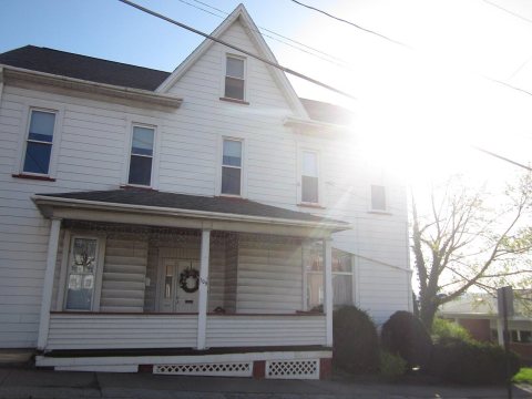 2012Martinsburg, Pennsylvania
 2012Martinsburg, Pennsylvania
 2012Martinsburg, Pennsylvania
 2012Everett Railroad 1712, Martinsburg, PA, May 2012
 20081761 - Martinsburg - PA164 approaching Highland Ave
 20081760 - Martinsburg - PA164 approaching Bassler St
 20081759 - Martinsburg - PA164 approaching Nicodemus St
 20081758 - Martinsburg - PA164 approaching Railroad St
 20081757 - Martinsburg - PA866 at PA164
 20081756 - Martinsburg - PA164 approaching Market St
 20081755 - Martinsburg - PA164 approaching Wall St
 20081754 - Martinsburg - PA164 approaching Walnut St
 20081751 - North Woodbury Twp - PA164 WB
Fire insurance maps drew every building, what it was made of and what it was used for, so insurers could price the risk of fire. Pick a year, then a sheet.
 1905Sheet 1 of 3
Sanborn Map Company, via the Library of Congress. Editions published in 1930 or earlier, which are in the public domain.
No then-and-now pairs yet. Take a photo from the same spot as an old one and they appear here side by side.

Find the spot, match the angle, and add your photo. It becomes the first then-and-now pair on Martinsburg’s page.
Retake this view · +15Between 442 and 2,236 people in every census since 1840.
19 censuses, 1840–2020.
U.S. Census Bureau decennial counts, from the census table on Martinsburg’s Wikipedia page.
Each neighbor’s History grade, on the same three inputs.
In 1815, according to Wikidata. Martinsburg’s post office opened in 1821, and the census of 1840 counted 442 people here.
Martinsburg is more historic than 71% of U.S. towns. The History grade combines the town’s founding era, the share of homes built before 1940 and its National Register listings. It’s a character grade, so it isn’t part of the overall grade. How it works.
32% of Martinsburg’s homes were built before 1940 (Census estimate, ±7.0 points), against a typical 18% for a Pennsylvania town; the median home was built in 1958.
What the archives can’t tell you, neighbors can.
Founding dates: Wikidata, Wikipedia, the U.S. post office records of Blevins & Helbock (CC0) and the Census. Homes by year built: Census ACS 2020–24. National Register of Historic Places: National Park Service (list of May 22, 2026). Old photos, postcards and papers: Wikimedia Commons, the Library of Congress and other public archives, credited on each item’s page. Maps: U.S. Geological Survey historical topographic maps (via Esri) and Sanborn fire-insurance maps (Library of Congress). History text and census tables: Wikipedia (CC BY-SA 4.0). Places that used to be: USGS Geographic Names Information System (2021).
From Wikimedia Commons (24), the Library of Congress (2), Wikipedia, Wikidata and Wikipedia for famous people, U.S. Geological Survey historical maps, U.S. Census counts (via Wikipedia), the US Post Offices dataset (Blevins & Helbock), the USGS Geographic Names Information System, Sanborn fire insurance maps (Library of Congress) and old county and town histories (Internet Archive). Archive images are copied here with their credits and licenses, shown on each photo’s page. Refreshed monthly.