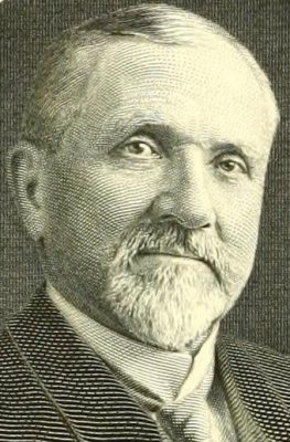
PA 194 shield not made correctly, 2009
Littlestown’s story
261 years in pictures
Census counts: 394 in 1850, 4,782 in 2020. The archive holds 6 old photos and papers going back to 2009 and 3 maps from 1911 on.
- 1765Littlestown is settled
Each edition grades its towns against each other only.
Littlestown grades B+ overall, 462nd of 1032 graded towns in Pennsylvania, with clear strengths and some subjects that lag. It reports less crime per resident than 82% of U.S. towns and natural-hazard risk is low. It also does better than most on incomes: the median household earns $71K. Its lowest everyday mark is in health: CDC estimates put its residents' health behind 65% of the country. A typical home there costs about $340K, 4 years of the Gettysburg metro’s $84K median household income. Littlestown’s average commute is 35 minutes, against 26 minutes in Pennsylvania’s towns and 25 minutes across U.S. towns. Littlestown is easier to get around on foot or by transit than 75% of U.S. towns. The biggest park or preserve is Littlestown Community Park, at 22 acres.
Where Littlestown beats most towns.
Where Littlestown’s working residents go each day. Line width shows the share.
Census LEHD 2023
Each subject compared with towns across the country (schools within Pennsylvania), ordered by how far Littlestown is from typical.
How TownRatings grades towns →
Census counts: 394 in 1850, 4,782 in 2020. The archive holds 6 old photos and papers going back to 2009 and 3 maps from 1911 on.
Museums, parks, gardens and other places to visit around Littlestown. Close and well known come first.
 Big draw18 mi LandmarkRaven Rock Mountain Complex
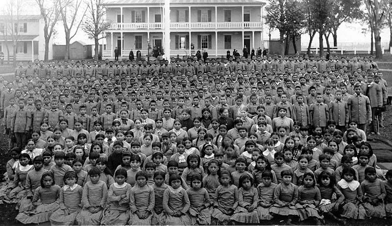 32 mi National MonumentCarlisle Federal Indian Boarding School National Monument
 9 mi Ancient siteGettysburg Battlefield
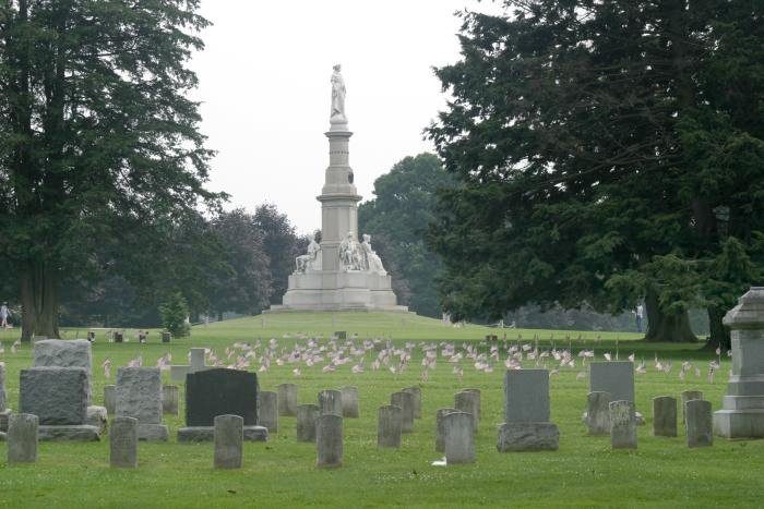 9 mi LandmarkGettysburg National Cemetery
 7 mi National Military ParkGettysburg National Military Park730K visitors a year
 10 mi National Historic SiteEisenhower National Historic Site75K visitors a year
Raven Rock Mountain Complex: US Government, Public domain · Carlisle Federal Indian Boarding School National Monument: Unknown authorUnknown author, Public domain · Gettysburg Battlefield: Veggies, Public domain · Gettysburg National Cemetery: Photo: Henryhartley at en.wikipedia Statue: Randolph Rogers (1825-1892), Public domain · Gettysburg National Military Park: David Dugan, CC BY-SA 3.0 · Eisenhower National Historic Site: Jack E. Boucher, Public domain
Who provides power, water and the rest in Littlestown, and how to reach them.
EPA SDWIS (Oct 9, 2026) · HIFLD + EIA-861 2025 · Census 2020 ZCTAs · NCES 2024–25 · registration: vote.gov, updated Nov 18, 2024.
Ordered by what stands out in Littlestown.
Littlestown sends many workers across the state line to Westminster and is safe by national standards but not by Pennsylvania’s.
56% of Littlestown’s expected losses from natural hazards come from inland flooding, followed by hurricanes at 14%. Storm and flood damage is expected to run lower than in 88% of U.S. communities. Households here have drawn federal disaster aid once, in 2011.
FEMA National Risk Index · OpenFEMA
The largest public high school is Littlestown SHS, with 532 students. Littlestown Area SD runs its public schools. Two of its 3 schools are shown below, with the reason for each.
| School | Level | Students | Letter |
|---|---|---|---|
| Alloway Creek El SchLargest public elementary schoolGrades K–5 | Grades K–5 | 746 | B− |
| Littlestown SHSLargest public high schoolGrades 9–12 | Grades 9–12 | 532 | B− |
NCES · EDFacts · graded within PA on state tests and graduation
At 7.8 crimes per 1,000 residents a year, it reports less crime than 64% of Pennsylvania’s graded towns. Violent crime is rare: 1 reported in 2025, 0.2 per 1,000 residents.
Littlestown’s level of violent crime is 0.2 per 1,000 residents. Its level of property crime is 5.3 per 1,000 residents.
| Littlestown | Pennsylvania towns | U.S. towns | |
|---|---|---|---|
| Violent crimes per 1,000 (2025) | 0.2 per 1,000 residents | 0.7 | 1.6 |
| Property crimes per 1,000 (2025) | 5.3 per 1,000 residents | 5.7 | 9.9 |
FBI crime data, 2025 · crimes reported to police
30% of working residents cross a state line to work, Westminster among the top destinations. The average commute for its 2,102 working residents takes 34.9 minutes, against 26.3 across Pennsylvania.
The top destinations are Hanover (7%), Penn Township (5%) and Westminster (4%). Jobs in Littlestown grew by 337 from 2013 to 2023, reaching 1,148. The share of residents in Littlestown who live below the poverty line: 13%. For half of commuters, work is under 15 miles away.
| Littlestown | Pennsylvania towns | U.S. towns | |
|---|---|---|---|
| Below the poverty line | 13% | 7.6% | 9.6% |
| Median household income | $71,000 | $81,000 | $80,000 |
Census LEHD 2023 · ACS
In July, afternoons reach 86°; in January, nights fall to 22°, and about 28 inches of snow falls in a winter.
NOAA U.S. Climate Normals, 1991–2020
Littlestown: 25% of adults have been diagnosed with depression. 39% of adults locally have obesity; 15% report frequent physical distress.
| Littlestown | Pennsylvania towns | U.S. towns | |
|---|---|---|---|
| Smoke cigarettes (CDC PLACES) | 18% | 16% | 14% |
| Obesity (CDC PLACES) | 39% | 35% | 35% |
| Frequent physical distress (CDC PLACES) | 15% | 14% | 14% |
| Sleep under 7 hours (CDC PLACES) | 39% | 38% | 36% |
| What stands out | Littlestown | PA |
|---|---|---|
| More uninsured adults | 7.9% | 5.8% |
| More adults with COPD | 9.8% | 7.7% |
| More adults with heart disease | 8.6% | 7.4% |
CDC PLACES 2025 · modeled estimates for adults · CMS · HRSA
Zillow values the typical Littlestown home at about $340,000, up 3.5% in a year, 19% above the Pennsylvania typical home. For Littlestown, the going rate for rent is $964 a month. In Littlestown, 25% of sales closed above the list price.
| Littlestown | Pennsylvania towns | U.S. towns | |
|---|---|---|---|
| Median rent | $964 a month | $1,116 a month | $1,185 a month |
| Households that own their home | 72% | 78% | 73% |
Census ACS, 2020–24 · Zillow Home Value Index · Redfin Data Center
0.9 miles of trail wind through 2 parks and preserves. The trail network density in Littlestown is 0.5 miles per square mile.
| Littlestown | Pennsylvania towns | U.S. towns | |
|---|---|---|---|
| Conserved land | 5.9% | 8.2% | 4.3% |
| Miles of trail per square mile | 0.5 miles per square mile | 0.4 | 0.4 |
| Biggest places to walk | Trails | Acres |
|---|---|---|
| 1. Littlestown Community Park | — | 22 |
| 2. Crouse Park | — | 2 |
Trails & parks © OpenStreetMap contributors · Conserved land: USGS PAD-US
4 within 15 miles of the center of Littlestown
About 4 of every 100 Littlestown residents are enrolled in college, against 6 across Pennsylvania.
3 notable people were born in Littlestown.
Borough in Pennsylvania, US
Littlestown is a borough in Adams County, Pennsylvania, United States. The population was 4,782 at the 2020 census. Originally laid out by Peter Klein in 1760, the town was first named Petersburg. German settlers in the area came to call the town Kleine Stedtle. In 1795, as confusion between the town and a neighboring town (also named Petersburg and now named York Springs) was growing, the town changed its name to Littlestown, an English translation of the German name Kleine Stedtle.
From Wikipedia, licensed CC BY-SA 4.0 · facts via Wikidata (CC0)
2 towns share a border with Littlestown.
| Town | PA rank | Overall | Cost | Safety | Schools | Health |
|---|---|---|---|---|---|---|
| Littlestown | #462 | B+ | B | A− | C+ | C |
| Germany Township | #767 | C+ | C+ | — | C+ | B− |
| Union Township | #758 | C+ | C+ | — | C+ | B− |
Germany Township and Union Township report no FBI crime data of their own. Compare Littlestown with a neighbor →
Short answers, built from the data on this page.
By most measures, yes. Littlestown grades B+ overall, better than 69% of U.S. towns and #462 of 1032 in Pennsylvania. It grades C for health, A− for safety and C+ for schools.
Cost of living, which also weighs rents, property taxes and how many households pay 30% or more of their income for housing, grades B.
3 notable people were born here, including Joseph A. Goulden and Halo Meadows.