Lost post offices, old corners and burying grounds
Three other post offices opened and closed inside today’s town.
Trout Run
1825–today
Bodinesville
1856–1887
Fields Station
1873–1933
Bodines
1887–1967
18201920today
Hamlets and corners on the map
BodinesCaldwellGrayTrout Run
3cemeteries and burying grounds inside Lewis Township
Bobst MountainPennsdaleTrout Run
US Post Offices dataset (Blevins & Helbock, CC0). Places and cemeteries from the USGS Geographic Names Information System (2021).
On the map
Lewis Township on the map, 1921 to 1973
Every edition of the U.S. Geological Survey’s map of Lewis Township. Tap a year, or press play to watch the town change.
1921Trout Run sheet · 1:62,500
U.S. Geological Survey historical topographic maps (public domain), via Esri’s collection of the scans. The red ring marks the center of Lewis Township.
Lewis Township was formed from part of Hepburn Township in 1835. It is named for Ellis Lewis, who was the president judge of the local district court at the time. The township was expanded on December 10, 1846, when part of Cascade Township was added to Lewis Township. This was done at the request of the residents of the area who were geographically cut off from the rest of Cascade Township.
Passages that mention Lewis Township, cut from the printed page as they were published.
History of Lycoming County, Pennsylvania1929 · page 216Read the page →
Read the text
McIntyre Township.—In 1848 a large slice was cut from Lewis Township and that of McIntyre established. It was named for Samuel McIntyre, of Philadelphia, who was one of the original incorporators of the Williamsport and Elmira railroad. It is the second largest in the county and contains 46,260 acres. Tioga County adjoins it on the north. It ieee mountainous region and although there is some farming land on the plateaus the soil is thin. Its early history is that of
Text read by machine from the scan; it may contain errors.
History of Lycoming County, Pennsylvania1929 · page 236Read the page →
Read the text
Lewis Township is well supplied with schools and churches and its citizens are of the highest character. It had a popula. tion of 575 in 1920.
Text read by machine from the scan; it may contain errors.
Scans and text from the Internet Archive. Books published in 1930 or earlier, which are in the public domain.
Timeline
Lewis Township, 1812 to 1933
Woven from the archive, old maps, post office records, the National Register and the people born here.
Nothing in the archives for these yearsWeddings on Main Street, storms, parades, school pictures, the old store. If it’s in your family album, it belongs here.
Founding dates: Wikidata, Wikipedia, the U.S. post office records of Blevins & Helbock (CC0) and the Census. Homes by year built: Census ACS 2020–24. National Register of Historic Places: National Park Service (list of May 22, 2026). Old photos, postcards and papers: Wikimedia Commons, the Library of Congress and other public archives, credited on each item’s page. Maps: U.S. Geological Survey historical topographic maps (via Esri) and Sanborn fire-insurance maps (Library of Congress). History text and census tables: Wikipedia (CC BY-SA 4.0). Places that used to be: USGS Geographic Names Information System (2021). How TownRatings grades history →
From Wikimedia Commons (11), the National Register of Historic Places (1), Wikipedia, U.S. Geological Survey historical maps, the US Post Offices dataset (Blevins & Helbock), the USGS Geographic Names Information System and old county and town histories (Internet Archive). Archive images are copied here with their credits and licenses, shown on each photo’s page. Refreshed monthly.


 2025
 2025
 2022
 2015
 2015
 2015
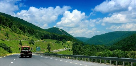 2013
 2012
 2012
 2011