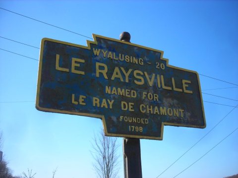
A post office called Le Raysville was established in 1827. The borough was named for James Le Ray de Chaumont, a Frenchman-turned American citizen who purchased 80,000 acres in eastern Bradford County.
Passages that mention LeRaysville, cut from the printed page as they were published.
History and Geography of Bradford County Pennsylvania1926 · page 360Read the page →
Read the text
LeRaysville, by virtue of its central location, that section at the ‘‘cross-roads,’’ was early selected as the best point for business and enterprise. A post-office was established here in 1827 with Josiah Benham, postmaster. Stores, shops and manufacturing concerns multiplied and the place became a thriving village. In 1863 it was incorporated as LeRaysville borough. It had a population of 284 in 1870 and 253 in 1920.
Text read by machine from the scan; it may contain errors.
History of Bradford County, Pennsylvania, with biographical selections1891 · page 1199Read the page →
Read the text
Oliver W. Stevens, the subject of this sketch, attended the common school in Stevensville, and the Academy of LeRaysville, also Owego, Academy, and when about twenty years of age began the practice of surveying and civil engineering, teaching school winters for a number of years. In 1852 he purchased a farm near LeRaysville and located there. In 1859 he sold his farm and purchased the Hill Side farm in Herrick, to which he moved and where he has since resided, a few acres of the same being the first improvement made in the township. There
Text read by machine from the scan; it may contain errors.
Scans and text from the Internet Archive. Books published in 1930 or earlier, which are in the public domain.
Founding dates: Wikidata, Wikipedia, the U.S. post office records of Blevins & Helbock (CC0) and the Census. Homes by year built: Census ACS 2020–24. National Register of Historic Places: National Park Service (list of May 22, 2026). Old photos, postcards and papers: Wikimedia Commons, the Library of Congress and other public archives, credited on each item’s page. Maps: U.S. Geological Survey historical topographic maps (via Esri) and Sanborn fire-insurance maps (Library of Congress). History text and census tables: Wikipedia (CC BY-SA 4.0). Places that used to be: USGS Geographic Names Information System (2021). How TownRatings grades history →
From Wikimedia Commons (6), Wikipedia, U.S. Geological Survey historical maps, U.S. Census counts (via Wikipedia), the US Post Offices dataset (Blevins & Helbock), the USGS Geographic Names Information System and old county and town histories (Internet Archive). Archive images are copied here with their credits and licenses, shown on each photo’s page. Refreshed monthly.


 2017
 2017
 2007
 2007
 2007
 2007


