Kutztown dates to 1815, and 29% of its homes were built before 1940
More historic than 87% of U.S. towns · #229 of 1,035 in Pennsylvania. What drives it
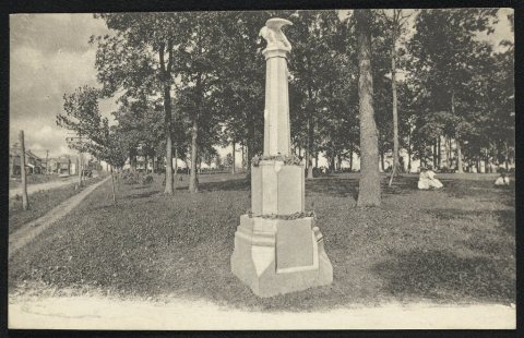
Its Register listings are the Kutztown 1892 Public School Building and the Deisher, H. K., Knitting Mill. Its Register listings are the Kutztown 1892 Public School Building and the Deisher, H. K., Knitting Mill. Below: 12 old photos and papers, maps from 1909 on, and the census since 1840.
Founding year: Wikidata; Wikipedia’s history section gives the same year. First post office: 1835.The full story ↓
History grade
What drives Kutztown’s History grade
On its age, its old homes and the National Register, Kutztown is more historic than 87% of U.S. towns, #229 of 1,035 in Pennsylvania. All 3 inputs are above most U.S. towns; its share of homes from before 1940 ranks highest and its National Register listings lowest.
A
HistoryA character grade: shown, never part of Kutztown’s overall grade.
Pennsylvania towns list about as much on the Register as the country (a typical Pennsylvania town has 2.1 per 10,000 residents, the U.S. 2.4), so Kutztown’s 4.8 sits above most of its state (67% of Pennsylvania towns have fewer) while its 2 listings outnumber those of 60% of U.S. towns.
How sure. Graded on any two of the three inputs instead, the letter would range from A− to A. The pre-1940 share is a Census survey estimate (±9.2 points). Two sources give 1815.
Founding year: Wikidata (other dates in Quick answers). Homes: Census ACS 2020–24. National Register: National Park Service, May 2026 list; each listing counted once (boundary changes and added documentation belong to their listing), and a historic district counts its contributing buildings. How TownRatings grades history →
What stands out about Kutztown’s past
Read from the archive, the National Register and the record. The page puts what stands out first.
Nothing in the archives for these yearsWeddings on Main Street, storms, parades, school pictures, the old store. If it’s in your family album, it belongs here.
George (Coots) Kutz purchased 130 acres (53 ha) of land that became Kutztown on June 16, 1755, from Peter Wentz who owned much of what is present-day Maxatawny Township. Kutz first laid out his plans for the town in 1779. The first lots in the new town of Cootstown, later renamed Kutztown, were purchased in 1785 by Adam Dietrich and Henry Schweier.
Kutztown was incorporated as a borough on April 7, 1815, and is the second oldest borough in Berks County after Reading, which became a borough in 1783 and became a city in 1847.
Like most of Berks County, Kutztown was settled predominantly by Germans, most of whom came from the Palatinate region of southwest Germany, which borders the Rhine river.
Passages that mention Kutztown, cut from the printed page as they were published.
History of Berks county in Pennsylvania1886 · page 1046Read the page →
Read the text
Lyons is a thriving village favorably located on the East Penn Railroad, one mile west of Bower's, and two and a half miles from Kutztown. It was the railway station of Kutztown till 1870, when the branch railroad was extended to that borough from Topton. It was named after M. E. Lyons, chief engineer of the railroad. The first improvements had been
Text read by machine from the scan; it may contain errors.
The centennial history of Kutztown, Pennsylvania1915 · page 65Read the page →
Read the text
THE FIRST HOUSE The date of erection of the first house in Kutztown is uncertain. Tradition asserts that it was built by George Esser, great grandfather to Jacob B. Esser, former proprietor of “The Kutztown Journal” and "The Kutztown Patriot.” One writer thinks it likely that the house was put u])
Text read by machine from the scan; it may contain errors.
The centennial history of Kutztown, Pennsylvania1915 · page 51Read the page →
Read the text
In 1868 a public meeting of the citizens of Kutztown and vicinity was held and at this meeting a petition was drawn un refiuesting the Philadelphia and Reading Railroad Company to complete the road from Topton to Kutztown. The petition met with a favorable response. Work on the branch was begun Tune o, i86q. It is of
Text read by machine from the scan; it may contain errors.
Scans and text from the Internet Archive. Books published in 1930 or earlier, which are in the public domain.
Every building
Kutztown, building by building, 1913
Fire insurance maps drew every building, what it was made of and what it was used for, so insurers could price the risk of fire. Pick a sheet.
In 1815, according to Wikidata and Wikipedia’s history of the town. Kutztown’s post office opened in 1835, and the census of 1840 counted 693 people here.
How does Kutztown rank for history?
Kutztown is more historic than 87% of U.S. towns, #229 of 1,035 in Pennsylvania. The History grade combines the town’s founding era, the share of homes built before 1940 and its National Register listings. It’s a character grade, so it isn’t part of the overall grade. How it works.
What is on the National Register in Kutztown?
Two places: the Kutztown 1892 Public School Building (listed 1980) and the Deisher, H. K., Knitting Mill (1985).
How old are the homes in Kutztown?
29% of Kutztown’s homes were built before 1940 (Census estimate, ±9.2 points), against a typical 18% for a Pennsylvania town; the median home was built in 1962.
Founding dates: Wikidata, Wikipedia, the U.S. post office records of Blevins & Helbock (CC0) and the Census. Homes by year built: Census ACS 2020–24. National Register of Historic Places: National Park Service (list of May 22, 2026). Old photos, postcards and papers: Wikimedia Commons, the Library of Congress and other public archives, credited on each item’s page. Maps: U.S. Geological Survey historical topographic maps (via Esri) and Sanborn fire-insurance maps (Library of Congress). History text and census tables: Wikipedia (CC BY-SA 4.0). Places that used to be: USGS Geographic Names Information System (2021).
From Wikimedia Commons (5), the Library of Congress (7), the National Register of Historic Places (2), Wikipedia, Wikidata and Wikipedia for famous people, U.S. Geological Survey historical maps, U.S. Census counts (via Wikipedia), the US Post Offices dataset (Blevins & Helbock), the USGS Geographic Names Information System, Sanborn fire insurance maps (Library of Congress) and old county and town histories (Internet Archive). Archive images are copied here with their credits and licenses, shown on each photo’s page. Refreshed monthly.


 1862
 1880
 1905
 1905
 1905
 1907
 1907
 1907
 1907
 1933
 1933
 1933


![THE FIRST HOUSE The date of erection of the first house in Kutztown is uncertain. Tradition asserts that it was built by George Esser, great grandfather to Jacob B. Esser, former proprietor of “The Kutztown Journal” and "The Kutztown Patriot.” One writer thinks it likely that the house was put u])](https://images.townratings.com/story/15286/bk-9cd873b3be4044c9-l.jpg)


