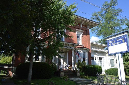
The town was founded in 1798 by James Campbell. The borough was incorporated in 1853.
The Jamestown area is served by the Jamestown Area School District, and is home to Combined Systems, Inc., a tactical weapons producer that exports tear gas and smoke grenades.
The Gibson House was added to the National Register of Historic Places in 1978.
Pymatuning Deer Park is a tourist attraction bringing a zoo like experience with a small petting zoo and interactive bird cage.
Jamestown Coating Technologies employs a large amount of locals and distributes high quality paints, powder coats and more throughout the world.
Passages that mention Jamestown, cut from the printed page as they were published.
History of Mercer County, Pennsylvania1888 · page 497Read the page →
Read the text
H. Hervey was installed pastor of Crooked Creek and North Shenango. He also ministered to Jamestown as a branch of the Crooked Creek charge. Shortly after this, October 28, 1853, he organized a regular congregation under the title of the Associate Reformed Presbyterians of Jamestown, Samuel Calvert and Robert Williamson being ruling elders. It continued to move on peacefully until the union in 1858. About 1847 steps were taken for the erection of a house of worship. The subscription not being all collected, the house was enclosed with difficulty. Finally, about 1852, an agreement was
Text read by machine from the scan; it may contain errors.
History of Mercer County, Pennsylvania1888 · page 176Read the page →
Read the text
In 1856 a new charter was obtained under the name of the Erie & Pittsburgh Railroad. In 1859 the track was completed through Crawford County to Jamestown, which remained the terminus from the north until 1864. Work was also progressing from the direction of New Castle. The first freight train arrived at Sharon from the south October 11, 1863, and the first passenger train the 4th of the following January. The line was finished through Mercer County during 1864, and the company advertised to run regular trains from Erie to New Castle after October 31, 1864. This road enters the county at
Text read by machine from the scan; it may contain errors.
Scans and text from the Internet Archive. Books published in 1930 or earlier, which are in the public domain.
By decade
Jamestown, decade by decade
2 decades in the archive, from the 1900s to the 1920s. Scroll each row; tap a photo for its story.
Nothing in the archives for these yearsWeddings on Main Street, storms, parades, school pictures, the old store. If it’s in your family album, it belongs here.
Founding dates: Wikidata, Wikipedia, the U.S. post office records of Blevins & Helbock (CC0) and the Census. Homes by year built: Census ACS 2020–24. National Register of Historic Places: National Park Service (list of May 22, 2026). Old photos, postcards and papers: Wikimedia Commons, the Library of Congress and other public archives, credited on each item’s page. Maps: U.S. Geological Survey historical topographic maps (via Esri) and Sanborn fire-insurance maps (Library of Congress). History text and census tables: Wikipedia (CC BY-SA 4.0). Places that used to be: USGS Geographic Names Information System (2021). How TownRatings grades history →
From Wikimedia Commons (4), the Library of Congress (2), the National Register of Historic Places (1), Wikipedia, the US Post Offices dataset (Blevins & Helbock), the USGS Geographic Names Information System and old county and town histories (Internet Archive). Archive images are copied here with their credits and licenses, shown on each photo’s page. Refreshed monthly.


 1908
 2009
 2009
 2003