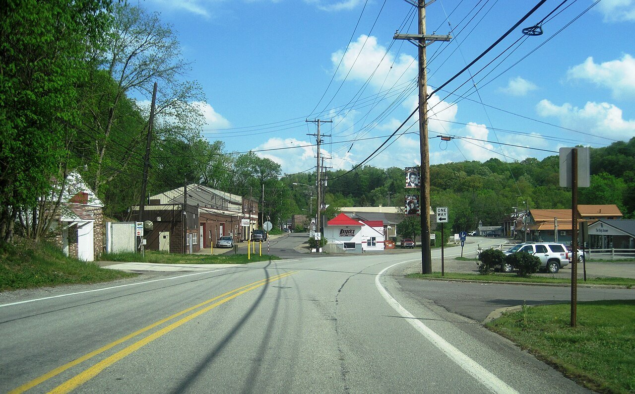
Photo: Mr. Matté (if there is an issue with this image, contact me using this image's Commons talk page, my Commons user talk page, or my English Wikipedia user talk page; I'll know about it a lot faster) · CC BY-SA 4.0
Quick answers
How Imperial began
When was Imperial founded?
1879
Imperial dates its founding to 1879 (Wikipedia’s history).
Imperial was established as a mining town circa 1879 by the Imperial Coal Company. It sits along Montour Run on land that had been the farm of Robert Wilson. Known at first as Montour City, the town soon took the name of the coal company, with a post office under the name Imperial opening in 1880. The town and nearby mines were served by the Montour Railroad. The community was formerly part of the Imperial-Enlow CDP before splitting into two separate CDPs. In 2020, Amazon opened a large fulfillment center complex in Imperial off of Pennsylvania Route 576.
Passages that mention Imperial, cut from the printed page as they were published.
History of Allegheny county, Pennsylvania1889 · page 12Read the page →
Read the text
Clinton, a village of some importance as a local business center, was laid out in 1826, by John Charles. The postoffice, one of the oldest in this part of the county, was established in 1828. A postoffice at Cliff Mine was established in February, 1886, and one at McMinn in June, 1881. Imperial, the southern terminus of the Montour railroad, is partly in this township. Hopewell Presbyterian Church was organized in 1814 as part of the charge of Eev. Michael Law. Among the early pastors were Revs. William J. Frazier and James D. Ray, installed in 1825 and 1829, respectively. Rev. William
Text read by machine from the scan; it may contain errors.
History of Allegheny county, Pennsylvania1889 · page 65Read the page →
Read the text
to their ownership in 1878, and Jessup & Co. in the same year, when (1879) the present proprietor, Frank Armstrong, assumed control. Six hundred tons are prodiiced daily, employing 175 men, and requiring 96 cars. The old Bower Hill mines, 1 , 200 feet east of Bower Hill station, were reopened by the Imperial Coal company in 1887 after a long period of suspension. Bower Hill No. 2, 1,500 feet east of the station of that name, has been operated since 1875 by A. J. Schulte. One hundred and twenty-five men are employed.
Text read by machine from the scan; it may contain errors.
History of Allegheny county, Pennsylvania1889 · page 65Read the page →
Read the text
to their ownership in 1878, and Jessup & Co. in the same year, when (1879) the present proprietor, Frank Armstrong, assumed control. Six hundred tons are produced daily, employing 175 men, and requiring 96 cars. The old Bower Hill mines, 1 , 200 feet east of Bower Hill station, were reopened by the Imperial Coal company in 1887 after a long period of suspension. Bower Hill No. 2, 1,500 feet east of the station of that name, has been operated since 1875 by A. J. Schulte. One hundred and twenty-five men are employed.
Text read by machine from the scan; it may contain errors.
History of Allegheny county, Pennsylvania1889 · page 9Read the page →
Read the text
kins, treasurer, and F. L. Shallenberger, superintendent, was incorporated in 1878. The road is eleven and one-half miles long. The terminal points are Montour Junction, on the Pittsburgh & Lake Erie railroad, in this township, and Montour City (Imperial), in North Fayette. The road was built for coal transportation from the mines of the Imperial Coal company, a corporation identical in management and control, but also affords passenger facilities, and has proven an important factor in the development of the Montour valley.
Text read by machine from the scan; it may contain errors.
Scans and text from the Internet Archive. Books published in 1930 or earlier, which are in the public domain.
Founding dates: Wikidata, Wikipedia, the U.S. post office records of Blevins & Helbock (CC0) and the Census. Homes by year built: Census ACS 2020–24. National Register of Historic Places: National Park Service (list of May 22, 2026). Old photos, postcards and papers: Wikimedia Commons, the Library of Congress and other public archives, credited on each item’s page. Maps: U.S. Geological Survey historical topographic maps (via Esri) and Sanborn fire-insurance maps (Library of Congress). History text and census tables: Wikipedia (CC BY-SA 4.0). Places that used to be: USGS Geographic Names Information System (2021). How TownRatings grades history →
From Wikimedia Commons (6), Wikipedia and old county and town histories (Internet Archive). Archive images are copied here with their credits and licenses, shown on each photo’s page. Refreshed monthly.


 2024
 2024
 2024
 2024
 2024
 2024