Hollidaysburg dates to 1768, and 42% of its homes were built before 1940
Among the most historic 1% of U.S. towns · #16 of 1,035 in Pennsylvania. What drives it
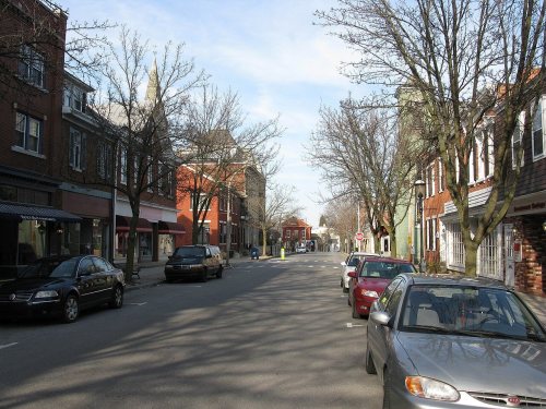
4 places in town are on the National Register, among them a historic district with 426 buildings. Below: 3 old photos and papers, maps from 1886 on, and the census since 1840.
Founding year: Wikidata. First post office: 1805.The full story ↓
History grade
What drives Hollidaysburg’s History grade
On its age, its old homes and the National Register, Hollidaysburg is among the most historic 1% of U.S. towns, #16 of 1,035 in Pennsylvania. All 2 inputs put Hollidaysburg near the top nationally; its National Register listings ranks highest.
A+
HistoryA character grade: shown, never part of Hollidaysburg’s overall grade.
Pennsylvania towns list about as much on the Register as the country (a typical Pennsylvania town has 2.1 per 10,000 residents, the U.S. 2.4), so Hollidaysburg’s 770 sits above most of its state (96% of Pennsylvania towns have fewer) while its 428 historic buildings outnumber those of 97% of U.S. towns.
NoteThe founding year comes from Wikidata alone; no second source gives 1768.
How sure. Graded on two of the three inputs, so a change in either one moves the letter more than it would with three. The pre-1940 share is a Census survey estimate (±9.0 points).
Founding year: Wikidata (other dates in Quick answers). Homes: Census ACS 2020–24. National Register: National Park Service, May 2026 list; each listing counted once (boundary changes and added documentation belong to their listing), and a historic district counts its contributing buildings. How TownRatings grades history →
What stands out about Hollidaysburg’s past
Read from the archive, the National Register and the record. The page puts what stands out first.
Fire insurance maps drew every building, what it was made of and what it was used for, so insurers could price the risk of fire. Pick a year, then a sheet.
Hollidaysburg was first laid out in 1796 and was named after Adam and William Holliday, Irish immigrants who founded the settlement; by 1814 it consisted of several houses and a tavern. Hollidaysburg became the main transfer point between the Pennsylvania Canal and the Portage Railroad, a gateway to western Pennsylvania. The canal and Portage Railroad spurred industrial and commercial development in Hollidaysburg in the 1830s. In 1836, Hollidaysburg was established as a borough.
When Blair County was organized in 1846, the Borough of Hollidaysburg was designated the county seat. This designation allowed the borough to prosper when politicians and attorneys became attracted to the borough.
Passages that mention Hollidaysburg, cut from the printed page as they were published.
History of the city of Altoona and Blair County1880 · page 230Read the page →
Read the text
The Baptist church of Hollidaysburg sprung from the church at Williamsburg, which was admitted into the Juniata Baptist Association in 1829. Ten members of that church had their residence in Hollidaysburg, and when it was determined that the canal basin should be located there, and it became evident that the village of Hollidaysburg was destined to become a large and prosperous town, these ten members deemed it expedient and proper for them to organize a church of their own. Accordingly, in August, 1833, they ob-
Text read by machine from the scan; it may contain errors.
Twentieth century history of Altoona and Blair County, Pennsylvania1911 · page 133Read the page →
Read the text
burg branch. It was built by the Pennsylvania railroad company in 1873, interesting with the Martinsburg branch at Williamsburg junction, near Hollidaysburg, and extending to Williamsburg, fourteen miles from Hollidaysburg. At Franklin forge it intersected with the Springfield branch railroad, running via Wertz, Royer and
Text read by machine from the scan; it may contain errors.
History of the city of Altoona and Blair County1880 · page 207Read the page →
Read the text
Hollidaysburg" had its growth and became a town of importance from its situation being at the termini of the Pennsylvania canal and Allegheny Portage railroad. In 1831, when the act authorizing the construction of these public works became a law, Hollidaysburg was but a small hamlet ; Frankstown, as before intimated, and Xewry were towns of far greater importance. It was generally conceded that wherever the "basin" or canal terminus would be located, a town would spring into existence which would be of considerable
Text read by machine from the scan; it may contain errors.
Twentieth century history of Altoona and Blair County, Pennsylvania1911 · page 38Read the page →
Read the text
and included all of Blair except North Woodbury and Greenfield townships, continuing thus until 1846. During this period Frankstown, Hollidaysburg, Gaysport, Williamsburg, Martinsburg and several other small places were laid out, and some of them incorporated as boroughs, the pike road, from Huntingdon to Blairsville, passing through the county on the
Text read by machine from the scan; it may contain errors.
Scans and text from the Internet Archive. Books published in 1930 or earlier, which are in the public domain.
Timeline
Hollidaysburg, 1768 to 1995
Woven from the archive, old maps, post office records, the National Register and the people born here.
Nothing in the archives for these yearsWeddings on Main Street, storms, parades, school pictures, the old store. If it’s in your family album, it belongs here.
Nothing in the archives for these yearsWeddings on Main Street, storms, parades, school pictures, the old store. If it’s in your family album, it belongs here.
Every edition of the U.S. Geological Survey’s map of Hollidaysburg. Tap a year, or press play to watch the town change.
1902Hollidaysburg sheet · 1:62,500
U.S. Geological Survey historical topographic maps (public domain), via Esri’s collection of the scans. The red ring marks the center of Hollidaysburg.
Then & now
Stand where they stood
No then-and-now pairs yet. Take a photo from the same spot as an old one and they appear here side by side.
Retake this viewFemale Seminary, 1862
Find the spot, match the angle, and add your photo. It becomes the first then-and-now pair on Hollidaysburg’s page.
In 1768, according to Wikidata. Hollidaysburg’s post office opened in 1805, and the census of 1840 counted 1,896 people here.
How does Hollidaysburg rank for history?
Hollidaysburg is among the most historic 1% of U.S. towns, #16 of 1,035 in Pennsylvania. The History grade combines the town’s founding era, the share of homes built before 1940 and its National Register listings. It’s a character grade, so it isn’t part of the overall grade. How it works.
What is on the National Register in Hollidaysburg?
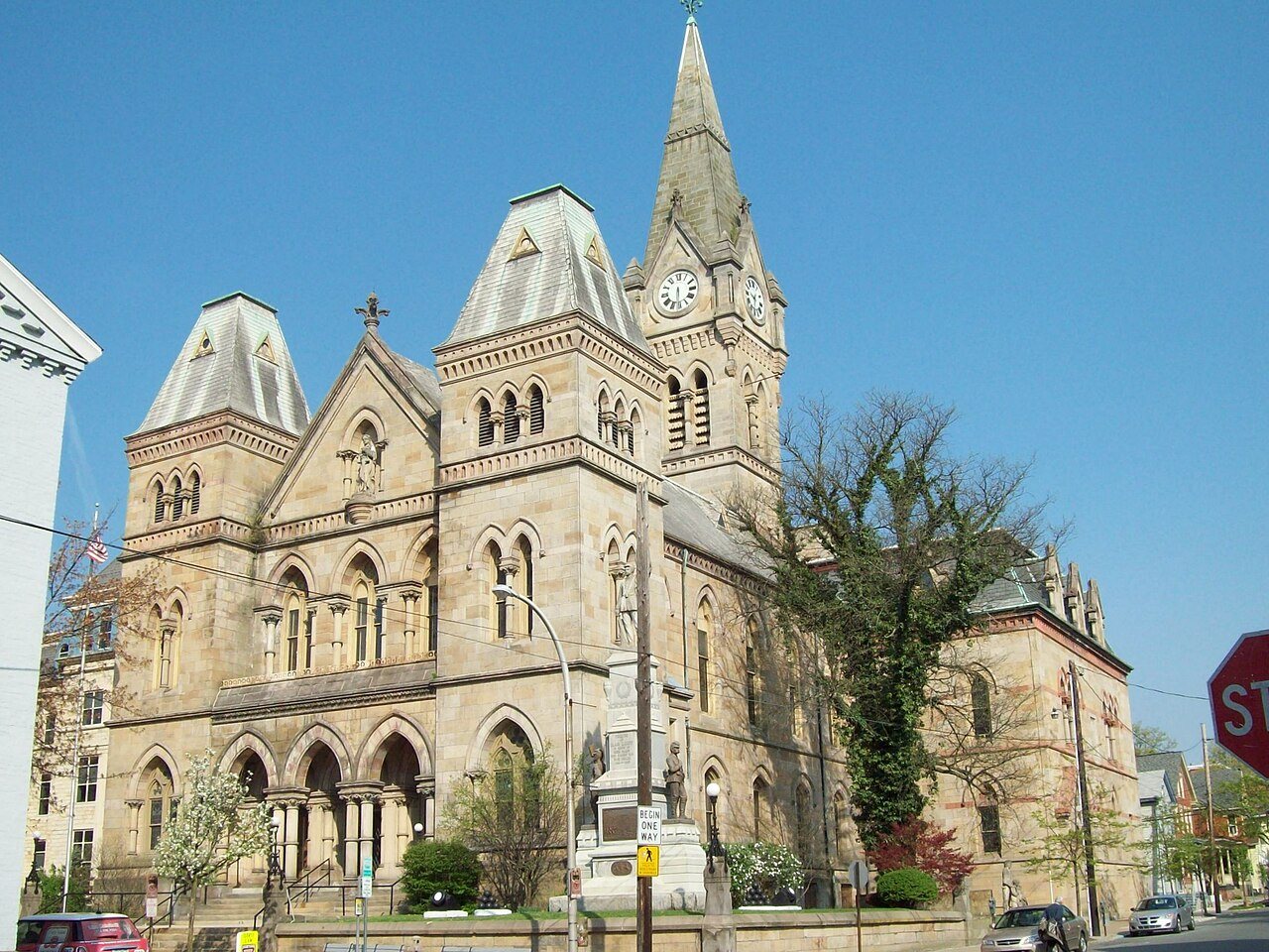
4 listings: 2 buildings, among them the Blair County Courthouse (listed 1976, the first), 1 historic district, the Hollidaysburg Historic District, with 426 contributing buildings, and 1 site. 428 historic buildings in all.
How old are the homes in Hollidaysburg?
42% of Hollidaysburg’s homes were built before 1940 (Census estimate, ±9.0 points), against a typical 18% for a Pennsylvania town; the median home was built in 1951.
Founding dates: Wikidata, Wikipedia, the U.S. post office records of Blevins & Helbock (CC0) and the Census. Homes by year built: Census ACS 2020–24. National Register of Historic Places: National Park Service (list of May 22, 2026). Old photos, postcards and papers: Wikimedia Commons, the Library of Congress and other public archives, credited on each item’s page. Maps: U.S. Geological Survey historical topographic maps (via Esri) and Sanborn fire-insurance maps (Library of Congress). History text and census tables: Wikipedia (CC BY-SA 4.0). Places that used to be: USGS Geographic Names Information System (2021).
From Wikimedia Commons (32), the Library of Congress (1), Wikidata (1), the National Register of Historic Places (4), Wikipedia, Wikidata and Wikipedia for famous people, U.S. Geological Survey historical maps, U.S. Census counts (via Wikipedia), the US Post Offices dataset (Blevins & Helbock), the USGS Geographic Names Information System, Sanborn fire insurance maps (Library of Congress) and old county and town histories (Internet Archive). Archive images are copied here with their credits and licenses, shown on each photo’s page. Refreshed monthly.




 2012
 2012
 2012
 2012
 2012
 2012
 2012
 2012
 2012
 2012
 2012
 2012
 2012
 2012
 2012
 2012
 2012
 2012
 2012
 2010
 2008
 2008
 2008
 2008
 2008
 2008
 2008
 2008
 2008
 2007


