Peaked at 1,136 in 1880; 627 people lived here in 2020.
16 censuses, 1870–2020.
U.S. Census Bureau decennial counts, from the census table on Great Bend’s Wikipedia page.
Every building
Great Bend, building by building, 1885–1911
Fire insurance maps drew every building, what it was made of and what it was used for, so insurers could price the risk of fire. Pick a year, then a sheet.
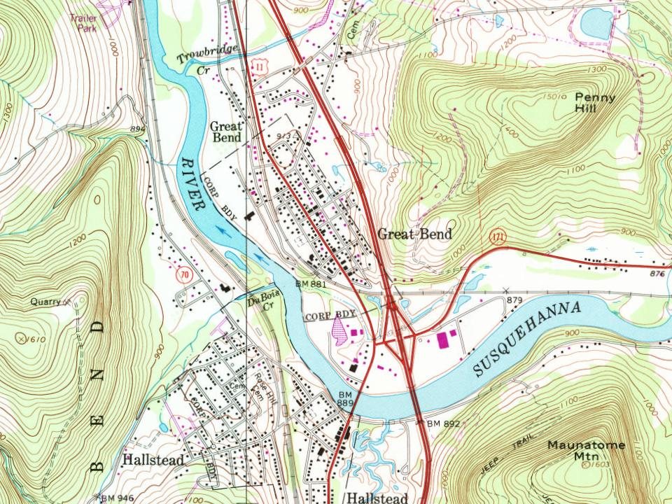
Great Bend Borough was incorporated on November 19, 1861, from parts of Great Bend Township. Great Bend was named from a bend in the Susquehanna River.
Passages that mention Great Bend, cut from the printed page as they were published.
Centennial history of Susquehanna County, Pennsylvania1887 · page 605Read the page →
Read the text
In 1853, when the church was built at Susquehanna, a new parish was created, called the Susquehanna parish. This was taken from the Silver Lake parish, and embraced Great Bend, New Milford and Nicholson. About 1872 Great Bend, New Milford and Nicholson were set off and Starrucca was annexed. From the origin of the church at this place until 1868, this parish was in the Philadelphia dio-
Text read by machine from the scan; it may contain errors.
History of Susquehanna County, Pennsylvania1873 · page 84Read the page →
Read the text
McKinney built his storehouse just previous, and it was at his platform the first trains stopped. The first superintendent of the road was Kirkwood ; Mr. E. J. Loder succeeded him, and the station at Great Bend was first named after him — Lodersville — the name also of the post-office, while the village on the south side of the river retained its old name — Great Bend. The post-office mark of the latter is now Great Bend Village, to distinguish it from the borough.
Text read by machine from the scan; it may contain errors.
History of Susquehanna County, Pennsylvania. from a period preceding its settlement to recent times, including the annals and geography of each township... Also a sketch of woman's work in the county for the United States sanitary commission, and a list o1873 · page 84Read the page →
Read the text
McKinney built his storehouse just previous, and it was at his platform the first trains stopped. The first superintendent of the road was ■ Kirkwood ; Mr. E. J. Loder succeeded him, and the station at Great Bend was first named after him — Lodersville — the name also of the post-office, while the village on the south side of the river retained its old name — Great Bend. The post-office mark of the latter is now Great Bend Village, to distinguish it from the borough.
Text read by machine from the scan; it may contain errors.
Centennial history of Susquehanna County, Pennsylvania1887 · page 581Read the page →
Read the text
boro' and the river bridge at Susquehanna, and assisted in building the depots on the line of the road between that place and Port Jervis, and had charge of the erection of the depot at Great Bend. In fall and winter of 1849-50 he wentto Centre Village, N. Y., and completed a toll-bridge over the Susquehanna River, built a toll-house and also a hotel. In 1850 himself and father associated themselves together, under the
Text read by machine from the scan; it may contain errors.
Scans and text from the Internet Archive. Books published in 1930 or earlier, which are in the public domain.
Timeline
Great Bend, 1823 to 1968
Woven from the archive, old maps, post office records, the National Register and the people born here.
Nothing in the archives for these yearsWeddings on Main Street, storms, parades, school pictures, the old store. If it’s in your family album, it belongs here.
Founding dates: Wikidata, Wikipedia, the U.S. post office records of Blevins & Helbock (CC0) and the Census. Homes by year built: Census ACS 2020–24. National Register of Historic Places: National Park Service (list of May 22, 2026). Old photos, postcards and papers: Wikimedia Commons, the Library of Congress and other public archives, credited on each item’s page. Maps: U.S. Geological Survey historical topographic maps (via Esri) and Sanborn fire-insurance maps (Library of Congress). History text and census tables: Wikipedia (CC BY-SA 4.0). Places that used to be: USGS Geographic Names Information System (2021). How TownRatings grades history →
From Wikimedia Commons (11), the Library of Congress (1), Wikipedia, Wikidata and Wikipedia for famous people, U.S. Geological Survey historical maps, U.S. Census counts (via Wikipedia), the US Post Offices dataset (Blevins & Helbock), the USGS Geographic Names Information System, Sanborn fire insurance maps (Library of Congress) and old county and town histories (Internet Archive). Archive images are copied here with their credits and licenses, shown on each photo’s page. Refreshed monthly.


 1887
 2009
 2009
 2009
 2009
 2009
 2009
 2009
 2009
 2009