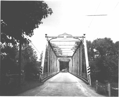
From French Creek Township’s archive · credits on each photo
Quick answers
How French Creek Township began
When was French Creek Township founded?
1837
The French Creek Township post office opened in 1837, the earliest record of the town by name. Three smaller post offices, French Creek (1837), Deer Creek (1839) and Milledgeville (1852), opened inside today’s town and later closed.
First census: 764 in 20002020 census: 710189 years
Founding year: the first French Creek Township post office (Blevins & Helbock, CC0).The full story ↓
What stands out about French Creek Township’s past
Read from the archive, the National Register and the record. The page puts what stands out first.
US Post Offices dataset (Blevins & Helbock, CC0). Places and cemeteries from the USGS Geographic Names Information System (2021).
On the map
French Creek Township on the map, 1911 to 1970
Every edition of the U.S. Geological Survey’s map of French Creek Township. Tap a year, or press play to watch the town change.
1911Stoneboro sheet · 1:62,500
U.S. Geological Survey historical topographic maps (public domain), via Esri’s collection of the scans. The red ring marks the center of French Creek Township.
The story
How French Creek Township came to be
From Wikipedia’s history of French Creek Township.
What they wrote about French Creek Township in 1888
Passages that mention French Creek Township, cut from the printed page as they were published.
History of Mercer County, Pennsylvania1888 · page 527Read the page →
Read the text
French Creek Township was formed in 1805, the first mention of it on the court records being under date of August, of that year, when the survey was returned and approved. It was originally much larger than at present, its territory having been very much diminished November 19, 1849, by the formation of Mill Ci'eek Township. The surface of the township is very much broken.
Text read by machine from the scan; it may contain errors.
History of Mercer County, Pennsylvania1888 · page 578Read the page →
Read the text
The old township of Sandy Creek, with its gigantic area of fifty square miles, was erected in 1804. It extended from the line of Crawford County on the north to the old township of Cool Spring on the south, and was bounded on the east by French Creek Township and on the west by Salem. It existed in this shape until the year 1850. On December 18, of that j«ear, a number of petitions, asking for a division of the old organization into four new ones, was presented in court. Francis Beatty, James A. Leech and Joseph Kerr were appointed commissioners. They reported a division, which, being confirmed June 23,
Text read by machine from the scan; it may contain errors.
Scans and text from the Internet Archive. Books published in 1930 or earlier, which are in the public domain.
Timeline
French Creek Township, 1837 to 1982
Woven from the archive, old maps, post office records, the National Register and the people born here.
Nothing in the archives for these yearsWeddings on Main Street, storms, parades, school pictures, the old store. If it’s in your family album, it belongs here.
Founding dates: Wikidata, Wikipedia, the U.S. post office records of Blevins & Helbock (CC0) and the Census. Homes by year built: Census ACS 2020–24. National Register of Historic Places: National Park Service (list of May 22, 2026). Old photos, postcards and papers: Wikimedia Commons, the Library of Congress and other public archives, credited on each item’s page. Maps: U.S. Geological Survey historical topographic maps (via Esri) and Sanborn fire-insurance maps (Library of Congress). History text and census tables: Wikipedia (CC BY-SA 4.0). Places that used to be: USGS Geographic Names Information System (2021). How TownRatings grades history →
From Wikimedia Commons (10), the National Register of Historic Places (1), Wikipedia, U.S. Geological Survey historical maps, U.S. Census counts (via Wikipedia), the US Post Offices dataset (Blevins & Helbock), the USGS Geographic Names Information System and old county and town histories (Internet Archive). Archive images are copied here with their credits and licenses, shown on each photo’s page. Refreshed monthly.


 2024
 2024
 2019
 2019
 2019
 2019
 2019
 2010
 2010