Guest, Sign inJoin

Post to Foxburg

We’ll email a one-tap link to publish your post. No password, and nothing is public until you click it.
Already a member? Sign in
–Not graded
History · Foxburg

Foxburg’s post office opened in 1868, and 69% of its homes were built before 1940

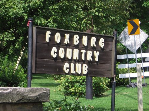
Its Register listings are the Foxburg Country Club and Golf Course and the Memorial Church of Our Father. Below: 1 old photo or paper, maps from 1907 on, and the census since 1880.

1868first post office
2on the National Register
69%homes built before 1940
1old photo or paper
From Foxburg’s archive · credits on each photo
Quick answers

How Foxburg began

When was Foxburg founded?

1868

The Foxburg post office opened in 1868, the earliest record of the town by name. Wikidata gives 1870.

First census: 514 in 18802020 census: 181158 years
Founding year: the first Foxburg post office (Blevins & Helbock, CC0). Wikidata: 1870.The full story ↓

What stands out about Foxburg’s past

Read from the archive, the National Register and the record. The page puts what stands out first.

★ What stands out · Help out

Start Foxburg’s collection

The first neighbors to add old photos shape how Foxburg’s history is told.

Decades since 1900 with photos
00s10s20s30s40s50s60s70s80s90s
1 of 10 decades. The empty ones are waiting for someone’s album.
The story

How Foxburg came to be

From Wikipedia’s history of Foxburg.

Read it all →

The town takes its name from the Fox family of Philadelphia, former owners of the land upon which the town was built. Samuel Mickle Fox (1763–1808), along with his brother George and brothers-in-law Joseph Parker Norris and George Roberts, purchased a number of tracts of land in western Pennsylvania from the Commonwealth during the 1790s. Six of these tracts, numbered #5725–5730, comprising 6,600 acres (2,700 ha), were contiguous and located along the Allegheny north of its confluence with Toby's Creek (today's Clarion River). The present town of Foxburg is located on what was designated tract #5729.

Text from Wikipedia, licensed CC BY-SA 4.0.

On the map

Foxburg on the map, 1907 to 1972

Every edition of the U.S. Geological Survey’s map of Foxburg. Tap a year, or press play to watch the town change.

Foxburg on the 1907 USGS mapFoxburg on the 1963 USGS mapFoxburg on the 1972 USGS map1907Foxburg sheet · 1:62,500

U.S. Geological Survey historical topographic maps (public domain), via Esri’s collection of the scans. The red ring marks the center of Foxburg.

From the old history books

What they wrote about Foxburg in 1887

Passages that mention Foxburg, cut from the printed page as they were published.

Enterprises of importance were constantly seeking his advice and co-operation. In railroad interests he was identified with the Foxburg, St. Petersburg and Clarion Railway (now the Pittsburgh and Western) as its treasurer, and was for many years a director of the company, and was also treasurer of …
History of Clarion County, Pennsylvania1887Read the page →
Read the text

Enterprises of importance were constantly seeking his advice and co-operation. In railroad interests he was identified with the Foxburg, St. Petersburg and Clarion Railway (now the Pittsburgh and Western) as its treasurer, and was for many years a director of the company, and was also treasurer of the Foxburg, Kane and Bradford Railroad ; a large stockholder in the Parker, Karns City and Butler Railroad, and in the Parker Bridge Company, and secretary and treasurer of the Foxburg and St. Petersburg Turnpike Company.

Text read by machine from the scan; it may contain errors.
Early in 1879 the Foxburg, St. Petersburg and Clarion Railroad was projected, and he, believing it would be of material benefit to the village of Foxburg, entered into its construction with his usual energy. He was made president, and the road was vigorously pushed toward completion. Later he bough…
History of Clarion County, Pennsylvania1887 · page 637Read the page →
Read the text

Early in 1879 the Foxburg, St. Petersburg and Clarion Railroad was projected, and he, believing it would be of material benefit to the village of Foxburg, entered into its construction with his usual energy. He was made president, and the road was vigorously pushed toward completion. Later he bought a controlling interest in the Emlenton, Shippenville and Clarion Railroad, running from Emlenton to Clarion, the total length of both roads being about fifty miles. He had in contemplation the enlarging of his railroads, and had acquired a charter to Kane, intending to make connection with the Philadelphia and Erie Railroad. This has been done since his death, and the roads

Text read by machine from the scan; it may contain errors.

Scans and text from the Internet Archive. Books published in 1930 or earlier, which are in the public domain.

Timeline

Foxburg, 1868 to 1923

Woven from the archive, old maps, post office records, the National Register and the people born here.

  1. 19th century
  2. 1868Post officeThe Foxburg post office opens
  3. 20th century
  4. 1907On the mapFirst mapped by the U.S. Geological Survey
  5. 1923In the archiveFoxburg PA Reformed PHS220
By decade

Foxburg, decade by decade

One decade in the archive so far: the 1920s. Scroll each row; tap a photo for its story.

1930s–1990snothing yet
Nothing in the archives for these yearsWeddings on Main Street, storms, parades, school pictures, the old store. If it’s in your family album, it belongs here.
Add from your album
Then & now

Stand where they stood

No then-and-now pairs yet. Take a photo from the same spot as an old one and they appear here side by side.

Foxburg PA Reformed PHS220
Retake this viewFoxburg PA Reformed PHS220, 1923

Find the spot, match the angle, and add your photo. It becomes the first then-and-now pair on Foxburg’s page.

Retake this view · +15
On the National Register

2 historic places in Foxburg

The country’s official list of buildings and places worth saving.

places listed
2
National Historic Landmarks
0
none yet
historic buildings protected
4
each building in a district counts
first listed
2007
Foxburg Country Club and Golf Course
BuildingsSites

Architectural styles listings

Late 19th Century Revival1
Early 20th Century Revival1
Arts and Crafts1
All 2 listings

National Park Service, National Register of Historic Places. Photos from Wikimedia Commons, credited on each place’s page.

People over time

Foxburg, census by census

010020030040050018801900192019401960198020002020Peak: 514

Between 181 and 514 people in every census since 1880.

11 censuses, 1880–2020.

U.S. Census Bureau decennial counts, from the census table on Foxburg’s Wikipedia page.

Famous people

Famous people close to Foxburg

Nobody well known was born in Foxburg itself, so here are the best known from just nearby.

See all →
Stories next door

History across the town line

Each neighbor’s History grade, on the same three inputs.

Questions about Foxburg’s history

What year was Foxburg founded?

The Foxburg post office opened in 1868, the earliest record of the town by name (U.S. post office records). Wikidata gives 1870.

What is on the National Register in Foxburg?

Two places: the Foxburg Country Club and Golf Course (listed 2007) and the Memorial Church of Our Father (2022).

Memory lane

What the archives can’t tell you, neighbors can.

Town Square →
Start a conversation
Sources

Where this page comes from

Founding dates: Wikidata, Wikipedia, the U.S. post office records of Blevins & Helbock (CC0) and the Census. Homes by year built: Census ACS 2020–24. National Register of Historic Places: National Park Service (list of May 22, 2026). Old photos, postcards and papers: Wikimedia Commons, the Library of Congress and other public archives, credited on each item’s page. Maps: U.S. Geological Survey historical topographic maps (via Esri) and Sanborn fire-insurance maps (Library of Congress). History text and census tables: Wikipedia (CC BY-SA 4.0). Places that used to be: USGS Geographic Names Information System (2021). How TownRatings grades history →

From Wikimedia Commons (6), the National Register of Historic Places (2), Wikipedia, U.S. Geological Survey historical maps, U.S. Census counts (via Wikipedia), the US Post Offices dataset (Blevins & Helbock), the USGS Geographic Names Information System and old county and town histories (Internet Archive). Archive images are copied here with their credits and licenses, shown on each photo’s page. Refreshed monthly.