
Fort Indiantown GapPA
A town in Pennsylvania.
Is Fort Indiantown Gap a good place to live?
Memorial Lake State Park, at 220 acres with 3.4 miles of trail, is the biggest park or preserve. We don’t grade Fort Indiantown Gap yet; the figures below are still real.
Hersheypark and 37 more within 40 miles
Museums, parks, gardens and other places to visit around Fort Indiantown Gap. Close and well known come first.
 12 mi Theme parkHersheypark3.0M visitors a year
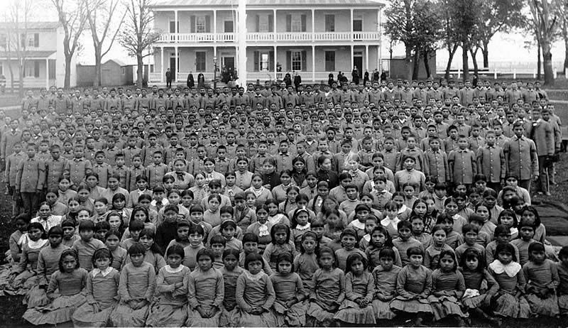 35 mi National MonumentCarlisle Federal Indian Boarding School National Monument
 11 mi Stadium & arenaHersheypark Stadium
 12 mi MuseumHershey's Chocolate World30 mi Theme parkKnoebels Amusement Resort
 12 mi Stadium & arenaHersheypark Arena
Photo credits
Hersheypark: Michael Gray, CC BY-SA 2.0 · Carlisle Federal Indian Boarding School National Monument: Unknown authorUnknown author, Public domain · Hersheypark Stadium: 45BearsFan, CC BY-SA 4.0 · Hershey's Chocolate World: Phillyfan0419, CC BY-SA 3.0 · Hersheypark Arena: Hersheyarena4ever at English Wikipedia, Public domain


Moving to Fort Indiantown Gap: who provides what
Fort Indiantown Gap is unincorporated, so Lebanon County and regional agencies provide most services.
EPA SDWIS (Oct 9, 2026) · HIFLD + EIA-861 2025 · Census 2020 ZCTAs · NCES 2024–25 · registration: vote.gov, updated Nov 18, 2024.
The data
Ordered by what stands out in Fort Indiantown Gap.
The biggest natural risk in Fort Indiantown Gap is inland flooding, at a low overall level
Just over three fifths of Fort Indiantown Gap’s expected losses from natural hazards come from inland flooding, followed by hurricanes at 18%. Expected storm and flood damage is lower than in just over three quarters of U.S. communities.
FEMA National Risk Index · OpenFEMA
The climate in Fort Indiantown Gap brings four seasons and pleasant summers
A winter brings about 24 inches of snow, with January nights at 21° and July afternoons at 85°.
Typical low → high °F
NOAA U.S. Climate Normals, 1991–2020
How healthy Fort Indiantown Gap is
For adults in Fort Indiantown Gap, the share who smoke cigarettes is 17%. Fort Indiantown Gap: a quarter of adults have been diagnosed with depression, against 24% in Pennsylvania’s towns and 23% across U.S. towns.
| Fort Indiantown Gap | Pennsylvania towns | U.S. towns | |
|---|---|---|---|
| Smoke cigarettes (CDC PLACES) | 17% | 17% | 14% |
| Depression (CDC PLACES) | 25% | 24% | 23% |
| Binge drink (CDC PLACES) | 18% | 18% | 16% |
| High blood pressure (CDC PLACES) | 33% | 34% | 35% |
| What stands out | Fort Indiantown Gap | PA |
|---|---|---|
| More uninsured adults | 7.3% | 5.8% |
CDC PLACES 2025 · modeled estimates for adults · CMS · HRSA
1.9% of Fort Indiantown Gap is conserved land
4.5 miles of trail wind through 2 parks and preserves. The trail density in Fort Indiantown Gap is 0.2 miles per square mile.
| Fort Indiantown Gap | Pennsylvania towns | U.S. towns | |
|---|---|---|---|
| Conserved land | 1.9% | 8.2% | 4.3% |
| Miles of trail per square mile | 0.2 miles per square mile | 0.4 | 0.4 |
| Biggest places to walk | Trails | Acres |
|---|---|---|
| 1. Memorial Lake State Park | 3.4 mi | 220 |
| 2. State Game Lands Number 211 | — | 8 |
Trails & parks © OpenStreetMap contributors · Conserved land: USGS PAD-US
Everything we know about Fort Indiantown Gap
Colleges nearby
1 within 15 miles of the center of Fort Indiantown Gap
About Fort Indiantown Gap
National Guard training facility in Pennsylvania, US
Fort Indiantown Gap, also referred to as "The Gap" or "FIG", is a census-designated place and National Guard Training Center primarily located in East Hanover and Union townships in Lebanon County, Pennsylvania, United States. (A portion of the installation is located in eastern Dauphin County.) It is located adjacent to Interstate 81, 23 miles (37 km) northeast of Harrisburg, just north of the northern terminus of Pennsylvania Route 934 at I-81's Exit 85. The installation is an active National Guard Training Center and serves as headquarters for the Pennsylvania Department of Military and Veterans Affairs and the Pennsylvania National Guard. The post includes about 18,000 acres (73 km2) of…
From Wikipedia, licensed CC BY-SA 4.0 · facts via Wikidata (CC0)
- Established
- 1931
- Area
- 20 sq mi
- Elevation
- 571 ft
Fort Indiantown Gap’s neighbors
2 towns share a border with Fort Indiantown Gap.
| Town | PA rank | Overall | Cost | Safety | Schools | Health |
|---|---|---|---|---|---|---|
| Fort Indiantown Gap | — | — | — | — | — | — |
| East Hanover Township | #682 | B− | C+ | — | B− | B |
| East Hanover Township | #417 | B+ | C+ | — | B+ | A− |
East Hanover Township and East Hanover Township report no FBI crime data of their own. Fort Indiantown Gap isn’t graded (fewer than 1,000 residents, or not enough data). Compare Fort Indiantown Gap with a neighbor →
Questions about Fort Indiantown Gap
Short answers, built from the data on this page.
Is Fort Indiantown Gap, PA a good place to live?
We don’t grade Fort Indiantown Gap yet; the figures below are still real. A town in Pennsylvania.