A post office called Export has been in operation since 1892. The borough was so named because coal was once mined in and exported from the town.
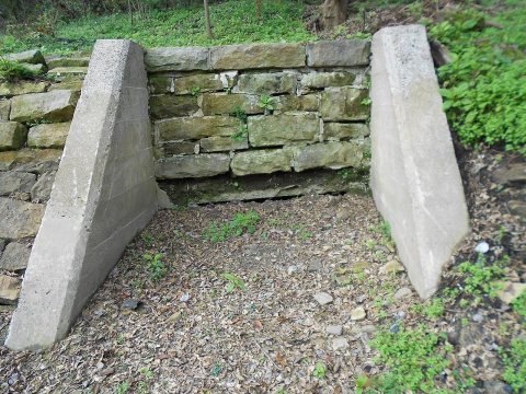
The remains of Westmoreland Coal Company's South (#2) mine are still visible behind the District Court building in Export. A 2018 project unearthed three entrances. A fourth entrance was rediscovered in January 2019 by Michael Mance and Lou Corsi.
Passages that mention Export, cut from the printed page as they were published.
History of Westmoreland county, Pennsylvania1906 · page 466Read the page →
Read the text
particularly coal lands, and on his return to Pennsylvania made large purchases of coal lands for the Westmoreland Coal Company. In 1890 he went to Irwin, his present home. In 1900, having purchased for the company their lands at Export, he accpiired property there in his own name and began mining independently, and in 1902 organized the W. B. Skelly Coal Company, which is now carrying on a flourishing business. In the conduct of his coal operations Mr. Skelly gives employment to a large number of men and distributes his output throughout the central states and Canada.
Text read by machine from the scan; it may contain errors.
Scans and text from the Internet Archive. Books published in 1930 or earlier, which are in the public domain.
Founding dates: Wikidata, Wikipedia, the U.S. post office records of Blevins & Helbock (CC0) and the Census. Homes by year built: Census ACS 2020–24. National Register of Historic Places: National Park Service (list of May 22, 2026). Old photos, postcards and papers: Wikimedia Commons, the Library of Congress and other public archives, credited on each item’s page. Maps: U.S. Geological Survey historical topographic maps (via Esri) and Sanborn fire-insurance maps (Library of Congress). History text and census tables: Wikipedia (CC BY-SA 4.0). Places that used to be: USGS Geographic Names Information System (2021). How TownRatings grades history →
From Wikimedia Commons (9), the Library of Congress (1), Wikipedia, U.S. Geological Survey historical maps, U.S. Census counts (via Wikipedia), the US Post Offices dataset (Blevins & Helbock), the USGS Geographic Names Information System, Sanborn fire insurance maps (Library of Congress) and old county and town histories (Internet Archive). Archive images are copied here with their credits and licenses, shown on each photo’s page. Refreshed monthly.


 Date?
 2019
 2019
 2019
 2018
 2018
 2018
 2018
 2016
 2010

