Egypt is one of the oldest communities in the Lehigh Valley region of eastern Pennsylvania. It was settled as early as 1733. It was the first settlement in Pennsylvania north of South Mountain. Egypt is one several Lehigh Valley locations, including Bethlehem, Nazareth, Emmaus, and Allentown's Jordan Creek, whose name was inspired by locations referenced in the Bible.
Passages that mention Egypt, cut from the printed page as they were published.
Observations on the expedition of General Buonaparte to the East1798Read the page →
Read the text
The Coptic is the most ancient language of Egypt. This was succceeded by the Greek, about the time of Alexander the Great ; and that by the Arabic, upon the commencement of the Califate, when the Arabs dispossessed, the Greeks of Egypt.
Text read by machine from the scan; it may contain errors.
Observations on the expedition of General Buonaparte to the East1798Read the page →
Read the text
tractable. The hippopotamus, or the river horse, an amphibious animal, resembling an ox in its hinder parts, with the head like a horse, is common in U pper Egypt. Tygers, hyenas, camels, antelopes, apes, with the head like a dog, and the rat, called icheumon, are natives of Egypt. The camelion, a little animal something resembling a lizard, that
Text read by machine from the scan; it may contain errors.
Scans and text from the Internet Archive. Books published in 1930 or earlier, which are in the public domain.
By decade
Egypt, decade by decade
One decade in the archive so far: the 1890s. Scroll each row; tap a photo for its story.
Nothing in the archives for these yearsWeddings on Main Street, storms, parades, school pictures, the old store. If it’s in your family album, it belongs here.
Founding dates: Wikidata, Wikipedia, the U.S. post office records of Blevins & Helbock (CC0) and the Census. Homes by year built: Census ACS 2020–24. National Register of Historic Places: National Park Service (list of May 22, 2026). Old photos, postcards and papers: Wikimedia Commons, the Library of Congress and other public archives, credited on each item’s page. Maps: U.S. Geological Survey historical topographic maps (via Esri) and Sanborn fire-insurance maps (Library of Congress). History text and census tables: Wikipedia (CC BY-SA 4.0). Places that used to be: USGS Geographic Names Information System (2021). How TownRatings grades history →
From Wikimedia Commons (6), Wikipedia, Wikidata and Wikipedia for famous people and old county and town histories (Internet Archive). Archive images are copied here with their credits and licenses, shown on each photo’s page. Refreshed monthly.


 2012
 2012
 2012
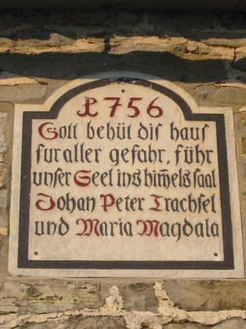 2008
 2008