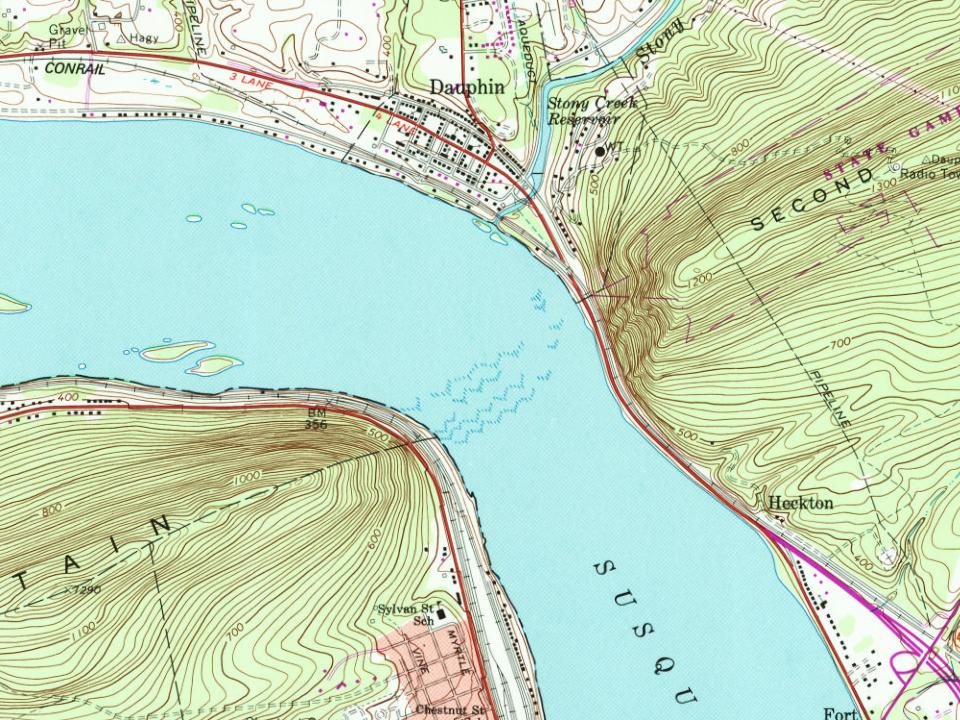
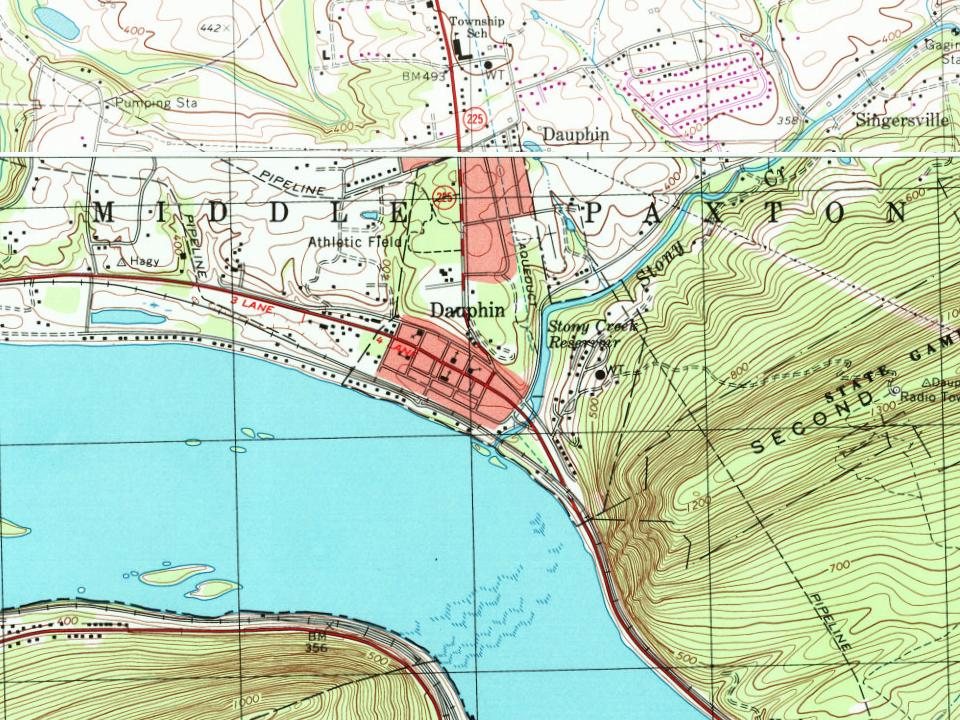
Dauphin borough began as a settlement at the mouth of Stony Creek, the head of a valley between Second and Third Mountains. It was established by Samuel Sturgeon in 1765. By the end of the eighteenth century, the Sturgeon property was owned by Revolutionary War soldier Timothy Green. The locality became known as Green's Mill, after the grist mill Colonel Green built at the mouth of the creek. According to local history, the area was also known for its colonial-period fort, alternately called Fort Lyon or Fort McKee. Colonel Green continued to hold highly valued real estate until his death in 1812. By 1814, his plantation property with its mills became part of his son Judge Innis Green's holdings. Judge Green continued to add to his real estate holdings throughout the early nineteenth century. The borough also took the name, Greensburg, after a post office.
Passages that mention Dauphin, cut from the printed page as they were published.
History of the counties of Dauphin and Lebanon1883 · page 113Read the page →
Read the text
"And be it fiiriher enacted by the authority aforesaid. That the district elections for the said County of Dauphin shall be held for the Townships of Derry and Londonderry at Hummels Town in the township of derry aforesaid, for the township of upper Paxtang on the north side of Peter's Mountain at Peter Hoffman's in said township, for the township of Lower Paxtang on the South side of Peter's Mountain, and West Hannover at the Court House 'of the said County, or at John Harris' until such Court House shall be erected, and for the Townships of Lebanon,
Text read by machine from the scan; it may contain errors.
History of the counties of Dauphin and Lebanon1883 · page 428Read the page →
Read the text
tinued until 1813, when Lebanon was formed, when the entire East Hanover, with a portion of West Hanover, were included in the new county. West Hanover in Dauphin continued as such until the year 1842, when by the sixty-fourth section of an act of Assembly, passed on the 4th of March that year, it provided " that the township of West Hanover, in the county of Dauphin, shall, as then divided into three
Text read by machine from the scan; it may contain errors.
The history and topography of Dauphin, Cumberland, Franklin, Bedford, Adams, and Perry counties [Pennsylvania]1846 · page 223Read the page →
Read the text
The first settlement, within the limits of Dauphin, chieflyconsisted of emigrants from the north of Ireland and Scotland, who commenced the improvement of farms prior to 1719 or 1720 ; for, it is evident, from authentic sources, that the Presbyterians organized the Paxton church and Derry church in 1720.* If tradition may, in this case, be relied on, John Harris, a native Yorkshire, who, it is said, was the first settler of the Conewago hills, must have commenced a settlement
Text read by machine from the scan; it may contain errors.
The history and topography of Dauphin, Cumberland, Franklin, Bedford, Adams, and Perry counties [Pennsylvania]1846 · page 209Read the page →
Read the text
Dauphin was afterwards reduced, by an act of Feb. 16, 1813, erecting Lebanon county out of parts of Dauphin and Lancaster. Dauphin is now bounded, north by Northumberland, northeast by Schuylkill, east by Lebanon, and south by Lebanon and Lancaster, and on the west by the Susquehanna, separating it from the counties of York, Cumberland and Perry ; the whole stream, however, being within the county, the course of the river through it, which is forty-
Text read by machine from the scan; it may contain errors.
Scans and text from the Internet Archive. Books published in 1930 or earlier, which are in the public domain.
Timeline
Dauphin, 1765 to 1892
Woven from the archive, old maps, post office records, the National Register and the people born here.
Fire insurance maps drew every building, what it was made of and what it was used for, so insurers could price the risk of fire. Pick a year, then a sheet.
1884Sheet 1 of 1
Edition
Sheets
BrickWoodStone
Sanborn Map Company, via the Library of Congress. Editions published in 1930 or earlier, which are in the public domain.
People over time
Dauphin, census by census
Between 545 and 998 people in every census since 1850.
18 censuses, 1850–2020.
U.S. Census Bureau decennial counts, from the census table on Dauphin’s Wikipedia page.
Questions about Dauphin’s history
What year was Dauphin founded?
In 1765, according to Wikidata and Wikipedia’s history of the town. Dauphin’s post office opened in 1826, and the census of 1850 counted 650 people here.
Founding dates: Wikidata, Wikipedia, the U.S. post office records of Blevins & Helbock (CC0) and the Census. Homes by year built: Census ACS 2020–24. National Register of Historic Places: National Park Service (list of May 22, 2026). Old photos, postcards and papers: Wikimedia Commons, the Library of Congress and other public archives, credited on each item’s page. Maps: U.S. Geological Survey historical topographic maps (via Esri) and Sanborn fire-insurance maps (Library of Congress). History text and census tables: Wikipedia (CC BY-SA 4.0). Places that used to be: USGS Geographic Names Information System (2021). How TownRatings grades history →
From Wikimedia Commons (5), Wikipedia, U.S. Geological Survey historical maps, U.S. Census counts (via Wikipedia), the US Post Offices dataset (Blevins & Helbock), the USGS Geographic Names Information System, Sanborn fire insurance maps (Library of Congress) and old county and town histories (Internet Archive). Archive images are copied here with their credits and licenses, shown on each photo’s page. Refreshed monthly.




 2025
 2025
 2020
 2020
 2013
