Founding year: Wikidata. First post office: 1857.The full story ↓
History grade
What drives Crafton’s History grade
On its age, its old homes and the National Register, Crafton is more historic than 72% of U.S. towns, #448 of 1,035 in Pennsylvania. Its share of homes from before 1940 holds the grade up; its age pulls it down.
B+
HistoryA character grade: shown, never part of Crafton’s overall grade.
Pennsylvania towns list about as much on the Register as the country (a typical Pennsylvania town has 2.1 per 10,000 residents, the U.S. 2.4), so Crafton’s 1.7 sits near the middle of its state (55% of Pennsylvania towns have fewer) while its 1 listings outnumber those of 51% of U.S. towns.
How sure. Graded on any two of the three inputs instead, the letter would range from C+ to A. The pre-1940 share is a Census survey estimate (±5.9 points). Two sources give 1872.
Founding year: Wikidata (other dates in Quick answers). Homes: Census ACS 2020–24. National Register: National Park Service, May 2026 list; each listing counted once (boundary changes and added documentation belong to their listing), and a historic district counts its contributing buildings. How TownRatings grades history →
What stands out about Crafton’s past
Read from the archive, the National Register and the record. The page puts what stands out first.
Prior to European colonial usurpation, the area was inhabited and controlled by the Seneca Indians. It is believed the legendary chief of the Seneca, Cornplanter, called the area Killemun. But even before the Seneca came, the Crafton/Ingram area was inhabited. In her 1993 historical account, local historian and Crafton-native, Betsy Martin, writes that, “Burial mounds from a much earlier pre-Columbian Adena Culture were found farther down the [Chartiers] creek toward the ‘Rocks’ in the vicinity of the Fall Hole.” It is likely Martin is referring to a mound site near the junction of the Creek with the Ohio River, a site which underwent excavations in 1896 by the Carnegie Museum. The excavation unearthed at least 33 burials, all “Early Woodland Adena in affiliation.” The Indians who built the mounds are believed to be Algonquin. While there is no way of knowing exactly which mounds Martin…
Passages that mention Crafton, cut from the printed page as they were published.
History of Allegheny county, Pennsylvania1889 · page 61Read the page →
Read the text
Brodhead post office was established in 1857 ; the name was changed to Crafton in 1881. It has been applied to the railroad station since 1873. St. Philip’s Roman Catholic Church, Crafton, is the oldest in Chartiers township. It is so named in honor of Philip Smith, of Philadelphia, by whom the site was donated. The church is a brick building, forty feet long and twenty-five feet wide, and was dedicated by Bishop Kenrick July 25, 1839.
Text read by machine from the scan; it may contain errors.
History of Allegheny county, Pennsylvania1889 · page 61Read the page →
Read the text
Brodhead post ofl&ce was established in 1857; the name was changed to Crafton in 1881. It has been applied to the railroad station since 1873. St. Philip's Roman Catholic Church, Crafton, is the oldest in Chartiers township. It is so named in honor of Philip Smith, of Philadelphia, by whom the site was donated. The church is a brick building, forty feet long and twenty-five feet wide, and was dedicated by Bishop Kenrick July 25, 1839.
Text read by machine from the scan; it may contain errors.
Scans and text from the Internet Archive. Books published in 1930 or earlier, which are in the public domain.
Timeline
Crafton, 1857 to 1960
Woven from the archive, old maps, post office records, the National Register and the people born here.
In 1872, according to Wikidata. Crafton’s post office opened in 1857, and the census of 1900 counted 1,927 people here.
How does Crafton rank for history?
Crafton is more historic than 72% of U.S. towns, #448 of 1,035 in Pennsylvania. The History grade combines the town’s founding era, the share of homes built before 1940 and its National Register listings. It’s a character grade, so it isn’t part of the overall grade. How it works.
What is on the National Register in Crafton?
One place: the Campbell Building (listed 1988).
How old are the homes in Crafton?
51% of Crafton’s homes were built before 1940 (Census estimate, ±5.9 points), against a typical 18% for a Pennsylvania town; the median home was built in 1938.
Founding dates: Wikidata, Wikipedia, the U.S. post office records of Blevins & Helbock (CC0) and the Census. Homes by year built: Census ACS 2020–24. National Register of Historic Places: National Park Service (list of May 22, 2026). Old photos, postcards and papers: Wikimedia Commons, the Library of Congress and other public archives, credited on each item’s page. Maps: U.S. Geological Survey historical topographic maps (via Esri) and Sanborn fire-insurance maps (Library of Congress). History text and census tables: Wikipedia (CC BY-SA 4.0). Places that used to be: USGS Geographic Names Information System (2021).
From Wikimedia Commons (18), the National Register of Historic Places (1), Wikipedia, Wikidata and Wikipedia for famous people, U.S. Geological Survey historical maps, U.S. Census counts (via Wikipedia), the US Post Offices dataset (Blevins & Helbock), the USGS Geographic Names Information System, Sanborn fire insurance maps (Library of Congress) and old county and town histories (Internet Archive). Archive images are copied here with their credits and licenses, shown on each photo’s page. Refreshed monthly.


 2025
 2025
 2025
 2024
 2024
 2024
 2024
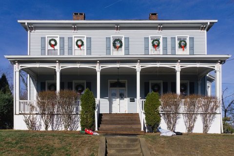 2024
 2024
 2020
 2020
 2020
 2011
 2010
 2010
 2010
 2009
 2007


