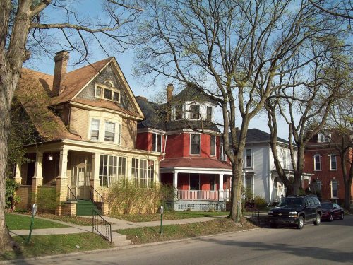
Clearfield dates to 1805, and 38% of its homes were built before 1940
More historic than 95% of U.S. towns · #113 of 1,035 in Pennsylvania. What drives it
4 places in town are on the National Register, among them a historic district with 19 buildings. Below: 6 old photos and papers, maps from 1887 on, and the census since 1850.
Founding year: Wikidata. First post office: 1823.The full story ↓
History grade
What drives Clearfield’s History grade
On its age, its old homes and the National Register, Clearfield is more historic than 95% of U.S. towns, #113 of 1,035 in Pennsylvania. All 3 inputs are above most U.S. towns; its share of homes from before 1940 ranks highest and its age lowest.
A+
HistoryA character grade: shown, never part of Clearfield’s overall grade.
Pennsylvania towns list about as much on the Register as the country (a typical Pennsylvania town has 2.1 per 10,000 residents, the U.S. 2.4), so Clearfield’s 37.5 sits above most of its state (85% of Pennsylvania towns have fewer) while its 22 historic buildings outnumber those of 80% of U.S. towns.
How sure. Graded on any two of the three inputs instead, the letter would range from A to A+. The pre-1940 share is a Census survey estimate (±5.8 points). Two sources give 1805.
Founding year: Wikidata (other dates in Quick answers). Homes: Census ACS 2020–24. National Register: National Park Service, May 2026 list; each listing counted once (boundary changes and added documentation belong to their listing), and a historic district counts its contributing buildings. How TownRatings grades history →
What stands out about Clearfield’s past
Read from the archive, the National Register and the record. The page puts what stands out first.
Fire insurance maps drew every building, what it was made of and what it was used for, so insurers could price the risk of fire. Pick a year, then a sheet.
There were many trade routes and paths for Native Americans living and passing through Clearfield County up to the 1600s. One major Indian path at the time was the Great Shamokin Path, which started near the Indian village of Shamokin (now Sunbury) on the Susquehanna River and continued west past Lock Haven, to Chinklacamoose, now the borough of Clearfield. Finally the path ended at the village of Kittanning on the Allegheny River, which is now the modern town of the same name.
Passages that mention Clearfield, cut from the printed page as they were published.
Twentieth century history of Clearfield County, Pennsylvania1911 · page 225Read the page →
Read the text
The Buffalo, Rochester and Pittsburg Railroad was built through the -northwestern part of Clearfield county in 1883. It originally entered this county from the northwest, running southeast to Du Bois and then south to Stump Creek, below which it again entered Jefferson county. In 1893 a branch known as the Clearfield and Mahoning Railroad was constructed
Text read by machine from the scan; it may contain errors.
History of Clearfield County, Pennsylvania1887 · page 498Read the page →
Read the text
Railroads. — With the extension of the Bell's Gap Railroad from Irvona, in Clearfield county, to Punxsutawney, in Jefferson county, by the Clearfield and Jefferson Railroad Company, the first railroad was constructed in Chest township in 1887. It passes through the extreme northern end of the township, and at the village of Newburg, one of the old towns of the township, has sprung up a flourishing town. From the southern boundary, through the whole length of the township, and to the northwestern corner flows Chest Creek, which has its source in Clearfield township, Cambria county. Situated
Text read by machine from the scan; it may contain errors.
History of Clearfield County, Pennsylvania1887Read the page →
Read the text
tion in the county. Alexander Irvin, that year, ran as a Whig, but without party nomination, for the ofifice of prothonotary, and was elected over Constance C. Hemphill. In 1842, Dr. Henry Loraine, a practicing physician of the town of Clearfield, received the instructions of Clearfield county for Congress. The convention of the district was held at Clearfield, where he was nominated by the convention of the district. The Democratic party had a fair working majority in the district at the time, but on account of the personal unpopularity of the candidate he was defeated at the polls.
Text read by machine from the scan; it may contain errors.
History of Clearfield County Pennsylvania1887 · page 105Read the page →
Read the text
The Beech Creek, Clearfield and Southwestern Railroad was constructed in Clearfield county during the year 1884, by a company of practical and experienced railroad men and capitalists, who desired to reach the Clearfield county coal regions by a route independent of the existing roads. The route extends from Jersey Shore, Lycoming county, to Philipsburg, Gazzam, and Clearfield.
Text read by machine from the scan; it may contain errors.
Scans and text from the Internet Archive. Books published in 1930 or earlier, which are in the public domain.
Timeline
Clearfield, 1805 to 1967
Woven from the archive, old maps, post office records, the National Register and the people born here.
Nothing in the archives for these yearsWeddings on Main Street, storms, parades, school pictures, the old store. If it’s in your family album, it belongs here.
In 1805, according to Wikidata. Clearfield’s post office opened in 1823, and the census of 1850 counted 503 people here.
How does Clearfield rank for history?
Clearfield is more historic than 95% of U.S. towns, #113 of 1,035 in Pennsylvania. The History grade combines the town’s founding era, the share of homes built before 1940 and its National Register listings. It’s a character grade, so it isn’t part of the overall grade. How it works.
What is on the National Register in Clearfield?
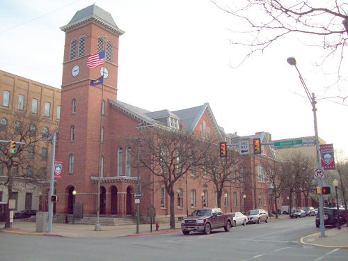
4 listings: 3 buildings, among them the Clearfield County Courthouse (listed 1979, the first), and 1 historic district, the Old Town Historic District, with 19 contributing buildings. 22 historic buildings in all.
How old are the homes in Clearfield?
38% of Clearfield’s homes were built before 1940 (Census estimate, ±5.8 points), against a typical 18% for a Pennsylvania town; the median home was built in 1950.
Founding dates: Wikidata, Wikipedia, the U.S. post office records of Blevins & Helbock (CC0) and the Census. Homes by year built: Census ACS 2020–24. National Register of Historic Places: National Park Service (list of May 22, 2026). Old photos, postcards and papers: Wikimedia Commons, the Library of Congress and other public archives, credited on each item’s page. Maps: U.S. Geological Survey historical topographic maps (via Esri) and Sanborn fire-insurance maps (Library of Congress). History text and census tables: Wikipedia (CC BY-SA 4.0). Places that used to be: USGS Geographic Names Information System (2021).
From Wikimedia Commons (10), the Library of Congress (1), Wikidata (1), the National Register of Historic Places (4), Wikipedia, Wikidata and Wikipedia for famous people, U.S. Geological Survey historical maps, U.S. Census counts (via Wikipedia), the US Post Offices dataset (Blevins & Helbock), the USGS Geographic Names Information System, Sanborn fire insurance maps (Library of Congress) and old county and town histories (Internet Archive). Archive images are copied here with their credits and licenses, shown on each photo’s page. Refreshed monthly.
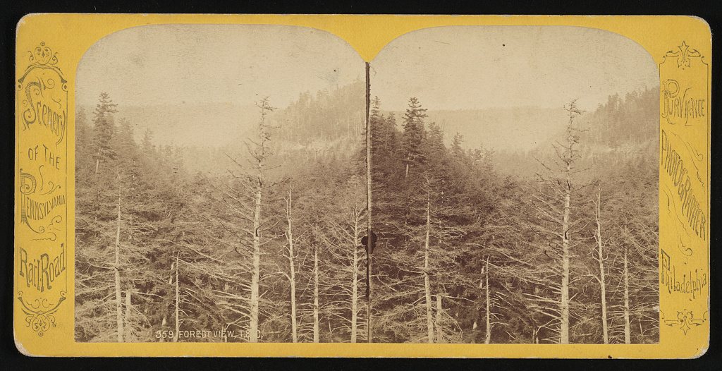




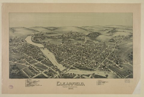 1895
 1895
 1895
 2012
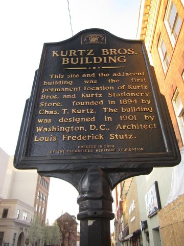 2012
 2012
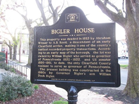 2012
 2005