Founding year: Wikidata. First post office: 1775.The full story ↓
History grade
What drives Chester’s History grade
On its age, its old homes and the National Register, Chester is more historic than 96% of U.S. towns, #110 of 1,035 in Pennsylvania. All 3 inputs are above most U.S. towns; its age ranks highest and its National Register listings lowest.
A+
HistoryA character grade: shown, never part of Chester’s overall grade.
Pennsylvania towns list about as much on the Register as the country (a typical Pennsylvania town has 2.1 per 10,000 residents, the U.S. 2.4), so Chester’s 2.4 sits near the middle of its state (59% of Pennsylvania towns have fewer) while its 8 listings outnumber those of 74% of U.S. towns.
NoteThe founding year comes from Wikidata alone; no second source gives 1682.
How sure. Graded on any two of the three inputs instead, the letter would range from A to A+. The pre-1940 share (±2.7 points) is firm at this size.
Founding year: Wikidata (other dates in Quick answers). Homes: Census ACS 2020–24. National Register: National Park Service, May 2026 list; each listing counted once (boundary changes and added documentation belong to their listing), and a historic district counts its contributing buildings. How TownRatings grades history →
What stands out about Chester’s past
Read from the archive, the National Register and the record. The page puts what stands out first.
Nothing in the archives for these yearsWeddings on Main Street, storms, parades, school pictures, the old store. If it’s in your family album, it belongs here.
The indigenous tribe that owned the land where Chester now stands were the Okehockings, removed by order of William Penn in 1702 to other lands in Chester County. The original indigenous name of Chester was Mecoponaca, which means "the stream along which large potatoes grow".
The first European settlers in the area were members of the New Sweden colony. The settlement that became Chester was first called "Finlandia" (the Latin name for Finland) and then "Upland" after the Swedish province of Uppland. The New Sweden settlers built Fort Mecoponacka in 1641 to defend the settlement.
In 1644, the present site of Chester was a tobacco plantation operated by the New Sweden colonists.
Passages that mention Chester, cut from the printed page as they were published.
History of Chester County, Pennsylvania, with genealogical and biographical sketches1881 · page 383Read the page →
Read the text
It will thus be seen that this senatorial district was composed of Chester County alone from 1790 to 1808; of Chester and Delaware from 1808 to 1836; of Chester, Delaware, and Montgomery from 1836 to 1843 ; of Chester and Delaware from 1843 to 1864; of Chester, Delaware, and Montgomery from 1864 to 1871 ; and again of Chester and Delaware from 1871 to 1874, since which Chester County alone forms a district.
Text read by machine from the scan; it may contain errors.
Biographical and portrait cyclopedia of Chester County, Pennsylvania, comprising a historical sketch of the county, by Samuel T. Wiley. Together with more than five hundred biographical sketches of the prominent men and leading citizens of the county1893 · page 98Read the page →
Read the text
Banks. — The "Bank of Chester" was one of the forty-one new banks that, were authorized by an act of legislature, in 1813, to be established in the State. Before the expiration of its last charter, in 1867, it was surrendered, and on October 25, 1864, it was organized under its present title, " The National Bank of Chester County." Since
Text read by machine from the scan; it may contain errors.
History of Chester County, Pennsylvania, with genealogical and biographical sketches1881 · page 355Read the page →
Read the text
bridges' should be a charge upon the county. This is the first instance on the records of a county bridge : " Feb. 25, 1707, upon the petition of the inhabitants of the town and county of Chester, and consented to and agreed to be allowed by the Grand Inquest of this county, representing that the bridge at Chester over the creek, and one bridge built over Ridley creek, and also a bridge to be built at Crum creek, at the Rock in the Queen's road, and that all roads leading to and from the same, shnll be erected,
Text read by machine from the scan; it may contain errors.
Biographical and portrait cyclopedia of Chester County, Pennsylvania, comprising a historical sketch of the county, by Samuel T. Wiley. Together with more than five hundred biographical sketches of the prominent men and leading citizens of the county1893 · page 34Read the page →
Read the text
Printz, built a fort on Tinicum island, just below Philadelphia. Three years later a Swedish settlement was made at Upland (Chester), in Delaware county, and thus was founded the first settlement in Chester county and the State of Pennsylvania. The Dutch held their several forts, or trading posts, on the east bank of the Delaware,
Text read by machine from the scan; it may contain errors.
Scans and text from the Internet Archive. Books published in 1930 or earlier, which are in the public domain.
Every building
Chester, building by building, 1885–1917
Fire insurance maps drew every building, what it was made of and what it was used for, so insurers could price the risk of fire. Pick a year, then a sheet.
In 1682, according to Wikidata. Chester’s post office opened in 1775, and the census of 1820 counted 657 people here.
How does Chester rank for history?
Chester is more historic than 96% of U.S. towns, #110 of 1,035 in Pennsylvania. The History grade combines the town’s founding era, the share of homes built before 1940 and its National Register listings. It’s a character grade, so it isn’t part of the overall grade. How it works.
What is on the National Register in Chester?
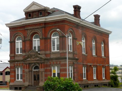
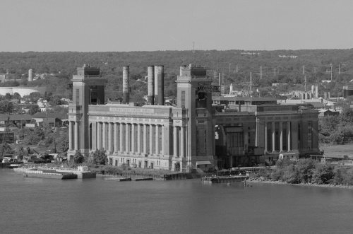
8 listings: 6 buildings, 1 site, and 1 structure.
How old are the homes in Chester?
36% of Chester’s homes were built before 1940 (Census estimate, ±2.7 points), against a typical 18% for a Pennsylvania town; the median home was built in 1949.
Founding dates: Wikidata, Wikipedia, the U.S. post office records of Blevins & Helbock (CC0) and the Census. Homes by year built: Census ACS 2020–24. National Register of Historic Places: National Park Service (list of May 22, 2026). Old photos, postcards and papers: Wikimedia Commons, the Library of Congress and other public archives, credited on each item’s page. Maps: U.S. Geological Survey historical topographic maps (via Esri) and Sanborn fire-insurance maps (Library of Congress). History text and census tables: Wikipedia (CC BY-SA 4.0). Places that used to be: USGS Geographic Names Information System (2021).
From Wikimedia Commons (18), the Library of Congress (4), the National Register of Historic Places (8), Wikipedia, Wikidata and Wikipedia for famous people, U.S. Geological Survey historical maps, U.S. Census counts (via Wikipedia), the US Post Offices dataset (Blevins & Helbock), the USGS Geographic Names Information System, Sanborn fire insurance maps (Library of Congress) and old county and town histories (Internet Archive). Archive images are copied here with their credits and licenses, shown on each photo’s page. Refreshed monthly.


 c. 1875
 1875
 1875
 1875
 1880
 1880
 1880
 1884
 1885
 1885
 1890s
 1900
 1900
 1900
 1900
 1914
 1914
 1914
 1914
 1917
 1917
 1917