Guest, Sign inJoin

Post to Brownsville Township

We’ll email a one-tap link to publish your post. No password, and nothing is public until you click it.
Already a member? Sign in
–Not graded
History · Brownsville Township

Brownsville Township dates to 1785, and 53% of its homes were built before 1940

Below: 17 old photos and papers, maps from 1902 on, and the census since 1810.

1785founded
0on the National Register
53%homes built before 1940
17old photos & papers
From Brownsville Township’s archive · credits on each photo
Quick answers

How Brownsville Township began

When was Brownsville Township founded?

1785

Brownsville Township dates its founding to 1785 (Wikidata). The census first counted it in 1810.

First census: 698 in 18102020 census: 534241 years
Founding year: Wikidata.The full story ↓

What stands out about Brownsville Township’s past

Read from the archive, the National Register and the record. The page puts what stands out first.

★ What stands out · By decade

Brownsville Township, decade by decade

6 decades in the archive, from the 1810s to the 1930s. Scroll each row; tap a photo for its story.

The story

How Brownsville Township came to be

From Wikipedia’s history of Brownsville Township.

Read it all →

In pre-Columbian times, the right bank of the Monongahela River held several mounds where iron-rich red stone predominated, now believed to have been constructed by a branch of the Mound Builders cultures, but believed by colonials to have been forts. This led to the area near the river crossing being called Redstone Old Fort in various colonial government records and later Fort Burd when an arms cache was built there. By the time the region first became known to Dutch colonists and traders and the French in the 1640s, the lands were largely unoccupied, but under the management of one tribe or shared by several groups of Iroquoian peoples, likely the Erie people or Wenro people and possibly shared with the Seneca, the Shawnee people and the Susquehannocks. With all the rivers and streams tributary to the Monongahela, Youghiogheny, and Allegheny Rivers, there is little known about the re…

Text from Wikipedia, licensed CC BY-SA 4.0.

On the map

Brownsville Township on the map, 1902 to 1979

Every edition of the U.S. Geological Survey’s map of Brownsville Township. Tap a year, or press play to watch the town change.

Brownsville Township on the 1902 USGS mapBrownsville Township on the 1931 USGS mapBrownsville Township on the 1940 USGS mapBrownsville Township on the 1954 USGS mapBrownsville Township on the 1969 USGS mapBrownsville Township on the 1979 USGS map1902Brownsville sheet · 1:62,500

U.S. Geological Survey historical topographic maps (public domain), via Esri’s collection of the scans. The red ring marks the center of Brownsville Township.

Timeline

Brownsville Township, 1785 to 1940

Woven from the archive, old maps, post office records, the National Register and the people born here.

  1. 18th century
  2. 1785
    FoundingBrownsville Township is established
  3. 19th century
  4. 1815In the archiveAmerican Telegraph 7-5-1815
  5. 1880In the archiveThe first iron bridge in the U.S
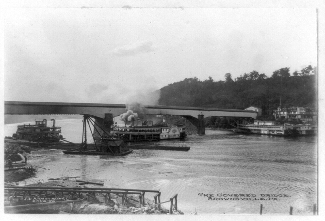
  6. 1890In the archiveThe Covered bridge, Brownsville, Pa
  7. 20th century
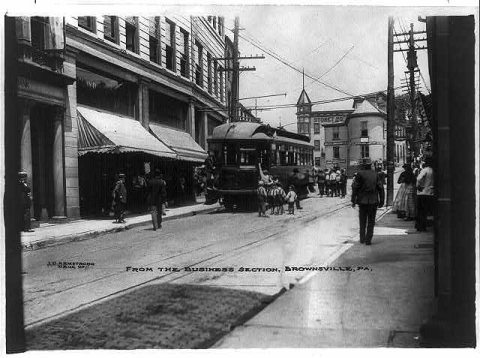
  8. 1900In the archiveFrom the business section, Brownsville, Pa
  9. 1902On the mapFirst mapped by the U.S. Geological Survey
  10. 1910In the archiveFirst iron bridge in the United States, Brownsville, Pennsylvania, 1910
  11. 1930In the archiveBrownsville from National Pike (Route 40), going west and the Monongahela River, Brownsvi…
  12. 1940CensusPopulation peaks at 8,015
Then & now

Stand where they stood

No then-and-now pairs yet. Take a photo from the same spot as an old one and they appear here side by side.

The first iron bridge in the U.S
Retake this viewThe first iron bridge in the U.S, 1880

Find the spot, match the angle, and add your photo. It becomes the first then-and-now pair on Brownsville Township’s page.

Retake this view · +15
People over time

Brownsville Township, census by census

02,0004,0006,0008,0001850190019502000Peak: 8,015

Peaked at 8,015 in 1940; 2,185 people lived here in 2020.

22 censuses, 1810–2020.

U.S. Census Bureau decennial counts, from the census table on Brownsville Township’s Wikipedia page.

Places that used to be

Old corners, places now gone and burying grounds

Old hamlets and crossroads still carry their names on the map.

Hamlets and corners on the map
CenturyKnoxville
Gone or out of use
Pike Minemine
1cemetery inside Brownsville Township
Redstone

Places and cemeteries from the USGS Geographic Names Information System (2021).

Help out

Finish Brownsville Township’s story

Most archives stop around 1920. The photos from after that are in family albums, not libraries.

Decades since 1900 with photos
00s10s20s30s40s50s60s70s80s90s
3 of 10 decades. The empty ones are waiting for someone’s album.
Stories next door

History across the town line

Each neighbor’s History grade, on the same three inputs.

Questions about Brownsville Township’s history

What year was Brownsville Township founded?

In 1785, according to Wikidata. the census of 1810 counted 698 people here.

Memory lane

What the archives can’t tell you, neighbors can.

Town Square →
Start a conversation
Sources

Where this page comes from

Founding dates: Wikidata, Wikipedia, the U.S. post office records of Blevins & Helbock (CC0) and the Census. Homes by year built: Census ACS 2020–24. National Register of Historic Places: National Park Service (list of May 22, 2026). Old photos, postcards and papers: Wikimedia Commons, the Library of Congress and other public archives, credited on each item’s page. Maps: U.S. Geological Survey historical topographic maps (via Esri) and Sanborn fire-insurance maps (Library of Congress). History text and census tables: Wikipedia (CC BY-SA 4.0). Places that used to be: USGS Geographic Names Information System (2021). How TownRatings grades history →

From Wikimedia Commons (18), the Library of Congress (4), Wikidata (2), Wikipedia, U.S. Geological Survey historical maps, U.S. Census counts (via Wikipedia) and the USGS Geographic Names Information System. Archive images are copied here with their credits and licenses, shown on each photo’s page. Refreshed monthly.