Nothing in the archives for these yearsWeddings on Main Street, storms, parades, school pictures, the old store. If it’s in your family album, it belongs here.
Nothing in the archives for these yearsWeddings on Main Street, storms, parades, school pictures, the old store. If it’s in your family album, it belongs here.
Before European settlers arrived in the Tulpehocken Creek valley, the area was inhabited by the Lenape people. In 1723, thirty-three Palatine families from Schoharie, New York, moved to the confluences of the Tulpehocken and Northkill Creeks. By 1735, a saw and grist mill was located three and a half miles up the Tulpehocken river from Bernville.
Passages that mention Bernville, cut from the printed page as they were published.
Historical and biographical annals of Berks County, Pennsylvania, embracing a concise history of the county and a genealogical and biographical record of representative families, comp. by Morton L. Montgomery ..1909 · page 273Read the page →
Read the text
Creamery Business. — (Charles M. Richardson (the burgess of Bernville) has been very successfully engaged in conducting creameries in different parts of Berks county for a number of years, having directed their affairs from Bernville as a central office under two firms with which he is connected, Ahrens & Richardson and Richardson Brothers, the former controlling eight creameries
Text read by machine from the scan; it may contain errors.
History of Berks county in Pennsylvania1886 · page 914Read the page →
Read the text
William Umbenhauer tavern-keeper Daniel Klopp tavern-keeper John Daniel tinsmith Incorporation. — Bernville was incorporated as a borough in 1851 in order to secure better schools and roads. The latter at that time were in a very poor condition, and measures were taken, as soon as the power was vested
Text read by machine from the scan; it may contain errors.
History of Berks county in Pennsylvania1886 · page 913Read the page →
Read the text
The borough of Bernville is situated in the western part of Penn township, on the North- Kill, near its confluence with the Tulpehocken Creek, and about ten miles from the nearest railway station, Mohrville, on the Philadelphia and Beading Railroad. Many substantial improvements have been made lately and the business men are 'enterprising ; but there has been
Text read by machine from the scan; it may contain errors.
Historical and biographical annals of Berks County, Pennsylvania, embracing a concise history of the county and a genealogical and biographical record of representative families, comp. by Morton L. Montgomery ..1909 · page 487Read the page →
Read the text
toral relations which continued for twenty-four years without alterations, and in part still exist. In the spring of 1901 he resigned the pastorate of Friedens church at Bernville, leaving its congregation with a new church edifice, built a few years before, completely furnished and paid for, and with money in its treasury. Since resigning the Bernville part of his charge he devotes himself exclusively to St. John's Church at Kutztown. Here also his
Text read by machine from the scan; it may contain errors.
Scans and text from the Internet Archive. Books published in 1930 or earlier, which are in the public domain.
Timeline
Bernville, 1832 to 2010
Woven from the archive, old maps, post office records, the National Register and the people born here.
Founding dates: Wikidata, Wikipedia, the U.S. post office records of Blevins & Helbock (CC0) and the Census. Homes by year built: Census ACS 2020–24. National Register of Historic Places: National Park Service (list of May 22, 2026). Old photos, postcards and papers: Wikimedia Commons, the Library of Congress and other public archives, credited on each item’s page. Maps: U.S. Geological Survey historical topographic maps (via Esri) and Sanborn fire-insurance maps (Library of Congress). History text and census tables: Wikipedia (CC BY-SA 4.0). Places that used to be: USGS Geographic Names Information System (2021). How TownRatings grades history →
From Wikimedia Commons (24), Wikipedia, U.S. Geological Survey historical maps, U.S. Census counts (via Wikipedia), the US Post Offices dataset (Blevins & Helbock), the USGS Geographic Names Information System and old county and town histories (Internet Archive). Archive images are copied here with their credits and licenses, shown on each photo’s page. Refreshed monthly.


 1862
 1898
 1898
 1933
 1968
 1968
 1968
 1968
 1968
 1968
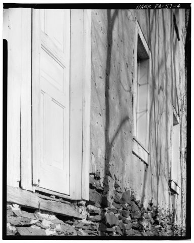 1968
 1968
 1968
 1968
 1968
 1968
 1968
 1968
 1968
 1975
 2012
 2012
 2012
 2012


