
Halprin Open Space Sequence
Many listed buildings are private homes. Please enjoy them from the street.
About the district
Halprin Open Space Sequence, at SW Open Spaces & Pedestrian Malls from Lincoln to Clay Sts., was added to the National Register of Historic Places on Mar 6, 2013. The Register lists it for its landscape design and town planning, at the national level. The listing covers 6 acres. 11 more Register listings are within a quarter mile.
What it isSeries of urban open spaces and pedestrian zones between Southwest Lincoln Street and Clay Street, in downtown Portland, Oregon, United States. From Wikidata (CC0). Read about it on Wikipedia ↗
Make it a walk: 5 landmarks in about 10 minutes
SW Open Spaces & Pedestrian Malls from Lincoln to Clay Sts., Portland · about 0.3 miles on foot, as the crow flies


- 1Halprin Open Space SequenceStart here
- 2
 Peter Taylor House and Haehlen, Gotlieb, HouseItalianate · Built 1882 · next door
- 3
 Walter F. Burrell HouseLate 19th and Early 20th Century American Movements · next door
- 4Walter F. Burrell House (Boundary Increase)Late 19th and Early 20th Century American Movements · next door
- 5
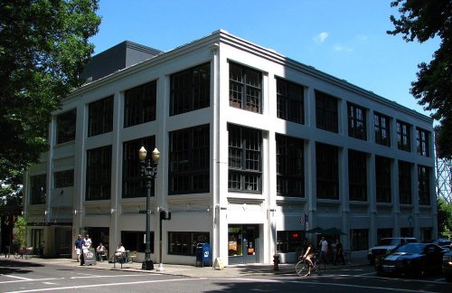 Jefferson SubstationBuilt 1909 · 0.2 mi on
66 more Register listings within half a mile
★ National Historic Landmark · D district · B building · S site. Each opens its own page.
Show the other 48
Memories of Halprin Open Space Sequence
The record says what it is. Neighbors know what it means.
Your answer becomes a post in Town Square.
Questions about Halprin Open Space Sequence
Is Halprin Open Space Sequence on the National Register of Historic Places?
Yes. It was added on Mar 6, 2013 (Register number 13000058).
Is Halprin Open Space Sequence a National Historic Landmark?
No. It is on the National Register; Oregon has 16 National Historic Landmarks. The nearest is Pioneer Courthouse, 0.5 miles away.
Can you visit Halprin Open Space Sequence?
Our record doesn’t say whether it is open to visitors. Many listed buildings are private, so it may only be seen from the street.
Sources: National Park Service, National Register of Historic Places (05/22/2026) · Wikidata. Map tiles © OpenStreetMap contributors.