
Oakridge, Oregon, 1942
Oakridge’s story
114 years in pictures
Census counts: 520 in 1940, 3,206 in 2020. The archive holds 6 old photos and papers going back to 1942 and 3 maps from 1925 on.
- 1912Oakridge is settled
Each edition grades its towns against each other only.
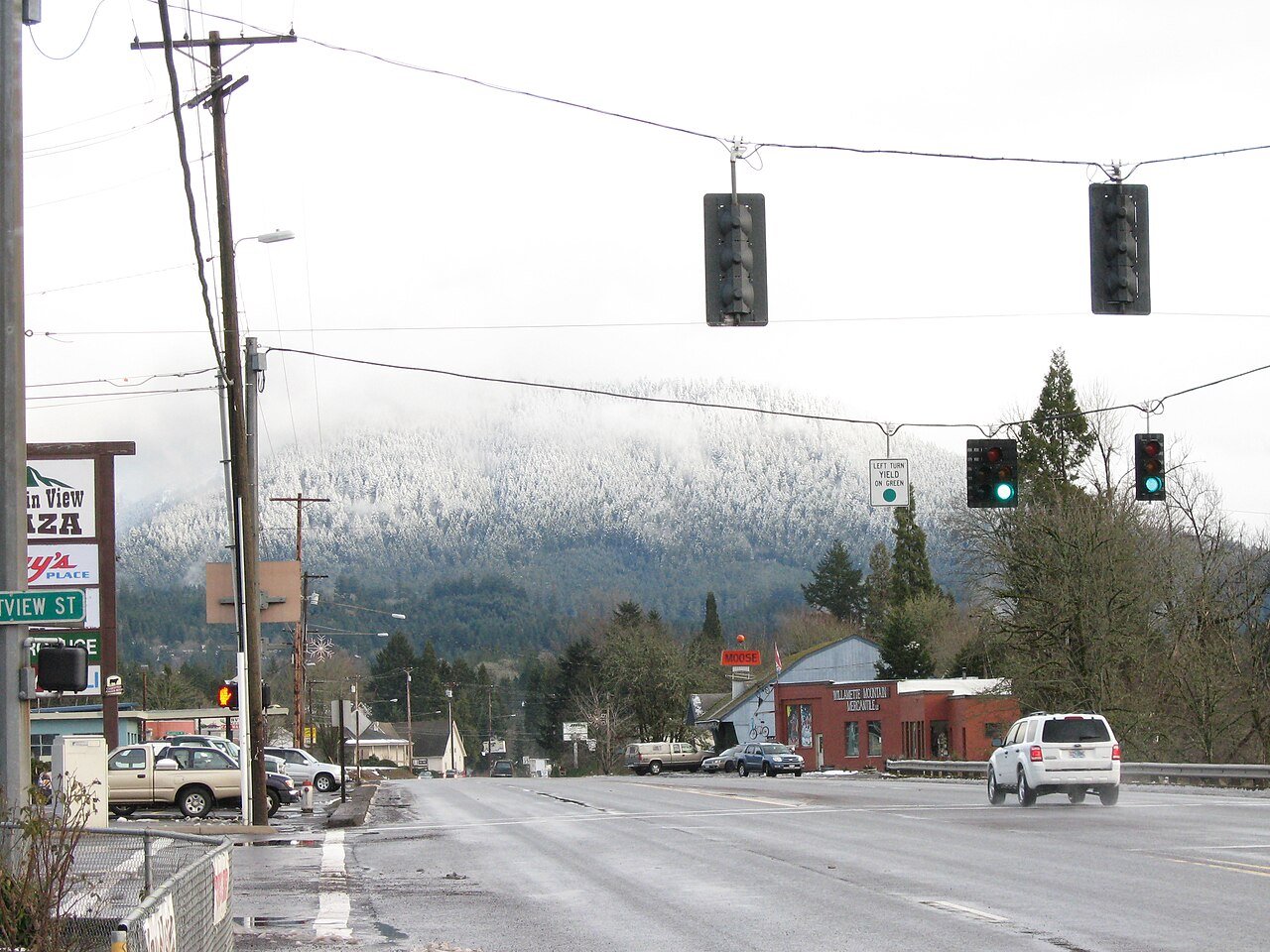
A town of 3,127, settled in 1912.
Oakridge earns a D−, 133rd of 142 graded towns in Oregon, mostly because of incomes and schools. The median household income is $40K, and 24% of residents live below the poverty line. Its schools rank behind 96% of the state's. In its favor, 5% of its land is conserved. Oakridge’s average trip to work is 45 minutes, against 23 minutes in Oregon’s towns and 25 minutes across U.S. towns. Only 2 of Oregon’s 228 towns score lower on health. FEMA rates its natural-hazard risk higher than 90% of U.S. communities, with inland flooding at the top.
Where Oakridge beats most towns, and one thing worth knowing.
| School | Grades | Students |
|---|---|---|
| Oakridge Elementary School | K–6 | 280 |
| Oakridge Junior High School | 7–8 | 80 |
| Oakridge High School | 9–12 | 155 |
Each subject compared with towns across the country (schools within Oregon), ordered by how far Oakridge is from typical.
How TownRatings grades towns →
Census counts: 520 in 1940, 3,206 in 2020. The archive holds 6 old photos and papers going back to 1942 and 3 maps from 1925 on.
Who provides power, water and the rest in Oakridge, and how to reach them.
EPA SDWIS (Oct 9, 2026) · HIFLD + EIA-861 2025 · Census 2020 ZCTAs · NCES 2024–25 · registration: vote.gov, updated Oct 2, 2026.
Ordered by what stands out in Oakridge.
Oakridge fares better on crime within Oregon than nationally, but it is a long drive from an emergency room and has poverty well above the Oregon rate.
Its public schools are run by Oakridge SD 76. Two of its 3 schools are below, each with why it’s listed.
| School | Level | Students | Letter |
|---|---|---|---|
| Oakridge Elementary SchoolLargest public elementary schoolGrades K–6 | Grades K–6 | 280 | C+ |
| Oakridge High SchoolLargest public high schoolGrades 9–12 | Grades 9–12 | 155 | – |
NCES · EDFacts · graded within OR on state tests and graduation
The nearest emergency room, Peacehealth Cottage Grove Community Medical Center, is 28.9 miles away in a straight line. Against the 2,477 U.S. towns with household incomes like Oakridge’s, it is less healthy than 64%, so its D isn’t only a matter of income.
21% of adults report frequent physical distress in Oakridge. Among 142 Oregon towns, just 2 have a higher share of adults who say their health is fair or poor than Oakridge. 17% of adults have diabetes in Oakridge.
| Oakridge | Oregon towns | U.S. towns | |
|---|---|---|---|
| Frequent physical distress (CDC PLACES) | 21% | 15% | 14% |
| Diabetes (CDC PLACES) | 17% | 11% | 12% |
| Fair or poor health (CDC PLACES) | 30% | 20% | 19% |
| High blood pressure (CDC PLACES) | 44% | 33% | 35% |
| What stands out | Oakridge | OR |
|---|---|---|
| Fewer binge drinkers | 11.5% | 15.4% |
| More adults treating high blood pressure | 77.6% | 71.4% |
| More adults with COPD | 14.1% | 6.8% |
CDC PLACES 2025 · modeled estimates for adults · CMS · HRSA
2.8 miles of trail in 2 parks and preserves. The trail density in Oakridge is 1.3 miles per square mile.
| Oakridge | Oregon towns | U.S. towns | |
|---|---|---|---|
| Miles of trail per square mile | 1.3 miles per square mile | 0.8 | 0.4 |
| Conserved land | 4.7% | 4.3% | 4.3% |
| Biggest places to walk | Trails | Acres |
|---|---|---|
| 1. Greenwaters Park | 0.4 mi | 19 |
| 2. Salmon Creek Park | — | 5 |
Trails & parks © OpenStreetMap contributors · Conserved land: USGS PAD-US
Among 142 Oregon towns, just 8 have a higher FEMA risk score than Oakridge.
FEMA National Risk Index · OpenFEMA
67.6% of renter households pay 30% or more of their income for housing, against 52.5% across Oregon.
The typical Oakridge home is worth about $282,000, about the same as a year ago, 43% below the Oregon typical home. Oakridge’s median rent is $1,017 a month.
| Oakridge | Oregon towns | U.S. towns | |
|---|---|---|---|
| Median rent | $1,017 a month | $1,415 a month | $1,185 a month |
| Households that own their home | 68% | 65% | 73% |
Census ACS, 2020–24 · Zillow Home Value Index · Redfin Data Center
Oakridge has mild winters and pleasant summers. July afternoons reach 82°, January nights drop to 34° and about 5 inches of snow falls in a winter.
NOAA U.S. Climate Normals, 1991–2020
The average commute for its 947 working residents takes 45.3 minutes, against 23 across Oregon. Jobs based here grew from 464 in 2013 to 776.
Since 2013, Oakridge has added 312 jobs, to 776 in 2023. About one in 4 of Oakridge’s working residents works in town. The top destinations are Eugene (18%), Springfield (9%) and Portland (5%).
Census LEHD 2023 · ACS
At 15.6 crimes per 1,000 residents a year, it reports less crime than 86% of Oregon’s graded towns. Violent crime is rare: 3 reported in 2025, 1 per 1,000 residents.
FBI crime data, 2025 · crimes reported to police
None within 15 miles of Oakridge; the nearest are
About 4 of every 100 Oakridge residents are enrolled in college, against 6 across Oregon.
City in Oregon, United States
Oakridge is a city in Lane County, Oregon, United States. The population was 3,206 as of the 2020 census. It is located east of Westfir on Oregon Route 58, about 40 miles (64 km) east of Eugene and 150 miles (240 km) southeast of Portland. Surrounded by the Willamette National Forest and the Cascade Range, Oakridge is popular with outdoor enthusiasts for its hiking, mountain biking, wildflowers, fly fishing, birding, watersports, and the nearby Willamette Pass Resort. The city was originally a community called "Hazeldell", and its post office was established on July 26, 1888. When a station on the Southern Pacific Railroad opened in May 1912, it was named "Oak Ridge" by a railroad executive…
From Wikipedia, licensed CC BY-SA 4.0 · facts via Wikidata (CC0)
Short answers, built from the data on this page.
Oakridge grades D− overall, better than 3% of U.S. towns and #133 of 142 in Oregon. It grades D for health, B for safety and D− for schools. Jobs & income is its weak spot, with a D−.
That is 3.9 years of the area's median household income ($71,544 across the Eugene-Springfield, OR metro area). Cost of living, which also weighs rents, property taxes and how many households pay 30% or more of their income for housing, grades C.