


 1811
 1812
 1844
 1845
 c. 1845
 1854
 1854
 1854
 1868
The story
Read it all →How Astoria came to be
From Wikipedia’s history of Astoria.
The present area of Astoria was inhabited by a large, prehistoric Native American trade system of the Columbia Plateau.
Text from Wikipedia, licensed CC BY-SA 4.0.
Each edition grades its towns against each other only.
More historic than 98% of U.S. towns · #1 of 142 in Oregon. What drives it
44 places in town are on the National Register, among them 2 National Historic Landmarks and three historic districts with 428 buildings between them. Below: 20 old photos and papers, maps from 1884 on, and the census since 1860.
Astoria dates its founding to 1811 (Wikidata). The census first counted it in 1860.
More historic than 98% of U.S. towns, on its age, its old homes and the National Register.
On its age, its old homes and the National Register, Astoria is more historic than 98% of U.S. towns, #1 of 142 in Oregon. All 3 inputs are above most U.S. towns; its National Register listings ranks highest and its age lowest.
Oregon towns list more on the Register than most of the country (a typical Oregon town has 2.9 per 10,000 residents, the U.S. 2.4), so Astoria’s 469 sits above most of its state (100% of Oregon towns have fewer) while its 474 historic buildings outnumber those of 97% of U.S. towns.
Founding year: Wikidata (other dates in Quick answers). Homes: Census ACS 2020–24. National Register: National Park Service, May 2026 list; each listing counted once (boundary changes and added documentation belong to their listing), and a historic district counts its contributing buildings. How TownRatings grades history →
Read from the archive, the National Register and the record. The page puts what stands out first.
The country’s official list of buildings and places worth saving. 2 are National Historic Landmarks, the highest tier.
 ★ Landmark
 ★ Landmark


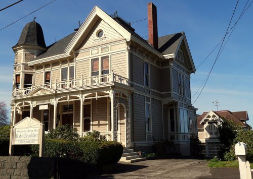


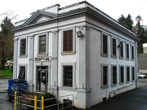
National Park Service, National Register of Historic Places. Photos from Wikimedia Commons, credited on each place’s page.
8 decades in the archive, from the 1810s to the 1910s. Scroll each row; tap a photo for its story.
 1887Astoria, Oregon, West Shore magazine, 1887
 1890Sailing ships in the Columbia River Estuary, as seen …
 1897Admiralty Chart No 2839 Columbia River, Published 1897
 1904Astoria (A Short History of Oregon)
 1910Fishing boat near Tongue Point, Astoria, Oregon, n.d
 c. 1910Man fishing with line through a crack in the sidewalk…
 c. 1910Salmon boats on the Columbia River near Astoria, Oreg…
From Wikipedia’s history of Astoria.
The present area of Astoria was inhabited by a large, prehistoric Native American trade system of the Columbia Plateau.
Text from Wikipedia, licensed CC BY-SA 4.0.
Passages that mention Astoria, cut from the printed page as they were published.
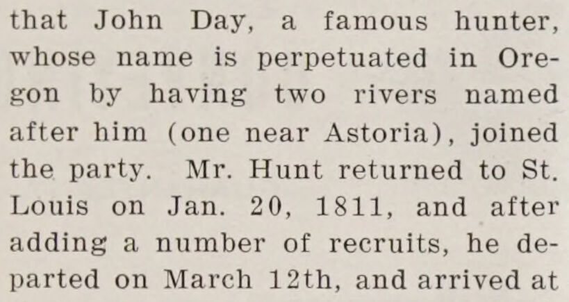
that John Day, a famous hunter, whose name is perpetuated in Oregon by having two rivers named after him (one near Astoria), joined the party. Mr. Hunt returned to St. Louis on Jan. 20, 1811, and after adding a number of recruits, he departed on March 12th, and arrived at
Text read by machine from the scan; it may contain errors.
The river was entered on March 25th, and on April 12th part of the party landed on the present site of Astoria, On June 1st the Tonquin left Astoria, put to sea on the 5th with twenty-three persons on board, and sailed north, and as far as can be
Text read by machine from the scan; it may contain errors.Scans and text from the Internet Archive. Books published in 1930 or earlier, which are in the public domain.
Woven from the archive, old maps, post office records, the National Register and the people born here.
 In the archiveFort Astoria, along the mouth of the Columbia River, Oregon, 1811-1813
 In the archiveNarrative of a Voyage around the World - Fort George
 In the archiveFur Trader Etienne Lucier and his wife, Fort
 In the archiveRoutes of parties founding Astoria July, 1810-March, 1814In the archiveAstoria, Oregon, West Shore magazine, 1887BuiltBenjamin Young House and Carriage House is builtIn the archiveSailing ships in the Columbia River Estuary, as seen looking east toward Tongue Point fro…
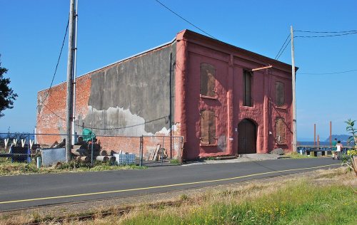 BuiltAstoria Wharf and Warehouse Company is built
 Born hereDonald Malarkey is born hereBuiltAstor, John Jacob, Hotel is builtBuiltAstoria Column is built
 On the mapFirst mapped by the U.S. Geological Survey
Every edition of the U.S. Geological Survey’s map of Astoria. Tap a year, or press play to watch the town change.

U.S. Geological Survey historical topographic maps (public domain), via Esri’s collection of the scans. The red ring marks the center of Astoria.
Fire insurance maps drew every building, what it was made of and what it was used for, so insurers could price the risk of fire. Pick a year, then a sheet.
 1884Sheet 1 of 6
Sanborn Map Company, via the Library of Congress. Editions published in 1930 or earlier, which are in the public domain.
No then-and-now pairs yet. Take a photo from the same spot as an old one and they appear here side by side.

Find the spot, match the angle, and add your photo. It becomes the first then-and-now pair on Astoria’s page.
Retake this view · +15Peaked at 14,027 in 1920; 10,181 people lived here in 2020.
17 censuses, 1860–2020.
U.S. Census Bureau decennial counts, from the census table on Astoria’s Wikipedia page.
Writers, athletes, leaders and more, ranked by how widely they’re known.

Astoria’s post office has been open since 1847. Another post office, Upper Astoria, opened and closed inside today’s town.
US Post Offices dataset (Blevins & Helbock, CC0). Places and cemeteries from the USGS Geographic Names Information System (2021).
Most archives stop around 1920. The photos from after that are in family albums, not libraries.
In 1811, according to Wikidata. Astoria’s post office opened in 1847, and the census of 1860 counted 252 people here.
Astoria is more historic than 98% of U.S. towns, #1 of 142 in Oregon. The History grade combines the town’s founding era, the share of homes built before 1940 and its National Register listings. It’s a character grade, so it isn’t part of the overall grade. How it works.
44 listings, 2 of them National Historic Landmarks: 37 buildings, 3 historic districts, the Astoria Downtown Historic District, the Shively-McClure Historic District and the Uniontown-Alameda Historic District, with 428 contributing buildings, 1 site, and 3 structures. 474 historic buildings in all.
41% of Astoria’s homes were built before 1940 (Census estimate, ±5.2 points), against a typical 5.3% for an Oregon town; the median home was built in 1948.
What the archives can’t tell you, neighbors can.
Founding dates: Wikidata, Wikipedia, the U.S. post office records of Blevins & Helbock (CC0) and the Census. Homes by year built: Census ACS 2020–24. National Register of Historic Places: National Park Service (list of May 22, 2026). Old photos, postcards and papers: Wikimedia Commons, the Library of Congress and other public archives, credited on each item’s page. Maps: U.S. Geological Survey historical topographic maps (via Esri) and Sanborn fire-insurance maps (Library of Congress). History text and census tables: Wikipedia (CC BY-SA 4.0). Places that used to be: USGS Geographic Names Information System (2021).
From Wikimedia Commons (20), Wikidata (10), the National Register of Historic Places (44), Wikipedia, Wikidata and Wikipedia for famous people, U.S. Geological Survey historical maps, U.S. Census counts (via Wikipedia), the US Post Offices dataset (Blevins & Helbock), the USGS Geographic Names Information System, Sanborn fire insurance maps (Library of Congress) and old county and town histories (Internet Archive). Archive images are copied here with their credits and licenses, shown on each photo’s page. Refreshed monthly.


