Guest, Sign inJoin

Post to Oklahoma City

We’ll email a one-tap link to publish your post. No password, and nothing is public until you click it.
Already a member? Sign in
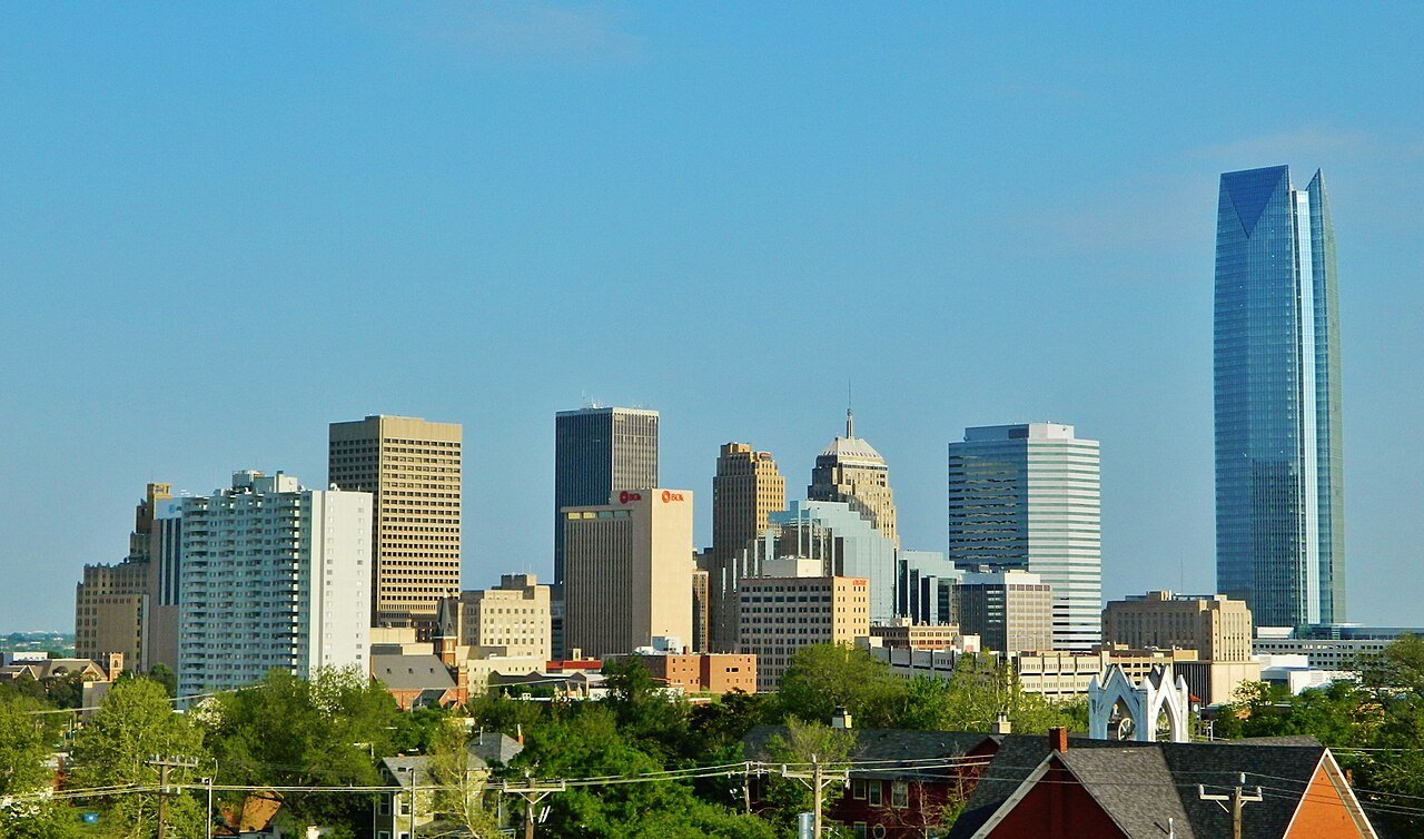
Oklahoma city downtownPhoto: Urbanative · CC BY-SA 3.0
B+Outdoors
Outdoors in Oklahoma City

10% of Oklahoma City’s land is conserved: 38,016 acres

The biggest trail networks: Crosstimbers Off-Road Vehicle Park (23.7 mi), Oklahoma State Capitol Park (4.7 mi), Martin Park Nature Center (2.5 mi). 16,686 acres are parks and preserves, 24 per 1,000 residents. 66% of residents live within a half mile of a park.

Ahead of 70% of U.S. towns · #20 of 131 in Oklahoma State. What drives it

Conserved land
10%
38,016 acres · of 607.0 sq mi of land
Trails
196 mi
0.3 per sq mi of land
Park land
16,686 ac
24 acres per 1,000 residents
Near a park
66%
of residents within ½ mile
Bike routes
192 mi
16 mi lanes · 132 mi paths
Lakes & rivers
70
28 boat launches

What kind of outdoors town is Oklahoma City?

Read from the map. The page puts what stands out first.

Outdoors grade

How much outdoors does Oklahoma City have?

On conserved land, trails, park land and how close residents live to a park, Oklahoma City is ahead of 70% of U.S. towns, #20 of 131 in Oklahoma State. All four inputs are above most U.S. towns; conserved land ranks highest, trail miles lowest.

B+
OutdoorsA character grade: shown, never part of Oklahoma City’s overall grade.
All U.S. towns we grade (21,298)Ahead of 70%
LessMore
Oklahoma State towns of 2,500+ (131)Ahead of 85%

Among the 400 U.S. cities of 100,000 or more, Oklahoma City ranks #270 on Outdoors.

Oklahoma State towns conserve more land than most (a typical one, 7%; the U.S., 4%), so Oklahoma City’s 10% is ahead of 67% of Oklahoma State towns, while its trails per square mile lead 71% of them.

How sure. Graded on any three of the four inputs instead, the letter would range from B to B+. Trails and many small parks come from OpenStreetMap, mapped by volunteers, so coverage varies from town to town; the half mile is a straight line from each census block, so a river or highway in the way isn’t counted against it.

PAD-US, OpenStreetMap (© OpenStreetMap contributors), Census 2025 Gazetteer and 2020 blocks; details in Sources below. How TownRatings grades the outdoors →

The map

Conserved land, trails & bike routes

Tap a number to zoom to a park. Tap a layer to hide it.

12345678
Easements protect land from building but are usually private.© OpenStreetMap contributors · USGS PAD-US
Places to walk

Pick a walk

The longest trail network is Crosstimbers Off-Road Vehicle Park, with 23.7 miles. Directions go to the nearest trailhead or public parking.

Crosstimbers Off-Road Vehicle Park

Nature preserve
1,225 acres23.7 mi of trail
Blue TrailGreen TrailGrass TrackRed Trail+1
Dog rules not recorded
Directionsto the parking lot

Oklahoma State Capitol Park

Park
240 acres4.7 mi of trail
Leon B. Field Tunnel
Dog rules not recorded
Directionsto the parking lot

Martin Park Nature Center

Park
122 acres2.5 mi of trail
Dog rules not recorded
Directionsto the parking lotWebsite ↗

Stinchcomb Wildlife Refuge

Nature preserve
931 acres2.1 mi of trail
Dog rules not recorded
Directionsto the parking lot

Will Rogers Park

Park
120 acres2.1 mi of trail
Dog rules not recorded
Directionsto the parking lot

Woodson Park

Park
114 acres2 mi of trail
Dog rules not recorded
Directionsto the parking lot

Myriad Botanical Gardens

Managed by Oklahoma City Urban Renewal Authority
11 acres1.9 mi of trail
Dog rules not recorded
Directionsto the parking lot

Riversport White Water Rafting

Park
24 acres1.7 mi of trail
Dog rules not recorded
Directionsto Parking A
All 153 parks & preserves
Crosstimbers Off-Road Vehicle Park1,225 acres · 23.7 mi of trail
Directions
Oklahoma State Capitol Park240 acres · 4.7 mi of trail
Directions
Martin Park Nature Center122 acres · 2.5 mi of trail
Directions
Stinchcomb Wildlife Refuge931 acres · 2.1 mi of trail
Directions
Will Rogers Park120 acres · 2.1 mi of trail
Directions
Woodson Park114 acres · 2 mi of trail
Directions
Myriad Botanical Gardens11 acres · 1.9 mi of trail · Oklahoma City Urban Renewal Authority
Directions
Riversport White Water Rafting24 acres · 1.7 mi of trail
Directions
Wheeler Park84 acres · 1.5 mi of trail · City of Oklahoma City
Directions
Trosper Park308 acres · 1.2 mi of trail
Directions
Bricktown River Walk Park24 acres · 1.1 mi of trail
Directions
Route 66 Park125 acres · 0.9 mi of trail
Directions
Edwards Park49 acres · 0.9 mi of trail
Directions
Bluff Creek Park275 acres · 0.8 mi of trail · The City of Oklahoma City Parks & Recreation Department
Directions
240 Sports Complex38 acres · 0.8 mi of trail
Directions
Charles B. Hall Airpark8 acres · 0.8 mi of trail
Directions
Stanton L. Young Walk5 acres · 0.8 mi of trail
Directions
Douglass Park122 acres · 0.7 mi of trail
Directions
Oklahoma State Fair Park425 acres · 0.6 mi of trail · City of Oklahoma City
Directions
Lake Hefner Park44 acres · 0.6 mi of trail
Directions
Scissortail Park30 acres · 0.6 mi of trail · City of Oklahoma City
Directions
Minnis Lakeview Park16 acres · 0.6 mi of trail
Directions
Williamson Farms Park16 acres · 0.6 mi of trail
Directions
Lakeshore Park41 acres · 0.5 mi of trail
Directions
South Rotary Park38 acres · 0.5 mi of trail
Directions
Southern Oaks Park22 acres · 0.5 mi of trail
Directions
Regatta Park14 acres · 0.5 mi of trail
Directions
Shallowbrook Park14 acres · 0.5 mi of trail
Directions
McCracken Park11 acres · 0.5 mi of trail
Directions
Schilling Park22 acres · 0.4 mi of trail
Directions
Dolphin Wharton Park22 acres · 0.4 mi of trail
Directions
Diggs Park16 acres · 0.4 mi of trail
Directions
McFarland Park14 acres · 0.4 mi of trail
Directions
Quail Creek Park14 acres · 0.4 mi of trail
Hathaway Park11 acres · 0.4 mi of trail
Directions
Kitchen Lake Park8 acres · 0.4 mi of trail
Oliver Park49 acres · 0.3 mi of trail
Directions
Draper Park (Capitol Hill)41 acres · 0.3 mi of trail
Directions
River Park38 acres · 0.3 mi of trail
Directions
Washington Park19 acres · 0.3 mi of trail
Directions
Progressive Community Park14 acres · 0.3 mi of trail
Directions
Bicentennial Park3 acres · 0.3 mi of trail
Directions
South Lakes Park152 acres · 0.2 mi of trail · City of Oklahoma City
Directions
Manuel Perez Park22 acres · 0.2 mi of trail
Directions
Lower Central Park22 acres · 0.2 mi of trail · City of Oklahoma City
Directions
Youngs Park16 acres · 0.2 mi of trail
Directions
Memorial Park14 acres · 0.2 mi of trail · City of Oklahoma City
Directions
John F. Kennedy Park11 acres · 0.2 mi of trail
Directions
Central Park8 acres · 0.2 mi of trail
Directions
Smitty Park5 acres · 0.2 mi of trail
Directions
Top O' Town Park5 acres · 0.2 mi of trail
Phillips Park5 acres · 0.2 mi of trail
Siler Park5 acres · 0.2 mi of trail
Directions
Mesta Park5 acres · 0.2 mi of trail · City of Oklahoma City
Directions
City Hall Park3 acres · 0.2 mi of trail
Directions
E.W. Perry Park3 acres · 0.2 mi of trail
Directions
Mike Dover Park3 acres · 0.2 mi of trail
Directions
Robert S. Kerr Park3 acres · 0.2 mi of trail
Directions
Dolese Youth Park171 acres · 0.1 mi of trail
Directions
Lake Overholser Park38 acres · 0.1 mi of trail
Directions
North Rotary Park22 acres · 0.1 mi of trail
Directions
Lincoln Park14 acres · 0.1 mi of trail
Directions
Merrel Medley Park11 acres · 0.1 mi of trail
Directions
Pitts Park11 acres · 0.1 mi of trail
Directions
Hiram Park11 acres · 0.1 mi of trail
Directions
McKinley Park11 acres · 0.1 mi of trail
Directions
Northeast Center Park11 acres · 0.1 mi of trail · City of Oklahoma City
Directions
Reed Park8 acres · 0.1 mi of trail
Directions
Pied Piper Park5 acres · 0.1 mi of trail
Bob Akers Park5 acres · 0.1 mi of trail
Directions
Flower Garden Park5 acres · 0.1 mi of trail
Harvest Hills Park3 acres · 0.1 mi of trail
Oklahoma County Courthouse3 acres · 0.1 mi of trail · Oklahoma County
Directions
Red Andrews Park3 acres · 0.1 mi of trail
Directions
Grant Corbin Park3 acres · 0.1 mi of trail
Glenn Ellyn Park3 acres · 0.1 mi of trail
Directions
Wayman's Park3 acres · 0.1 mi of trail
Hightower Park3 acres · 0.1 mi of trail
Directions
Lake Stanley Draper Mountain Bike Park180 acres
Directions
Earlywine Park103 acres · City of Oklahoma City
Directions
Douglas Park73 acres
Directions
Stars and Stripes Park65 acres
Directions
Overholser Park65 acres
Directions
Crossroads Sports Complex49 acres · City of Oklahoma City
Directions
Lions Childrens' Park44 acres
Directions
Zoo Park35 acres · OKC Zoo and Botanical Garden
Directions
Wiley Post Park33 acres
Directions
Brock Park33 acres
Directions
Quail Creek Detention Pond30 acres
Straka Detention Pond30 acres
Directions
Lightning Creek Park24 acres
Directions
Syl Goldman Park24 acres
Directions
Canyon Park22 acres
Directions
Edgemere Park22 acres
Directions
Redlands Park19 acres
Davis Ballpark16 acres
Directions
Ted Reynolds Park16 acres
Directions
L.D. Lacy Park16 acres
Directions
Crown Heights Park16 acres
Directions
Eagle Lake Park14 acres
Tolan Park14 acres
Pat Murphy Park11 acres
Directions
J. B. Black Park11 acres
Directions
Tulsa Park11 acres
Directions
Sellers Park11 acres
Directions
Girvin Park11 acres
Directions
Jack W. Cornett Park11 acres
Directions
Woodland Park8 acres
Directions
Ross Park8 acres
Directions
Woodrun Park8 acres
Hosea Vineyard Park8 acres
Directions
Zachary Taylor Park8 acres
Directions
Geraldine Park8 acres
Directions
TORKS RC Aircraft Field5 acres · The Oklahoma Radio Kontrol Society
Directions
Macklanberg Park5 acres
Directions
Melrose Park5 acres
Directions
Rotary Playground Park5 acres
Directions
Harlow Park5 acres
Directions
Lela Park5 acres
Directions
Tealridge Park5 acres
Directions
Zurline Park5 acres
Directions
Crossings Park5 acres
Dulaney Park5 acres
Directions
E.B. Jeffrey Park5 acres
Directions
Goodholm Park5 acres
Directions
Creston Hills Park5 acres
Seminole Point Park5 acres
Directions
Lytle Park5 acres
Directions
Lake Stanley Draper Park5 acres
Directions
Brighton Place HOA Park5 acres
The University of Oklahoma (Health Sciences Center)5 acres
Directions
Winans Park5 acres
Directions
BryantPlace Park5 acres
Meadowbrook Park3 acres
Directions
Brookwood Park3 acres
Directions
Castlewood Trails HOA Park3 acres
Swatek Park3 acres
Directions
Sparrow Park3 acres
Directions
Griffin Park Clubhouse and Green3 acres
Oklahoma Municipal League3 acres
Directions
Tinsley Park3 acres
Directions
Harden Park3 acres
Rockwell Park3 acres
Directions
Pirate Park3 acres
Lake Draper Recreation Area #1, Point 103 acres
Oklahoma Engineering Center3 acres
Directions
Britton Park3 acres
Directions
Military Park3 acres
Directions
Burton Park3 acres
Highley Park3 acres
Bentwood Creek Community Park3 acres
Culbertson Park3 acres
Directions
Old Miller Park3 acres
Who protects it

38,016 conserved acres

10% of Oklahoma City’s land. Who manages Oklahoma City’s conserved land, from the USGS Protected Areas Database. Approximate, because parcels can overlap.

Town or city21,580 ac
State land board18,336 ac
Private owners150 ac
County46 ac
State fish & wildlife30 ac
Other or Unknown Local Government27 ac
Bureau of Land Management8 ac
State Resource Management Area · 18,336 acLocal Recreation Area · 6,916 acWatershed Protection Area · 6,703 acLocal Park · 4,861 acLocal Conservation Area · 3,193 ac
Good to know

Conserved doesn’t always mean open to visitors. 27 acres are conservation easements, usually private land. Public access isn’t recorded for 1 of 180 parcels. The walks above are places people visit.

The biggest protected parcels
Parcel (PAD-US)Managed byAcresPublic access
CLO Lands
State Resource Management Area
State land board18,336Restricted
Lake Stanley Draper
Local Recreation Area
Town or city7,188Open
Lake Hefner
Local Recreation Area
Town or city4,126Open
Lake Overholser
Local Recreation Area
Town or city2,158Open
Stinchcomb Wildlife Refuge
Local Conservation Area
Town or city969Open
River Tract 9
Local Conservation Area
Town or city833Open
River Tract 8
Local Conservation Area
Town or city495Open
Lincoln Park
Local Park
Town or city493Open
Open Space - K
Local Conservation Area
Town or city400Open
Trosper Park
Local Park
Town or city367Open

5 smaller protected places aren’t shown.

Things to do

402 places to go in Oklahoma City

Beaches, playgrounds, peaks, falls and more. Pick a kind.

Playgrounds in Oklahoma City
Children's GardensIn Myriad Botanical Gardens
Directions
Hope Crossing Playground area
Directions
Kidz Funtown
Directions
Lakeside Playground
Directions
Seminole Point PlaygroundIn Seminole Point Park
Directions
The Valley Plaground
Directions
Walden Creek Playground
Directions
Wiley Post Park PlaygroundIn Wiley Post Park
Directions

339 playgrounds are on OpenStreetMap in all; the list shows named ones from the first 30.

Trails & water

10 named trails and 57 lakes & rivers

Named trails
Open to bikes · 4.9 miUnpaved · 29.3 mi
Blue Trail6.3 mi
Green Trail6.2 mi
Grass Track2.6 mi
Red Trail1.6 mi
KATY Trail0.8 mi
Oklahoma Greenway Trail0.6 mi
Shortcut0.2 mi
The Underground0.1 mi
Green Trail Shortcut0.1 mi
Leon B. Field Tunnel0.1 mi
Lakes & rivers tap for directions
Biking & sports

192 miles of bike routes

Bike lanes are often missing from the map in smaller towns, so that number is likely low.

16 mi
painted or protected bike lanes
132 mi
off-road bike paths
44 mi
shoulders & shared lanes
KATY TrailBike route
0.8 mi
Oklahoma Greenway Trail (Preliminary)Bike route
0.6 mi
Courts & fields
206Tennis
187Golf
186Baseball
132Soccer
128Basketball
29Football
21Pickleball
14Volleyball

Includes school and college facilities, which aren’t always open to the public.

History along the way

148 places on the National Register

The country’s official list of places worth saving (National Park Service). The map also marks 40 historic points from OpenStreetMap: plaques, memorials and old buildings.

History →
Overholser HouseBuilding · listed 1970
About it
"Ringing the Wild Horse" SiteSite · listed 1971
About it
Harn HouseBuilding · listed 1973
About it
Post Office, Courthouse, and Federal Office BuildingBuilding · listed 1974
About it
Fairchild WineryBuilding · listed 1975
About it
Capitol-Lincoln Terrace Historic DistrictDistrict · listed 1976
About it
Oklahoma State CapitolBuilding · listed 1976
About it
Central High SchoolBuilding · listed 1976
About it
Colcord BuildingBuilding · listed 1976
About it
St. Paul's CathedralBuilding · listed 1977
About it
Oklahoma City Discovery WellSite · listed 1977
About it
St. Joseph's CathedralBuilding · listed 1978
About it

136 more on the History page.

When to get out

April is the best month for walking in Oklahoma City

NOAA’s 1991–2020 normals for the town and the daylight at its latitude. Outlined months have long days, highs of 59 to 86 °F and little rain for the place.

JanFebMarAprMayJunJulAugSepOctNovDec
Daylight (h)10.010.911.913.014.014.514.313.512.311.210.29.8
High (°F)505463727988949385746151
Rain (in)1.31.52.63.55.14.73.43.53.53.32.01.8

January is the driest month (1.3 in) and July the warmest (highs of 94 °F). 5.1 inches fall in May, the wettest month. Summer highs reach 94 °F, too hot for the outline. The climate in Oklahoma City →

Next door

Oklahoma City and its neighbors

Oklahoma City has the most mapped trails of the 8 towns around it. Tap a town to see its outdoors.

TownConserved
of land
Trail mi
per sq mi
Park acres
per 1,000
Near a park
½ mile
Outdoors
Oklahoma City10%0.32466%B+
Tuttleunder 1%0.268%D
Midwest City2%0.41085%B
Edmond7%0.51362%B
Newcastle6%0.4829%C+
Yukon1%0.3985%C+
Del City4%0.51493%B+
Jones7%under 0.1611%C

The four inputs of the Outdoors grade, from the engine; shares are of land, not water.

Questions about parks and trails in Oklahoma City

Where can I hike in Oklahoma City?

The longest trail networks: Crosstimbers Off-Road Vehicle Park, 23.7 miles; Oklahoma State Capitol Park, 4.7 miles; Martin Park Nature Center, 2.5 miles; Stinchcomb Wildlife Refuge, 2.1 miles. Each one is on the map above, with directions to the nearest trailhead or parking.

How much of Oklahoma City is conserved land?

10% of its land, against a typical 7% for an Oklahoma State town and 4% nationally (PAD-US). Conserved doesn’t always mean open to visitors: easements are usually private land.

Are dogs allowed on Oklahoma City’s trails?

Crosstimbers Off-Road Vehicle Park and Oklahoma State Capitol Park don’t have dog rules recorded on the map; check the signs at the trailhead.

Where can I bike in Oklahoma City?

192 miles of bike routes are on the map: 16 of painted or protected lanes, 132 of off-road paths and 44 of shoulders and shared lanes. Named routes: KATY Trail and Oklahoma Greenway Trail (Preliminary).

Is there public land near Oklahoma City?

28,785 acres of parks and open public land lie inside Oklahoma City or within 10 miles of it (PAD-US), 16,691 of them inside the city line.

How much outdoors does Oklahoma City have?

Ahead of 70% of U.S. towns on the Outdoors grade, #20 of 131 in Oklahoma State. The grade combines the share of land that is conserved, miles of mapped trail per square mile of land, park acres per 1,000 residents and the share of residents within a half mile of a park. It’s a character grade, so it isn’t part of the overall grade. How it works.

Trail talk

Conditions, parking and favorite walks from Oklahoma City neighbors.

Town Square →
Share a tip
Sources

Where this page comes from

Conserved and public land: USGS Protected Areas Database of the United States (PAD-US), service updated July 2026. Parks, trails, playgrounds, beaches and other places: OpenStreetMap (© OpenStreetMap contributors, ODbL), map data as of 2026-10-28. Land and water area: Census 2025 Gazetteer. Residents near a park: 2020 Census blocks. National Register: National Park Service. How TownRatings grades the outdoors →