Most of Asher was built recently: 8% of its homes predate 1940 and the median home dates from 2001. Below: maps from 1901 on and the census since 1910.
The Asher post office opened in 1901, the earliest record of the town by name. Another post office, Avoca (1894), opened inside today’s town and later closed.
First census: 381 in 19102020 census: 370125 years
Founding year: the first Asher post office (Blevins & Helbock, CC0).The full story ↓
What stands out about Asher’s past
Read from the archive, the National Register and the record. The page puts what stands out first.
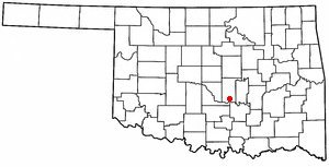
Asher dates back to 1892 when George "Matt" Asher, from Clay County, Kentucky, purchased land in Oklahoma Territory from a Shawnee estate salesperson to set up his farm home. The post office was established November 26, 1901, when the postmaster of nearby Avoca, Oklahoma, George A. McCurry, moved the Avoca post office and his store to the new community that would become Asher. This was done without permission from the government and left Avoca without a post office. According to the tale, McCurry was given a home and store building as payment for moving the post office to the new settlement. The town was named for Mr. Asher, who supplied the land with the consideration the community would carry his namesake, though he never lived there. There was a sale of public lots in 1902.
Founding dates: Wikidata, Wikipedia, the U.S. post office records of Blevins & Helbock (CC0) and the Census. Homes by year built: Census ACS 2020–24. National Register of Historic Places: National Park Service (list of May 22, 2026). Old photos, postcards and papers: Wikimedia Commons, the Library of Congress and other public archives, credited on each item’s page. Maps: U.S. Geological Survey historical topographic maps (via Esri) and Sanborn fire-insurance maps (Library of Congress). History text and census tables: Wikipedia (CC BY-SA 4.0). Places that used to be: USGS Geographic Names Information System (2021). How TownRatings grades history →
From Wikimedia Commons (6), Wikipedia, U.S. Geological Survey historical maps, U.S. Census counts (via Wikipedia), the US Post Offices dataset (Blevins & Helbock), the USGS Geographic Names Information System and Sanborn fire insurance maps (Library of Congress). Archive images are copied here with their credits and licenses, shown on each photo’s page. Refreshed monthly.

 2006
 2006
 2006
 2006
 2006
 2004


