Zanesfield is named for Isaac Zane, who was born in 1753 in what was then Berkeley County, Virginia, and is now Hardy County, West Virginia. He was the youngest brother of Ebenezer Zane, for whom Zanesville, Ohio, is named.
In 1762 at the age of nine, Isaac was captured by Native Americans of the Wyandot tribe and adopted into the tribe. He lived with them along the Sandusky River for seventeen years. He married Myeerah (White Crane), daughter of Chief Tarhe. They had several children.
Every edition of the U.S. Geological Survey’s map of Zanesfield. Tap a year, or press play to watch the town change.
1913East Liberty sheet · 1:62,500
U.S. Geological Survey historical topographic maps (public domain), via Esri’s collection of the scans. The red ring marks the center of Zanesfield.
From the old history books
What they wrote about Zanesfield, 1880–1900
Passages that mention Zanesfield, cut from the printed page as they were published.
History of Logan County and Ohio1880 · page 393Read the page →
Read the text
Zanesfield is the only regularly laid out village in the township, aud is located in the Mad River Valley, about midway of the township east and west, and about one-third of the distance from the south to the north end, on the original road from Urbana to Upper Sandusky, now known as the West Liberty, Zanesfield, and Rushsylvania Free Pike,
Text read by machine from the scan; it may contain errors.
History of Zanesfield and sketches of the interesting and historical places of Logan County1900 · page 18Read the page →
Read the text
The monument, an immense native boulder, unveiled, September 8, 1914, stands on a cement base in the south part of the village of Zanesfield overlooking the beautiful valley of the Mad River. The ground was donated by the late Martha Vaughn and son William, of Zanesfield. It came from the farm of J. B. Adams three miles east of the village, and weighs about 60 tons. Much credit is due Mr. C. H.
Text read by machine from the scan; it may contain errors.
History of Logan County and Ohio1880 · page 430Read the page →
Read the text
ing on the banks of Mad River, on the Middleburg road, probably in 1826, and one taught in the north room of the house occupied by Mr. J. G. Hamilton, in Zanesfield, by Miss Ann Amy, in 1830, in which only read- The first school taught in the brick schoolhouse in Zanesfield, in 1831, was by Orson Marsh, of
Text read by machine from the scan; it may contain errors.
History of Logan County and Ohio1880 · page 426Read the page →
Read the text
ing on the banks of Mad River, on the Middleburg road, probably in 1826, and one taught in the north room of the house occupied by Mr. J. G. Hamilton, in Zanesfield, by Miss Ann Amy, in 1830, in which only reading, writing and spelling were taught. The first school taught in the brick schoolhouse in Zanesfield, in -1831, was by Orson Marsh, of
Text read by machine from the scan; it may contain errors.
Scans and text from the Internet Archive. Books published in 1930 or earlier, which are in the public domain.
Timeline
Zanesfield, 1826 to 1913
Woven from the archive, old maps, post office records, the National Register and the people born here.
Nothing in the archives for these yearsWeddings on Main Street, storms, parades, school pictures, the old store. If it’s in your family album, it belongs here.
Founding dates: Wikidata, Wikipedia, the U.S. post office records of Blevins & Helbock (CC0) and the Census. Homes by year built: Census ACS 2020–24. National Register of Historic Places: National Park Service (list of May 22, 2026). Old photos, postcards and papers: Wikimedia Commons, the Library of Congress and other public archives, credited on each item’s page. Maps: U.S. Geological Survey historical topographic maps (via Esri) and Sanborn fire-insurance maps (Library of Congress). History text and census tables: Wikipedia (CC BY-SA 4.0). Places that used to be: USGS Geographic Names Information System (2021). How TownRatings grades history →
From Wikimedia Commons (11), the Library of Congress (1), Wikipedia, U.S. Geological Survey historical maps, U.S. Census counts (via Wikipedia), the US Post Offices dataset (Blevins & Helbock), the USGS Geographic Names Information System and old county and town histories (Internet Archive). Archive images are copied here with their credits and licenses, shown on each photo’s page. Refreshed monthly.


 2010
 2010
 2010
 2010
 2010
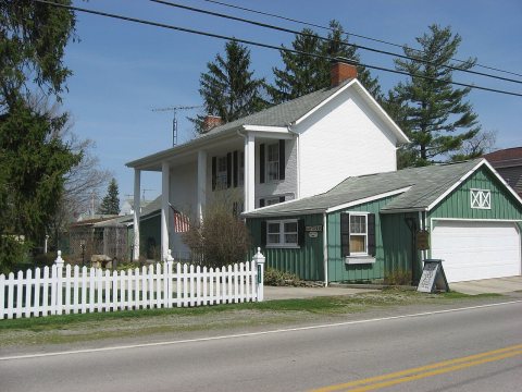 2010
 2010
 2010
 2008
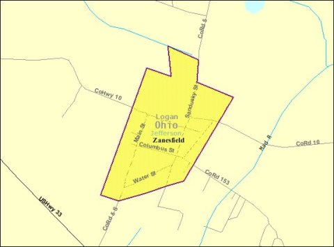 2008
 2004