Guest, Sign inJoin

Post to Youngstown

We’ll email a one-tap link to publish your post. No password, and nothing is public until you click it.
Already a member? Sign in
A+History
History · Youngstown

Youngstown dates to 1796, and 39% of its homes were built before 1940

More historic than 98% of U.S. towns · #22 of 993 in Ohio. What drives it

49 places in town are on the National Register, among them six historic districts with 438 buildings between them. Below: 11 old photos and papers, maps from 1884 on, and the census since 1820.

1796founded
49on the National Register
39%homes built before 1940
11old photos & papers
34famous people
From Youngstown’s archive · credits on each photo
Quick answers

How Youngstown began

When was Youngstown founded?

1796

Youngstown dates its founding to 1796 (Wikidata). The census first counted it in 1820.

First census: 273 in 18202020 census: 60,068230 years

How historic is Youngstown?

A+

More historic than 98% of U.S. towns, on its age, its old homes and the National Register.

What drives the grade ↓
Founding year: Wikidata. First post office: 1801.The full story ↓
History grade

What drives Youngstown’s History grade

On its age, its old homes and the National Register, Youngstown is more historic than 98% of U.S. towns, #22 of 993 in Ohio. All 3 inputs are above most U.S. towns; its National Register listings ranks highest and its age lowest.

A+
HistoryA character grade: shown, never part of Youngstown’s overall grade.
All U.S. towns we grade (21,289)Ahead of 98%
NewerOlder
Ohio towns of 2,500+ (993)Ahead of 98%

Ohio towns list about as much on the Register as the country (a typical Ohio town has 2.9 per 10,000 residents, the U.S. 2.4), so Youngstown’s 81.2 sits above most of its state (92% of Ohio towns have fewer) while its 482 historic buildings outnumber those of 97% of U.S. towns.

How sure. Graded on any two of the three inputs instead, the letter would range from A to A+. The pre-1940 share (±1.7 points) is firm at this size. Two sources give 1796.

Founding year: Wikidata (other dates in Quick answers). Homes: Census ACS 2020–24. National Register: National Park Service, May 2026 list; each listing counted once (boundary changes and added documentation belong to their listing), and a historic district counts its contributing buildings. How TownRatings grades history →

What stands out about Youngstown’s past

Read from the archive, the National Register and the record. The page puts what stands out first.

★ What stands out · On the National Register

49 listings protect 482 historic buildings

The country’s official list of buildings and places worth saving. Boundary changes and added documentation are counted with their listing.

places listed
49
National Historic Landmarks
0
none yet
historic buildings protected
482
each building in a district counts
first listed
1974
Lanterman Mill
All 49 listings
Our Lady of Mount Carmel ChurchBuilding · listed 1979Central Tower BuildingBuilding · listed 1980Federal BuildingBuilding · listed 1980First National Bank BuildingBuilding · listed 1980Mahoning National Bank BuildingBuilding · listed 1980Stambaugh BuildingBuilding · listed 1980Wick BuildingBuilding · listed 1980Warner TheaterBuilding · listed 1980Liberty TheatreBuilding · listed 1984Stambaugh, Henry H., Memorial AuditoriumBuilding · listed 1984McMillan, Reuben, Free LibraryBuilding · listed 1986Baltimore & Ohio Railroad TerminalBuilding · listed 1986City Hall AnnexBuilding · listed 1986Erie Terminal Building-Commerce Plaza BuildingBuilding · listed 1986Helen ChapelBuilding · listed 1986McCrory BuildingBuilding · listed 1986Ohio One-Ohio EdisonBuilding · listed 1986Peggy Ann BuildingBuilding · listed 1986State TheaterBuilding · listed 1986Strouss-Hirschberg CompanyBuilding · listed 1986Wells BuildingBuilding · listed 1986Welsh Congregational ChurchBuilding · listed 1986YWCA BuildingBuilding · listed 1986Idora ParkDistrict · listed 1993Masonic TempleBuilding · listed 1997Burt BuildingBuilding · listed 2008St. John's Episcopal ChurchBuilding · listed 2012Wick Avenue Historic DistrictDistrict · listed 1974Realty BuildingBuilding · listed 1980Jay's LunchBuilding · listed 1986Kress BuildingBuilding · listed 1986McKelvey-Higbee Co. BuildingsBuilding · listed 1986Republic Iron and Steel Office BuildingBuilding · listed 1986Crandall Park-Fifth Avenue Historic DistrictDistrict · listed 1990Wick Park Historic DistrictDistrict · listed 1990Mill Creek Park Historic DistrictDistrict · listed 2005Gallagher BuildingBuilding · listed 2014Schulte-United Building-G.C. Murphy’s BuildingBuilding · listed 2024Legal Arts CentreBuilding · listed 2024Youngstown Foundry and Machine East Boardman WorksBuilding · listed 2024West Federal Street Young Men’s Christian AssociationBuilding · listed 2025

National Park Service, National Register of Historic Places. Photos from Wikimedia Commons, credited on each place’s page.

Places that used to be

Lost post offices, old corners, places now gone and burying grounds

Youngstown’s post office has been open since 1801. Nine other post offices opened and closed inside today’s town.

Youngstown
1801–today
Coitsville
1826–1900
Cornersburg
1831–1902
Brier Hill
1847–1896
Briar Hill
1860–1890
Loveland Station
1871–1890
Haselton
1872–1896
Fosterville
1874–1877
Kyles Corners
1877–1906
Scienceville
1919–1935
18001910today
Hamlets and corners on the map
Brier HillCoitsville CenterCrab Creek JunctionEast SideFlint HillFostervilleGeography HallHaseltonKyles CornersMcGuffey HeightsNorth SideSciencevilleSouth SideThorn HillWest SideWilliamston
Gone or out of use
Brier Hill Post Officepost officeCoitsville Post Officepost officeCornersburg Post Officepost officeHaselton Post Officepost officeKyles Corner Post Officepost officeNorthside and Tod Childrens Hospital HeliportairportOsteopathic HospitalhospitalRayen High SchoolschoolRayen SchoolschoolScienceville Post Officepost officeThorn Hill StationlocaleWelsh Congregational Churchchurch
10cemeteries and burying grounds inside Youngstown
Anshe EmethCalvaryChildren of IsraelJacksonJewish FederationMount Hope ParkOak HillSaint MarysSaints Peter and PaulTod Homestead

US Post Offices dataset (Blevins & Helbock, CC0). Places and cemeteries from the USGS Geographic Names Information System (2021).

The story

How Youngstown came to be

From Wikipedia’s history of Youngstown.

Read it all →

Youngstown was named for New York native John Young, who surveyed the area in 1796 and settled there soon afterward. On February 9, 1797, Young purchased the township of 15,560 acres (6,300 ha) from the Western Reserve Land Company for $16,085. The 1797 establishment of Youngstown was officially recorded on August 19, 1802.

Text from Wikipedia, licensed CC BY-SA 4.0.

From the old history books

What they wrote about Youngstown in 1921

Passages that mention Youngstown, cut from the printed page as they were published.

The county court of Trumbull County which assembled at Warren on August 25, 1800, divided all Trumbull County east of the Cuyahoga River into eight civil townships. The civil township of Youngstown embraced the townships now known as Poland, Boardman, Canfield, Ellsworth, Austintown, Youngstown, Co…
History of Youngstown and the Mahoning Valley, Ohio1921 · page 260Read the page →
Read the text

The county court of Trumbull County which assembled at Warren on August 25, 1800, divided all Trumbull County east of the Cuyahoga River into eight civil townships. The civil township of Youngstown embraced the townships now known as Poland, Boardman, Canfield, Ellsworth, Austintown, Youngstown, Coitsville and Jackson, in Mahoning County, and Hubbard and Liberty in Trumbull County. Both the civil township of Youngstown and the surveyed township of Youngstown were well represented in the first county court of quarter

Text read by machine from the scan; it may contain errors.
Youngstown, in short, had attained a ripe age, and yet it was but a drowsy village of less than one thousand inhabitants; the township numbered less than two thousand residents all told. Gradually the adjoining townships that had been included at first in the civil township of Youngstown for govern…
History of Youngstown and the Mahoning Valley, Ohio1921 · page 180Read the page →
Read the text

Youngstown, in short, had attained a ripe age, and yet it was but a drowsy village of less than one thousand inhabitants; the township numbered less than two thousand residents all told. Gradually the adjoining townships that had been included at first in the civil township of Youngstown for governmental purposes were organized separately, and the civil township of Youngstown became identical with the surveyed township that John Young had bought. Yet in 1840 the Village of Youngstown was merely the center of the township, and not a sepa-

Text read by machine from the scan; it may contain errors.

Scans and text from the Internet Archive. Books published in 1930 or earlier, which are in the public domain.

Timeline

Youngstown, 1796 to 1946

Woven from the archive, old maps, post office records, the National Register and the people born here.

  1. 18th century
  2. 1796
    FoundingYoungstown is established
  3. 19th century
  4. 1801Post officeThe Youngstown post office opens
  5. 1826Post officeThe Coitsville post office opens
  6. 1831Post officeThe Cornersburg post office opens
  7. 20th century
  8. 1900In the archiveYoungstown
  9. 1900Post officeThe Coitsville post office closes
  10. 1902Post officeThe Cornersburg post office closes
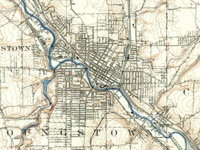
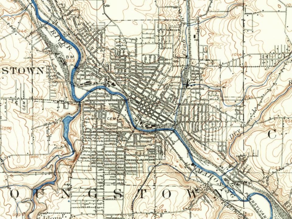
  11. 1906On the mapFirst mapped by the U.S. Geological Survey
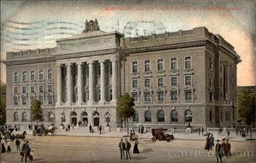
  12. 1908BuiltMahoning County Courthouse is built
  13. 1910BuiltMahoning National Bank Building is built
  14. 1910In the archiveOhio Works of the Carnegie Steel Co
  15. 1919BuiltButler Institute Of American Art is built
  16. 1922In the archiveAerial view
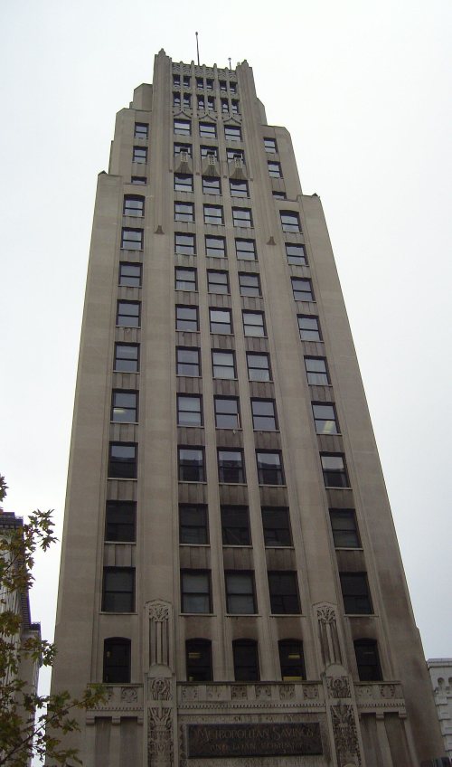
  17. 1929BuiltCentral Tower Building is built
  18. 1930CensusPopulation peaks at 170,002
  19. 1940Born hereArthur Laffer is born here
  20. 1943Born hereElizabeth Hartman is born here
  21. 1946Born hereEd O'Neill is born here
By decade

Youngstown, decade by decade

3 decades in the archive, from the 1900s to the 1920s. Scroll each row; tap a photo for its story.

On the map

Youngstown on the map, 1906 to 1994

Every edition of the U.S. Geological Survey’s map of Youngstown. Tap a year, or press play to watch the town change.

Youngstown on the 1906 USGS mapYoungstown on the 1951 USGS mapYoungstown on the 1963 USGS mapYoungstown on the 1970 USGS mapYoungstown on the 1984 USGS mapYoungstown on the 1994 USGS map1906Youngstown sheet · 1:62,500

U.S. Geological Survey historical topographic maps (public domain), via Esri’s collection of the scans. The red ring marks the center of Youngstown.

Every building

Youngstown, building by building, 1884–1907

Fire insurance maps drew every building, what it was made of and what it was used for, so insurers could price the risk of fire. Pick a year, then a sheet.

Youngstown fire insurance map, 1884, sheet 11884Sheet 1 of 14
Edition
BrickWoodStone

Sanborn Map Company, via the Library of Congress. Editions published in 1930 or earlier, which are in the public domain.

Then & now

Stand where they stood

No then-and-now pairs yet. Take a photo from the same spot as an old one and they appear here side by side.

Youngstown
Retake this viewYoungstown, 1900

Find the spot, match the angle, and add your photo. It becomes the first then-and-now pair on Youngstown’s page.

Retake this view · +15
People over time

Youngstown, census by census

020,00040,00060,00080,000100,000120,000140,000160,000180,0001850190019502000Peak: 170,002

Peaked at 170,002 in 1930; 60,068 people lived here in 2020.

21 censuses, 1820–2020.

U.S. Census Bureau decennial counts, from the census table on Youngstown’s Wikipedia page.

Famous people

34 famous people were born in Youngstown

Writers, athletes, leaders and more, ranked by how widely they’re known.

See all →
Help out

Finish Youngstown’s story

Most archives stop around 1920. The photos from after that are in family albums, not libraries.

Decades since 1900 with photos
00s10s20s30s40s50s60s70s80s90s
3 of 10 decades. The empty ones are waiting for someone’s album.
Stories next door

History across the town line

Each neighbor’s History grade, on the same three inputs.

Questions about Youngstown’s history

What year was Youngstown founded?

In 1796, according to Wikidata. Youngstown’s post office opened in 1801, and the census of 1820 counted 273 people here.

How does Youngstown rank for history?

Youngstown is more historic than 98% of U.S. towns, #22 of 993 in Ohio. The History grade combines the town’s founding era, the share of homes built before 1940 and its National Register listings. It’s a character grade, so it isn’t part of the overall grade. How it works.

What is on the National Register in Youngstown?

49 listings: 42 buildings, among them the Lanterman Mill (listed 1974, the first), 6 historic districts with 438 contributing buildings, and 1 structure. 482 historic buildings in all.

How old are the homes in Youngstown?

39% of Youngstown’s homes were built before 1940 (Census estimate, ±1.7 points), against a typical 15% for an Ohio town; the median home was built in 1950.

Memory lane

What the archives can’t tell you, neighbors can.

Town Square →
Start a conversation
Sources

Where this page comes from

Founding dates: Wikidata, Wikipedia, the U.S. post office records of Blevins & Helbock (CC0) and the Census. Homes by year built: Census ACS 2020–24. National Register of Historic Places: National Park Service (list of May 22, 2026). Old photos, postcards and papers: Wikimedia Commons, the Library of Congress and other public archives, credited on each item’s page. Maps: U.S. Geological Survey historical topographic maps (via Esri) and Sanborn fire-insurance maps (Library of Congress). History text and census tables: Wikipedia (CC BY-SA 4.0). Places that used to be: USGS Geographic Names Information System (2021).

From the Library of Congress (11), Wikidata (5), the National Register of Historic Places (49), Wikipedia, Wikidata and Wikipedia for famous people, U.S. Geological Survey historical maps, U.S. Census counts (via Wikipedia), the US Post Offices dataset (Blevins & Helbock), the USGS Geographic Names Information System, Sanborn fire insurance maps (Library of Congress) and old county and town histories (Internet Archive). Archive images are copied here with their credits and licenses, shown on each photo’s page. Refreshed monthly.