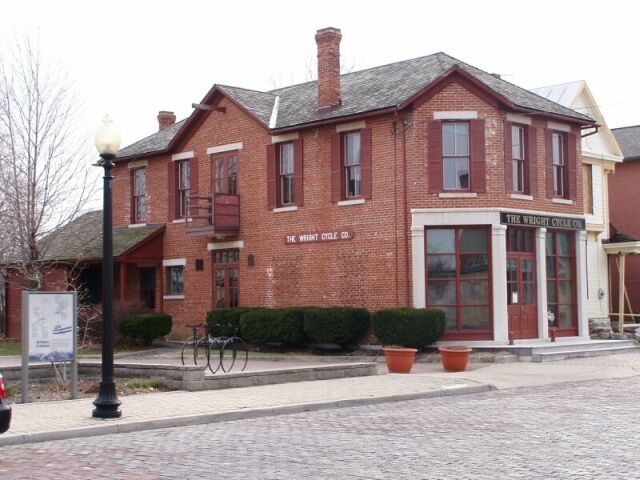
109 years in pictures
The archive holds 6 old photos and papers going back to 1917.
- 1917Wright-Patterson AFB is settled
Each edition grades its towns against each other only.

A town of 1,508, settled in 1917.
The best of Wright-Patterson AFB’s subject grades are an A for walkability and an A− for incomes and health; the weakest is a C for cost of living. Wright-Patterson AFB’s average trip to work is 13 minutes, below both Ohio’s towns (24 minutes) and U.S. towns (25 minutes). Only 6 of Ohio’s 1,718 towns score higher on hazard risk. Wright-Patterson AFB’s trail density is 1.1 miles per square mile, above both the Ohio town median (0.2) and the median of U.S. towns (0.4). The biggest place to walk is Huffman Prairie State Natural Landmark, 109 acres with 1.9 miles of trail. Wright-Patterson AFB has fewer than 2,500 residents, so it gets subject grades but no overall grade.
Where Wright-Patterson AFB beats most towns.
1,821 counted in 2010 and 1,567 in 2020.
U.S. Census 2010 & 2020 counts
Each subject compared with towns across the country (schools within Ohio), ordered by how far Wright-Patterson AFB is from typical.
How TownRatings grades towns →

The archive holds 6 old photos and papers going back to 1917.
Museums, parks, gardens and other places to visit around Wright-Patterson AFB. Close and well known come first.
4 mi MuseumNational Museum of the United States Air Force1.0M visitors a year
Big draw35 mi Theme parkKings Island3.5M visitors a year4 mi MuseumNational Aviation Hall of Fame300K visitors a year
in town MuseumHuffman Prairie
in town National Historical ParkDayton Aviation Heritage National Historical Park80K visitors a year
14 mi LandmarkMadonna of the TrailNational Museum of the United States Air Force: No machine-readable author provided. Rogerd assumed (based on copyright claims)., CC BY-SA 3.0 · Kings Island: Eli Duke from Portland, OR, USA, CC BY-SA 2.0 · Huffman Prairie: Wright Brothers, Public domain · Dayton Aviation Heritage National Historical Park: Chris Light (talk), CC BY-SA 3.0 · Madonna of the Trail: W. Guy Finley, Public domain
Wright-Patterson AFB is unincorporated, so Greene County and regional agencies provide most services.
EPA SDWIS (Oct 9, 2026) · HIFLD + EIA-861 2025 · Census 2020 ZCTAs · NCES 2024–25 · registration: vote.gov, updated Aug 3, 2026.
Ordered by what stands out in Wright-Patterson AFB.
The median age in Wright-Patterson AFB is 25.4 years. Adults 18 to 34 are 55% of residents (22% statewide); people 65 and older are 2% of residents (18% statewide). 37% of Wright-Patterson AFB adults 25 and older hold a bachelor’s degree or more.
| Wright-Patterson AFB | Ohio towns | U.S. towns | |
|---|---|---|---|
| Median age | 25.4 years | 41.7 years | 40.5 years |
| Bachelor’s degree or more, 25+ | 37% | 24% | 29% |
40% women, 60% men
About 148 men for every 100 women (the survey’s margin: ±6.8 points). Across Ohio, 50.7% of residents are women.
| Wright-Patterson AFB | OH | U.S. | |
|---|---|---|---|
| Under 10 | 17.6% | 11.7% | 11.6% |
| 10 to 17 | 4% | 10.3% | 10.3% |
| 18 to 24 | 26.3% | 8.9% | 9.1% |
| 25 to 34 | 28.4% | 13.2% | 13.7% |
| 35 to 44 | 7.2% | 12.5% | 13.2% |
| 45 to 54 | 9.8% | 12% | 12.2% |
| 55 to 64 | 4.8% | 13.2% | 12.7% |
| 65 to 74 | 1.9% | 10.9% | 10.2% |
| 75 and older | 0% | 7.3% | 7% |
| No diploma | 5% | 8.2% | 10.4% |
| High school | 10.8% | 32.1% | 26% |
| Some college | 20.7% | 19.3% | 19.1% |
| Associate’s | 26.2% | 9% | 8.8% |
| Bachelor’s | 25.8% | 19.3% | 21.6% |
| Graduate | 11.5% | 12.2% | 14.1% |
U.S. Census Bureau · ACS 2020-2024 5-year estimates · in a town of 1,500, single groups can be off by several points
Most working residents leave Wright-Patterson AFB for work: only 3% work in town. Since 2013, Wright-Patterson AFB has added 1,147 jobs, to 3,002 in 2023. Wright-Patterson AFB’s median household income is $90,000.
| Wright-Patterson AFB | Ohio towns | U.S. towns | |
|---|---|---|---|
| Working residents who work in town | 2.6% | 6.9% | 8% |
| Median household income | $90,000 | $75,000 | $80,000 |
| Below the poverty line | 7% | 9.1% | 9.6% |
Census LEHD 2023 · ACS
Among 994 Ohio towns, just 9 have a lower FEMA risk score than Wright-Patterson AFB. Since 1991, 2 flood insurance claims have been paid out in Wright-Patterson AFB.
FEMA flood insurance claims · FEMA National Risk Index · OpenFEMA
Wright-Patterson AFB beats the Ohio average on 13 of 32 CDC measures and trails it on 6. 5.7% of adults have diabetes in Wright-Patterson AFB. Among 994 Ohio towns, just 2 have a lower share of adults who have high blood pressure than Wright-Patterson AFB.
| Wright-Patterson AFB | Ohio towns | U.S. towns | |
|---|---|---|---|
| Diabetes (CDC PLACES) | 5.7% | 13% | 12% |
| Binge drink (CDC PLACES) | 22% | 17% | 16% |
| High blood pressure (CDC PLACES) | 21% | 38% | 35% |
| Frequent physical distress (CDC PLACES) | 9.4% | 15% | 14% |
| What stands out | Wright-Patterson AFB | OH |
|---|---|---|
| Fewer adults with heart disease | 2.5% | 7.1% |
| Fewer adults who have had a stroke | 1.4% | 3.7% |
| More binge drinkers | 21.8% | 16.6% |
CDC PLACES 2025 · modeled estimates for adults · CMS · HRSA
Wright-Patterson AFB has chilly winters and warm summers. July afternoons reach 85°, January nights drop to 22° and about 12 inches of snow falls in a winter.
NOAA U.S. Climate Normals, 1991–2020
11 miles of trail in 10 parks and preserves.
| Biggest places to walk | Trails | Acres |
|---|---|---|
| 1. Huffman Prairie State Natural Landmark | 1.9 mi | 109 |
| 2. Huffman Prairie Flying Field | 0.5 mi | 77 |
| 3. Wright Brothers Hill | 0.5 mi | 21 |
Trails & parks © OpenStreetMap contributors · Conserved land: USGS PAD-US
16 within 15 miles of the center of Wright-Patterson AFB
College town 15 of every 100 Wright-Patterson AFB residents are enrolled in college, against 6 across Ohio.
Where Wright-Patterson AFB’s working residents go each day. Line width shows the share.
Census LEHD 2023
United States Air Force base near Dayton, Ohio, United States
Wright-Patterson Air Force Base (WPAFB) (IATA: FFO, ICAO: KFFO, FAA LID: FFO) is a United States Air Force base and census-designated place just east of Dayton, Ohio, in Greene and Montgomery counties. It includes both Wright and Patterson Fields, which were originally Wilbur Wright Field and Fairfield Aviation General Supply Depot. Patterson Field is about 16 kilometres (10 mi) northeast of Dayton; Wright Field is about 8.0 kilometres (5 mi) northeast of Dayton. The host unit at Wright-Patterson AFB is the 88th Air Base Wing (88 ABW), assigned to the Air Force Life Cycle Management Center and Air Force Materiel Command. The 88 ABW operates the airfield, maintains all infrastructure and pro…
From Wikipedia, licensed CC BY-SA 4.0 · facts via Wikidata (CC0)
6 towns share a border with Wright-Patterson AFB.
| Town | OH rank | Overall | Cost | Safety | Schools | Health |
|---|---|---|---|---|---|---|
| Wright-Patterson AFB | — | — | C | — | C+ | A− |
| Fairborn | #668 | C+ | B | C+ | C+ | C+ |
| Beavercreek | #336 | B+ | C− | C+ | A | A |
| Riverside | #802 | C | B | — | C+ | C− |
| Bath Township | #492 | B | B | — | C+ | B |
| Beavercreek Township | #316 | B+ | C− | — | A | B |
| Huber Heights | #707 | C+ | B− | C+ | C+ | B− |
Wright-Patterson AFB has fewer than 2,500 residents, so it gets subject grades but no overall grade. Wright-Patterson AFB, Riverside, Bath Township and Beavercreek Township report no FBI crime data of their own. Compare Wright-Patterson AFB with a neighbor →