Wooster dates to 1808, and 17% of its homes were built before 1940
More historic than 87% of U.S. towns · #193 of 993 in Ohio. What drives it
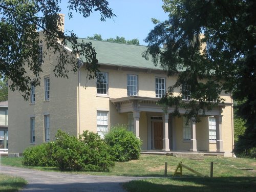
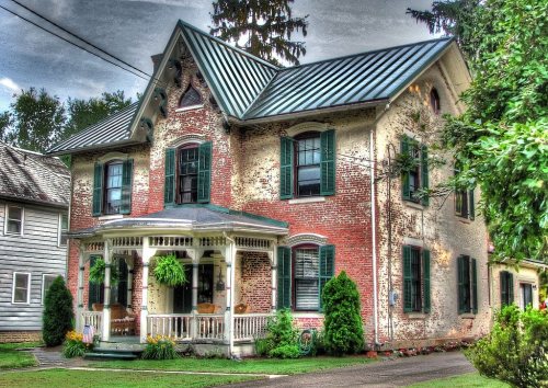
11 places in town are on the National Register, among them three historic districts with 59 buildings between them. Below: 3 old photos and papers, maps from 1884 on, and the census since 1810.
Founding year: Wikidata; Wikipedia’s history section gives the same year. First post office: 1812.The full story ↓
History grade
What drives Wooster’s History grade
On its age, its old homes and the National Register, Wooster is more historic than 87% of U.S. towns, #193 of 993 in Ohio. All 3 inputs are above most U.S. towns; its National Register listings ranks highest and its share of homes from before 1940 lowest.
A
HistoryA character grade: shown, never part of Wooster’s overall grade.
Ohio towns list about as much on the Register as the country (a typical Ohio town has 2.9 per 10,000 residents, the U.S. 2.4), so Wooster’s 25.2 sits above most of its state (83% of Ohio towns have fewer) while its 68 historic buildings outnumber those of 87% of U.S. towns.
How sure. Graded on any two of the three inputs instead, the letter would range from A− to A. The pre-1940 share (±2.5 points) is firm at this size. Two sources give 1808.
Founding year: Wikidata (other dates in Quick answers). Homes: Census ACS 2020–24. National Register: National Park Service, May 2026 list; each listing counted once (boundary changes and added documentation belong to their listing), and a historic district counts its contributing buildings. How TownRatings grades history →
What stands out about Wooster’s past
Read from the archive, the National Register and the record. The page puts what stands out first.
Lost post offices, old corners, places now gone and burying grounds
Wooster’s post office has been open since 1812. Two other post offices opened and closed inside today’s town.
Wooster
1812–today
Madisonburg
1851–1902
Wayne
1870–1893
18101920today
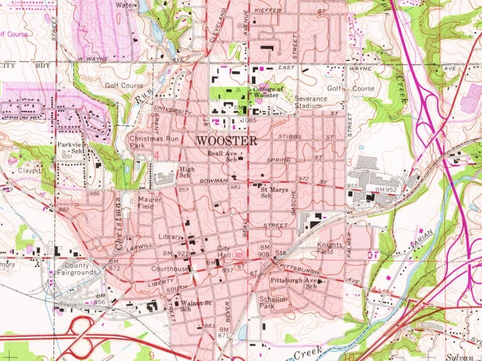
Hamlets and corners on the map
Boys VillageChristmas RunDeer CreekForest CreekHighland ParkMadison HillMadisonburgMeadow BrookMelrose VillageMiller LakesParkviewRamblewoodShel Mar Mobile Home ParkThe MeadowsWooster Trailer Park
Gone or out of use
School Number 1schoolSchool Number 3schoolSchool Number 4schoolSchool Number 5schoolSchool Number 8schoolWest Bowman Street Public Schoolschool
3cemeteries and burying grounds inside Wooster
Highland ParkMadisonburgWooster
US Post Offices dataset (Blevins & Helbock, CC0). Places and cemeteries from the USGS Geographic Names Information System (2021).
Help out
Start Wooster’s collection
The first neighbors to add old photos shape how Wooster’s history is told.
Decades since 1900 with photos
00s10s20s30s40s50s60s70s80s90s
1 of 10 decades. The empty ones are waiting for someone’s album.
Fire insurance maps drew every building, what it was made of and what it was used for, so insurers could price the risk of fire. Pick a year, then a sheet.
Wooster was established in 1808 by John Bever, William Henry, and Joseph Larwill and named after David Wooster, a general in the American Revolutionary War.
Passages that mention Wooster, cut from the printed page as they were published.
history of wayne county, ohio, from the days of the pioneers and first settlers to the present time1878 · page 438Read the page →
Read the text
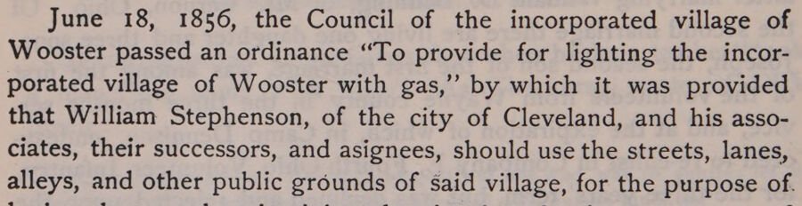
June 18, 1856, the Council of the incorporated village of Wooster passed an ordinance “To provide for lighting the incorporated village of Wooster with gas,’ by which it was provided that William Stephenson, of the city of Cleveland, and his associates, their successors, and asignees, should use the streets, lanes, alleys, and other public grounds of Said village, for the purpose of.
Text read by machine from the scan; it may contain errors.
History of Wayne county, Ohio, from the days of the pioneers and the first settlers to the present time1878 · page 438Read the page →
Read the text
June i8, 1856, the Council of the incorporated village of Wooster passed an ordinance "To provide for lighting the incorporated village of Wooster with gas," by which it was provided that William Stephenson, of the city of Cleveland, and his associates, their successors, and asignees, should use the streets, lanes, alleys, and other public grounds of said village, for the purpose of laying down and maintaining therein pipes for the conveyance of gas in and through the same for the use of said village and the
Text read by machine from the scan; it may contain errors.
Clear creek and Christmas run rise in Wayne township and flow south, forming junction with the Kilibuck in Wooster township, two miles west of Wooster, on the old Eicher farm; the Christmas run joins the Kilibuck a mile southwest of the city of Wooster. Reddick’s Springs, one of the branches of Christmas run, at one date furnished an abundant supply of pure water for the city of Wooster.
Text read by machine from the scan; it may contain errors.
History of Wayne county, Ohio, from the days of the pioneers and the first settlers to the present time1878 · page 71Read the page →
Read the text
Clear creek and Christmas run rise in Wayne township and flow south, the former joining with the Killbuck in Wooster township, two miles west of the city of Wooster, on the Eicher farm ; the latter joins the Killbuck in Wooster township, about a mile south-west of the city. Reddick's Springs, one of the branches of Christmas run, now furnish an ample supply of pure water to the city of Wooster.
Text read by machine from the scan; it may contain errors.
Scans and text from the Internet Archive. Books published in 1930 or earlier, which are in the public domain.
Timeline
Wooster, 1808 to 1961
Woven from the archive, old maps, post office records, the National Register and the people born here.
Nothing in the archives for these yearsWeddings on Main Street, storms, parades, school pictures, the old store. If it’s in your family album, it belongs here.
In 1808, according to Wikidata and Wikipedia’s history of the town. Wooster’s post office opened in 1812, and the census of 1810 counted 291 people here.
How does Wooster rank for history?
Wooster is more historic than 87% of U.S. towns, #193 of 993 in Ohio. The History grade combines the town’s founding era, the share of homes built before 1940 and its National Register listings. It’s a character grade, so it isn’t part of the overall grade. How it works.
What is on the National Register in Wooster?
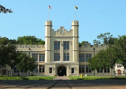
11 listings: 7 buildings and 3 historic districts, the Wayne County Courthouse District, the College of Wooster and the Wooster Public Square Historic District, with 59 contributing buildings. 68 historic buildings in all.
How old are the homes in Wooster?
17% of Wooster’s homes were built before 1940 (Census estimate, ±2.5 points), against a typical 15% for an Ohio town; the median home was built in 1972.
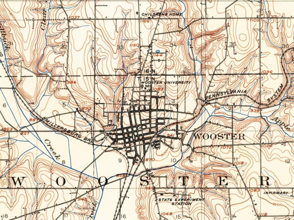
Founding dates: Wikidata, Wikipedia, the U.S. post office records of Blevins & Helbock (CC0) and the Census. Homes by year built: Census ACS 2020–24. National Register of Historic Places: National Park Service (list of May 22, 2026). Old photos, postcards and papers: Wikimedia Commons, the Library of Congress and other public archives, credited on each item’s page. Maps: U.S. Geological Survey historical topographic maps (via Esri) and Sanborn fire-insurance maps (Library of Congress). History text and census tables: Wikipedia (CC BY-SA 4.0). Places that used to be: USGS Geographic Names Information System (2021).
From Wikimedia Commons (2), the Library of Congress (1), Wikidata (3), the National Register of Historic Places (11), Wikipedia, Wikidata and Wikipedia for famous people, U.S. Geological Survey historical maps, U.S. Census counts (via Wikipedia), the US Post Offices dataset (Blevins & Helbock), the USGS Geographic Names Information System, Sanborn fire insurance maps (Library of Congress) and old county and town histories (Internet Archive). Archive images are copied here with their credits and licenses, shown on each photo’s page. Refreshed monthly.