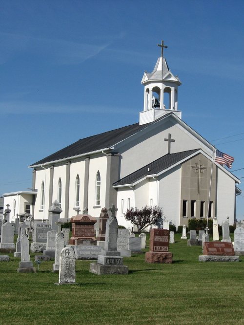
St. Marys dates to 1823, and 39% of its homes were built before 1940
More historic than 91% of U.S. towns · #138 of 993 in Ohio. What drives it
Its Register listings are the Dr. Issac Elmer Williams House And Office, the Holy Rosary Catholic Church and the Fountain Hotel, The. Below: 11 old photos and papers, maps from 1911 on, and the census since 1840.
Founding year: Wikipedia. First post office: 1825.The full story ↓
History grade
What drives St. Marys’ History grade
On its age, its old homes and the National Register, St. Marys is more historic than 91% of U.S. towns, #138 of 993 in Ohio. All 3 inputs are above most U.S. towns; its share of homes from before 1940 ranks highest and its National Register listings lowest.
A
HistoryA character grade: shown, never part of St. Marys’ overall grade.
Ohio towns list about as much on the Register as the country (a typical Ohio town has 2.9 per 10,000 residents, the U.S. 2.4), so St. Marys’ 4.8 sits near the middle of its state (63% of Ohio towns have fewer) while its 4 historic buildings outnumber those of 68% of U.S. towns.
How sure. Graded on any two of the three inputs instead, the letter would range from A− to A. The pre-1940 share is a Census survey estimate (±6.0 points). Two sources give 1823.
Founding year: Wikipedia (other dates in Quick answers). Homes: Census ACS 2020–24. National Register: National Park Service, May 2026 list; each listing counted once (boundary changes and added documentation belong to their listing), and a historic district counts its contributing buildings. How TownRatings grades history →
What stands out about St. Marys’ past
Read from the archive, the National Register and the record. The page puts what stands out first.
After the Revolutionary War, the Shawnee village on the site became known as Girty's Town for the Indian traders James and Simon Girty, who had a trading post on the site. James Girty was originally a partner of Peter Loramie, but fled to the St. Marys River when Loramie's trading post was burned in 1782. Girty maintained his trading post between 1783 and 1790 and fled when General Harmar's army approached. He later returned to the post. When General Anthony Wayne approached the St. Marys area in 1794, James Girty packed up his goods and fled to Canada, thus ending the Girty Brothers era in Ohio. The village retained the name until the modern town was founded in 1823.
Passages that mention St. Marys, cut from the printed page as they were published.
History of western Ohio and Auglaize County1905 · page 655Read the page →
Read the text
"Murray and William A. Houston entered four hundred acres of land in sections three and ten, and in 1823-4 laid out the town of St. Marys. Houston was a brother of John S. Houston one of the early surveyors of Mercer county." At the close of the treaty, there were not more than six or eight families residing in the township, and they occupied the blockhouses.
Text read by machine from the scan; it may contain errors.
Official Program and Souvenir St. Marys, Ohio Centennial1923 · page 7Read the page →
Read the text
port that he gave to the General Chairman; to Mrs. М. К. Clover, who .gave so splendidly of her executive ability and musical talent; and to the citizenship of the City of St. Marys which stood shoulder to shoulder to put across the greatest event in its history.
Text read by machine from the scan; it may contain errors.
Scans and text from the Internet Archive. Books published in 1930 or earlier, which are in the public domain.
By decade
St. Marys, decade by decade
2 decades in the archive, from the 1900s to the 1910s. Scroll each row; tap a photo for its story.
Nothing in the archives for these yearsWeddings on Main Street, storms, parades, school pictures, the old store. If it’s in your family album, it belongs here.
In 1823, according to Wikipedia’s history of the town. St. Marys’ post office opened in 1825, and the census of 1840 counted 92 people here.
How does St. Marys rank for history?
St. Marys is more historic than 91% of U.S. towns, #138 of 993 in Ohio. The History grade combines the town’s founding era, the share of homes built before 1940 and its National Register listings. It’s a character grade, so it isn’t part of the overall grade. How it works.
What is on the National Register in St. Marys?
Three places: the Dr. Issac Elmer Williams House And Office (listed 1979), the Holy Rosary Catholic Church (1979) and the Fountain Hotel, The (1997).
How old are the homes in St. Marys?
39% of St. Marys’ homes were built before 1940 (Census estimate, ±6.0 points), against a typical 15% for an Ohio town; the median home was built in 1952.
Founding dates: Wikidata, Wikipedia, the U.S. post office records of Blevins & Helbock (CC0) and the Census. Homes by year built: Census ACS 2020–24. National Register of Historic Places: National Park Service (list of May 22, 2026). Old photos, postcards and papers: Wikimedia Commons, the Library of Congress and other public archives, credited on each item’s page. Maps: U.S. Geological Survey historical topographic maps (via Esri) and Sanborn fire-insurance maps (Library of Congress). History text and census tables: Wikipedia (CC BY-SA 4.0). Places that used to be: USGS Geographic Names Information System (2021).
From Wikimedia Commons (12), the National Register of Historic Places (3), Wikipedia, Wikidata and Wikipedia for famous people, U.S. Geological Survey historical maps, U.S. Census counts (via Wikipedia), the US Post Offices dataset (Blevins & Helbock), the USGS Geographic Names Information System and old county and town histories (Internet Archive). Archive images are copied here with their credits and licenses, shown on each photo’s page. Refreshed monthly.


 1907
 1908
 1908
 1908
 1908
 1909
 1909
 1911
 1914
 2013