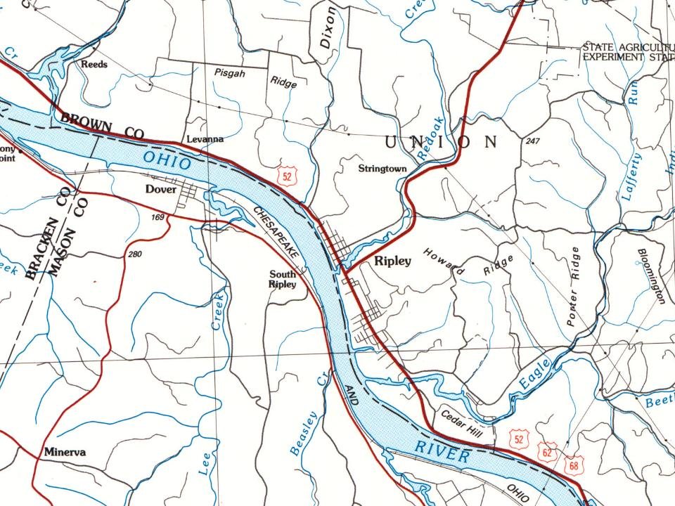
5 places in town are on the National Register, among them 2 National Historic Landmarks and a historic district with 216 buildings. Below: 2 old photos and papers, maps from 1961 on, and the census since 1820.
Founding year: Wikidata. First post office: 1816.The full story ↓
History grade
What drives Ripley’s History grade
On its age, its old homes and the National Register, Ripley is more historic than 98% of U.S. towns. All 3 inputs are above most U.S. towns; its National Register listings ranks highest and its age lowest.
A+
HistoryA character grade: shown, never part of Ripley’s overall grade.
Ohio towns list about as much on the Register as the country (a typical Ohio town has 2.9 per 10,000 residents, the U.S. 2.4), so Ripley’s 1,366 sits above most of its state (100% of Ohio towns have fewer) while its 220 historic buildings outnumber those of 94% of U.S. towns.
NoteThe founding year comes from Wikidata alone; no second source gives 1812.
How sure. Graded on any two of the three inputs instead, the letter would range from A to A+. The pre-1940 share is a Census survey estimate (±9.5 points).
Founding year: Wikidata (other dates in Quick answers). Homes: Census ACS 2020–24. National Register: National Park Service, May 2026 list; each listing counted once (boundary changes and added documentation belong to their listing), and a historic district counts its contributing buildings. How TownRatings grades history →
What stands out about Ripley’s past
Read from the archive, the National Register and the record. The page puts what stands out first.
Colonel James Poage, a veteran of the American Revolution, arrived in the free state of Ohio from Staunton, Virginia in 1804 to claim the 1,000 acres (4.0 km2) he had been granted in what was called the Virginia Military District. Poage was among a large group of veterans who received land grants in what was first organized as the Northwest Territory north of the Ohio River for their service in the American Revolutionary War, and freed the people that they had enslaved when they settled there. Poage and his family laid out the town of Staunton in 1812; it was renamed in 1816 to honor General Eleazar Wheelock Ripley, an American officer of the War of 1812.
Passages that mention Ripley, cut from the printed page as they were published.
The history of Brown County, Ohio, containing a history of the county ... general and local statistics1883 · page 449Read the page →
Read the text
Ripley has yet no railroad, but we have fair prospects for an early connection by rail with the outside world. It is confidently believed that work will soon be commenced on a standard gauge road connecting Huntington and Cincinnati through this county, along the Ohio River bank. But the town of Ripley was and is known far and wide as the place where the Underground Railroad had its mouth or entrance. On the high hill some 300 feet above the level overlooking the quiet village stands as of yore the old residence of Rev. John Rankin, who is still living at the ripe age of eighty-nine years. This building, if
Text read by machine from the scan; it may contain errors.
the history of brown county ohio1883 · page 449Read the page →
Read the text
Ripley has yet no railroad, but we have fair prospects for an early connection by rai] with the outside world. It is confidently believed that work will soon be commenced on a standard gauge road connecting Huntington and Cincinnati through this county. along the Ohio River bank. But the town of Ripley was and is known far and wide as the place where the Underground Railroad had its mouth or entrance. On the high hill some 300 feet above the level overlooking the quiet village stands as of yore the old residence of Rev. John Rankin, who is still living at the ripe age of eighty-nine years. This building, if
Text read by machine from the scan; it may contain errors.
The history of Brown County, Ohio, containing a history of the county ... general and local statistics1883 · page 286Read the page →
Read the text
court having been holden in the town of Ripley, and the several courts for said county shall continue to he holden in said town of Ripley until the first day of June next, and until said commissioners shall have fixed on a permanent seat of justice of said county, after which time the courts of said county shall be holden at the place selected by the commissioners appointed by virtue of this act.
Text read by machine from the scan; it may contain errors.
the history of brown county ohio1883 · page 286Read the page →
Read the text
court having been holden in the town of Ripley, and the several courts for said county shall continue to he holden in said town of Ripley until the first day of June next, and until said commissioners shall have fixed on a permanent seat of justice of said county, after which time the courts of said county shall be holden at the place selected by the commissioners appointed by virtue of this act.
Text read by machine from the scan; it may contain errors.
Scans and text from the Internet Archive. Books published in 1930 or earlier, which are in the public domain.
Timeline
Ripley, 1812 to 2005
Woven from the archive, old maps, post office records, the National Register and the people born here.
Nothing in the archives for these yearsWeddings on Main Street, storms, parades, school pictures, the old store. If it’s in your family album, it belongs here.
In 1812, according to Wikidata. Ripley’s post office opened in 1816, and the census of 1820 counted 421 people here.
How does Ripley rank for history?
Ripley is more historic than 98% of U.S. towns. The History grade combines the town’s founding era, the share of homes built before 1940 and its National Register listings. It’s a character grade, so it isn’t part of the overall grade. How it works.
What is on the National Register in Ripley?
5 listings, 2 of them National Historic Landmarks: 4 buildings, among them the John Rankin House (a National Historic Landmark since 1997), and 1 historic district, the Ripley Historic District, with 216 contributing buildings. 220 historic buildings in all.
How old are the homes in Ripley?
37% of Ripley’s homes were built before 1940 (Census estimate, ±9.5 points), against a typical 15% for an Ohio town; the median home was built in 1956.
Founding dates: Wikidata, Wikipedia, the U.S. post office records of Blevins & Helbock (CC0) and the Census. Homes by year built: Census ACS 2020–24. National Register of Historic Places: National Park Service (list of May 22, 2026). Old photos, postcards and papers: Wikimedia Commons, the Library of Congress and other public archives, credited on each item’s page. Maps: U.S. Geological Survey historical topographic maps (via Esri) and Sanborn fire-insurance maps (Library of Congress). History text and census tables: Wikipedia (CC BY-SA 4.0). Places that used to be: USGS Geographic Names Information System (2021).
From Wikimedia Commons (5), Wikidata (1), the National Register of Historic Places (5), Wikipedia, Wikidata and Wikipedia for famous people, U.S. Geological Survey historical maps, U.S. Census counts (via Wikipedia), the US Post Offices dataset (Blevins & Helbock), the USGS Geographic Names Information System and old county and town histories (Internet Archive). Archive images are copied here with their credits and licenses, shown on each photo’s page. Refreshed monthly.


 ★ Landmark
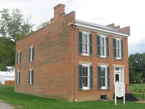 ★ Landmark


![Ripley has yet no railroad, but we have fair prospects for an early connection by rai] with the outside world. It is confidently believed that work will soon be commenced on a standard gauge road connecting Huntington and Cincinnati through this county. along the Ohio River bank. But the town of Ri…](https://images.townratings.com/story/13367/bk-8e21f6a4decdf2e7-l.jpg)


 1917
 2012
 2012
 2008