Founding year: the first Reading post office (Blevins & Helbock, CC0). Wikidata: 1851.The full story ↓
History grade
What drives Reading’s History grade
On its age, its old homes and the National Register, Reading is more historic than 64% of U.S. towns, #494 of 993 in Ohio. Its share of homes from before 1940 holds the grade up; its National Register listings pull it down.
B
HistoryA character grade: shown, never part of Reading’s overall grade.
Ohio towns list about as much on the Register as the country (a typical Ohio town has 2.9 per 10,000 residents, the U.S. 2.4), so Reading’s 0.0 sits below most of its state (23% of Ohio towns have fewer) while its 0 listings outnumber those of 23% of U.S. towns.
How sure. Graded on any two of the three inputs instead, the letter would range from C+ to A−. The pre-1940 share is a Census survey estimate (±6.2 points). The founding year is the first post office, not a stated founding date; Wikidata gives 1851.
Founding year: the first post office (other dates in Quick answers). Homes: Census ACS 2020–24. National Register: National Park Service, May 2026 list; each listing counted once (boundary changes and added documentation belong to their listing), and a historic district counts its contributing buildings. How TownRatings grades history →
What stands out about Reading’s past
Read from the archive, the National Register and the record. The page puts what stands out first.
In 1794, Abraham Voorhees moved his family from Somerset County, New Jersey, building a large double log cabin along the west bank of the Millcreek in Sycamore Township, in present-day Lockland. In the spring of 1795, Harvey Redinbo, a Pennsylvania Dutchman, visited from Reading, Pennsylvania. Pleased with the land that Voorhees had acquired, Redinbo purchased his own land, in the area of Hunt Road and Columbia Avenue. Around 1798, Voorhees platted a town named Voorhees-Town but did not record it with county officials until January 7, 1804. By then, Redinbo had convinced him to rename the town to Reading, after Redinbo's hometown.
Passages that mention Reading, cut from the printed page as they were published.
History of Cincinnati and Hamilton County, Ohio1894 · page 447Read the page →
Read the text
Here in 1787 Cunningham married Janette Park, and two years later they removed to Cincinnati. On May 26, 1789, he entered land warrant No. 139, “which he located on the west half of Section 28, Township 4, East Range 1, about a mile and a half north of the present village of Reading.” His brothers-in-law, Arthur, Andrew, and Culbertson Park, assisted in constructing his first improvements. This must have occurred prior to 1792, for in that year he was one of the petitioners for a road from Cincinnati to Runyan’s settlement. As the frontier enjoyed almost unbroken peace in 1789, Mr. Olden supposes that he probably located upon this land
Text read by machine from the scan; it may contain errors.
History of Cincinnati and Hamilton County, Ohio1894 · page 448Read the page →
Read the text
Reading. — The first settlement at Reading was made in 1794 by Abraham Voorhees. He was accompanied by his sons, Miney, Abraham, Garrett, John, and Jacob, and his sons-in-law, Thomas Higgins and John Rynearson. For purposes of mutual protection and defense. They united in the erection and occupancy of a large log house, the location of which was on the west bank of Mill creek within the present Digitized by^ Google
Text read by machine from the scan; it may contain errors.
History of Hamilton County, Ohio, with illustrations and biographical sketches1881Read the page →
Read the text
After the formation of the Lockland society, the New School branch in Reading languished, and in a few years ceased to exist, its members tninsterring their allegiance mainly to the Colony church. To this, many years after, October 14, 1870, in the year succeeding the formal reunion of the Old and New School assemblies of Pittsburgh, the Reading Old School wing also came over and joined the Lockland society, which now took the name of the
Text read by machine from the scan; it may contain errors.
History of Hamilton County, Ohio, with illustrations and biographical sketches1881 · page 393Read the page →
Read the text
The Rev. Daniel Hayden, from 1817 to 1820, and possibly later it is thought, preached once or twice a month in a little brick school-house (sixteen by twentyfour), on the hillside in the eastern part of Reading, near or upon the present school lot. H e resided a mile east of Reading. Rev. L. G. Gaines, of Montgomery, preached about as often from 1820 until ihe Presbyterian church of Reading was organized Friday, August 29, 1823, with Jehiel
Text read by machine from the scan; it may contain errors.
Scans and text from the Internet Archive. Books published in 1930 or earlier, which are in the public domain.
By decade
Reading, decade by decade
One decade in the archive so far: the 1950s. Scroll each row; tap a photo for its story.
Nothing in the archives for these yearsWeddings on Main Street, storms, parades, school pictures, the old store. If it’s in your family album, it belongs here.
The Reading post office opened in 1817, the earliest record of the town by name (U.S. post office records). Wikidata gives 1851.
How does Reading rank for history?
Reading is more historic than 64% of U.S. towns, #494 of 993 in Ohio. The History grade combines the town’s founding era, the share of homes built before 1940 and its National Register listings. It’s a character grade, so it isn’t part of the overall grade. How it works.
How old are the homes in Reading?
24% of Reading’s homes were built before 1940 (Census estimate, ±6.2 points), against a typical 15% for an Ohio town; the median home was built in 1956.
Founding dates: Wikidata, Wikipedia, the U.S. post office records of Blevins & Helbock (CC0) and the Census. Homes by year built: Census ACS 2020–24. National Register of Historic Places: National Park Service (list of May 22, 2026). Old photos, postcards and papers: Wikimedia Commons, the Library of Congress and other public archives, credited on each item’s page. Maps: U.S. Geological Survey historical topographic maps (via Esri) and Sanborn fire-insurance maps (Library of Congress). History text and census tables: Wikipedia (CC BY-SA 4.0). Places that used to be: USGS Geographic Names Information System (2021).
From Wikimedia Commons (18), Wikipedia, Wikidata and Wikipedia for famous people, U.S. Geological Survey historical maps, U.S. Census counts (via Wikipedia), the US Post Offices dataset (Blevins & Helbock), the USGS Geographic Names Information System, Sanborn fire insurance maps (Library of Congress) and old county and town histories (Internet Archive). Archive images are copied here with their credits and licenses, shown on each photo’s page. Refreshed monthly.


 1951
 1951
 1951
 1951
 2011
 2011
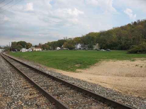 2011
 2011
 2011
 2011
 2011
 2011
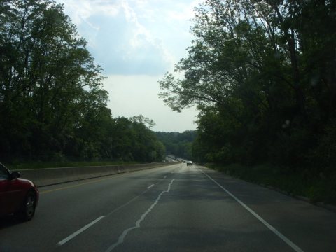 2009
 2009
 2006
 2006
 2006
