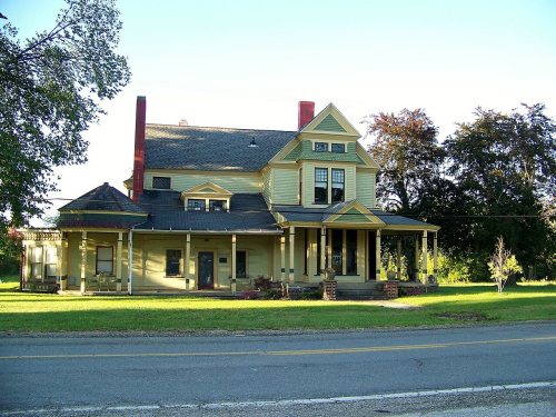
Ravenna Township dates to 1799, and 12% of its homes were built before 1940
More historic than 80% of U.S. towns · #306 of 993 in Ohio. What drives it
4 places in town are on the National Register, among them a historic district with 10 buildings. Below: 6 old photos and papers, maps from 1906 on, and the census since 1830.
Founding year: Wikidata; Wikipedia’s history section gives the same year. First post office: 1841.The full story ↓
History grade
What drives Ravenna Township’s History grade
On its age, its old homes and the National Register, Ravenna Township is more historic than 80% of U.S. towns, #306 of 993 in Ohio. All 3 inputs are above most U.S. towns; its National Register listings ranks highest and its share of homes from before 1940 lowest.
A−
HistoryA character grade: shown, never part of Ravenna Township’s overall grade.
Ohio towns list about as much on the Register as the country (a typical Ohio town has 2.9 per 10,000 residents, the U.S. 2.4), so Ravenna Township’s 15.4 sits above most of its state (79% of Ohio towns have fewer) while its 14 historic buildings outnumber those of 78% of U.S. towns.
How sure. Graded on any two of the three inputs instead, the letter would range from B+ to A−. The pre-1940 share is a Census survey estimate (±4.5 points). Two sources give 1799.
Founding year: Wikidata (other dates in Quick answers). Homes: Census ACS 2020–24. National Register: National Park Service, May 2026 list; each listing counted once (boundary changes and added documentation belong to their listing), and a historic district counts its contributing buildings. How TownRatings grades history →
What stands out about Ravenna Township’s past
Read from the archive, the National Register and the record. The page puts what stands out first.
Lost post offices, old corners and places now gone
Another post office, Campbellsport, opened and closed inside today’s town.
Hamlets and corners on the map
Birchwood ManorBlack HorseCampbellsportFair AcresHamlet ParkM And M Mobile Home ParkPine Gate VillageSummit Mobile Home ParkVillage Estate Mobile Home ParkWest Park Homes
Gone or out of use
Beechwood SchoolschoolCampells Port Post Officepost officeRavenna Stationlocale
US Post Offices dataset (Blevins & Helbock, CC0). Places and cemeteries from the USGS Geographic Names Information System (2021).
On the map
Ravenna Township on the map, 1906 to 1994
Every edition of the U.S. Geological Survey’s map of Ravenna Township. Tap a year, or press play to watch the town change.
1906Kent sheet · 1:62,500
U.S. Geological Survey historical topographic maps (public domain), via Esri’s collection of the scans. The red ring marks the center of Ravenna Township.
Timeline
Ravenna Township, 1799 to 1907
Woven from the archive, old maps, post office records, the National Register and the people born here.
Ravenna was founded by Benjamin Tappan, who arrived there on June 11, 1799, to lay claim in his father's name to land purchased in the Connecticut Western Reserve. Tappan did not stay in the area for long, however, but built a settlement of log cabins before returning to Connecticut during the summer of 1800.
Passages that mention Ravenna Township, cut from the printed page as they were published.
History of Portage County, Ohio1885 · page 817Read the page →
Read the text
County, then from 1862 till 1870 he held the position of foreman of masonry on the Atlantic & Great Western Railroad. In 1866 he purchased a farm in Ravenna Township, and there his family resided. He was Inspector of Masonry for the city of Cleveland, Ohio, in 1870, and in 1871 foreman of & force of men for E. W. Ensign, contractor on the Lake Shore Road. In 1872 Mr. Cook formed a partnership with Wanzer Holcomb, in taking contracts for various railroads and city corporations. In 1881 he built the Ravenna Mills on Main Street, and the Cleveland & Pittsburgh Railroad, and he now devotes
Text read by machine from the scan; it may contain errors.
History of Portage County, Ohio1885 · page 251Read the page →
Read the text
Harmon. An opening was soon made in the woods and sown with wheat brought out by Sheldon, the gi'ass seed being sown in the same field. Benjamin Tappan put in a few acres of corn and vegetables in 1800, on his land in the southeast corner of Ravenna Township, and the same fall planted the ground in wheat. William Chard and Conrad Boosinger, both of whom settled in Tappan's neighborhood, also planted small fields of the latter cereal in the fall of 1800. Asa Hall made the first clearing in Atwater Township early in 1800, and put in some corn, which was succeeded the next fall by wheat. In
Text read by machine from the scan; it may contain errors.
Scans and text from the Internet Archive. Books published in 1930 or earlier, which are in the public domain.
By decade
Ravenna Township, decade by decade
3 decades in the archive, from the 1850s to the 1900s. Scroll each row; tap a photo for its story.
Nothing in the archives for these yearsWeddings on Main Street, storms, parades, school pictures, the old store. If it’s in your family album, it belongs here.
In 1799, according to Wikidata and Wikipedia’s history of the town. Ravenna Township’s post office opened in 1841, and the census of 1830 counted 306 people here.
How does Ravenna Township rank for history?
Ravenna Township is more historic than 80% of U.S. towns, #306 of 993 in Ohio. The History grade combines the town’s founding era, the share of homes built before 1940 and its National Register listings. It’s a character grade, so it isn’t part of the overall grade. How it works.
What is on the National Register in Ravenna Township?
4 listings: 3 buildings, among them the Horace Y. Beebe House (listed 1983, the first), and 1 historic district, the Cottage Hill Farm, with 10 contributing buildings. 14 historic buildings in all.
How old are the homes in Ravenna Township?
12% of Ravenna Township’s homes were built before 1940 (Census estimate, ±4.5 points), against a typical 15% for an Ohio town; the median home was built in 1982.
Founding dates: Wikidata, Wikipedia, the U.S. post office records of Blevins & Helbock (CC0) and the Census. Homes by year built: Census ACS 2020–24. National Register of Historic Places: National Park Service (list of May 22, 2026). Old photos, postcards and papers: Wikimedia Commons, the Library of Congress and other public archives, credited on each item’s page. Maps: U.S. Geological Survey historical topographic maps (via Esri) and Sanborn fire-insurance maps (Library of Congress). History text and census tables: Wikipedia (CC BY-SA 4.0). Places that used to be: USGS Geographic Names Information System (2021).
From Wikimedia Commons (6), the National Register of Historic Places (4), Wikipedia, U.S. Geological Survey historical maps, U.S. Census counts (via Wikipedia), the US Post Offices dataset (Blevins & Helbock), the USGS Geographic Names Information System and old county and town histories (Internet Archive). Archive images are copied here with their credits and licenses, shown on each photo’s page. Refreshed monthly.


 1859
 c. 1907
 1908