Port William was originally called West Liberty, and under the latter name was platted in 1832. A post office called Port William has been in operation since 1834.
Passages that mention Port William, cut from the printed page as they were published.
The history of Clinton County, Ohio1882 · page 739Read the page →
Read the text
Port William Cemetery is situated about one-half mile east of Port William, near where Concord Meeting-House formerly stood. This was established as a buryingground in 1830. The first person buried here was Peter Ogen, who was buried in the year above named. This is the largest cemetery in the township.
Text read by machine from the scan; it may contain errors.
The history of Clinton County, Ohio1882 · page 677Read the page →
Read the text
Then came the “east and west,” or the “Jenkins Mill” road, that extended from Port William (now) to Mt. Holly, on the Little Miami, crossing the Bull skin in the village of New Burlington. Another started from the old State road, at the village of Clarksville, and intersected the Bullskin just south of where the latter village stands to-day. They were in those days but pathways through the woods — were filled with stumps, logs, tree-tops and sloughs, around and through which the teamster had to pilot his heavily laden wagon.
Text read by machine from the scan; it may contain errors.
History of Clinton County Ohio1915 · page 258Read the page →
Read the text
There is some evidence that points to the conclusion that this trail was traveled as early as 1802. The Bullskin road started from the Ohio river, traversed the state due north to the lakes and was laid out in 1807. Another early road was the Jenkins mill road. that extended from Port William to Mt. Holy. on the Little Miami, crossing the Bullskin in the village of Burlington. Another started from the village of Clirksville, and intersected the Bullskin just south of where the latter village stands today. The roads of those days were mere trails, blazed through the forest and filled with stumps, logs, tree tops and sloughs. The toll rouds that followed were a great improvement, but
Text read by machine from the scan; it may contain errors.
History of Clinton County Ohio1915 · page 283Read the page →
Read the text
Yumberton lies on the northern edge of the county between New Burlington and Port William. and on the Wilmington and Xenia pike. This village was called Tumberton for a town of that name in New Jersey. The first house built in the village was used for a wagon shop by Samuel Woolman, about 1820, About the same time he huilt
Text read by machine from the scan; it may contain errors.
Scans and text from the Internet Archive. Books published in 1930 or earlier, which are in the public domain.
Timeline
Port William, 1834 to 1960
Woven from the archive, old maps, post office records, the National Register and the people born here.
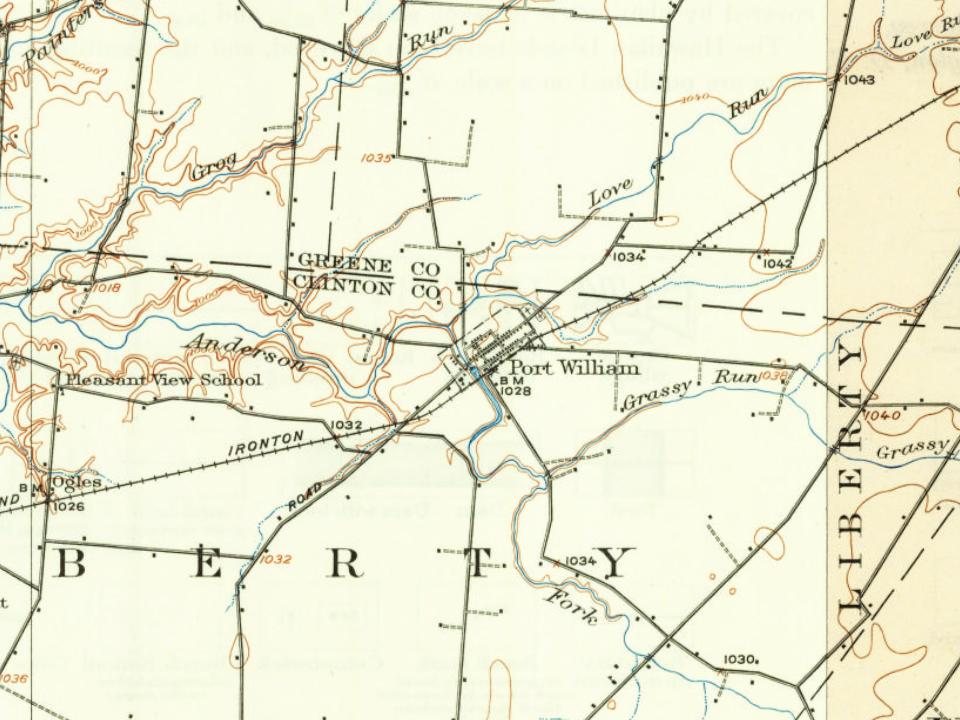
Founding dates: Wikidata, Wikipedia, the U.S. post office records of Blevins & Helbock (CC0) and the Census. Homes by year built: Census ACS 2020–24. National Register of Historic Places: National Park Service (list of May 22, 2026). Old photos, postcards and papers: Wikimedia Commons, the Library of Congress and other public archives, credited on each item’s page. Maps: U.S. Geological Survey historical topographic maps (via Esri) and Sanborn fire-insurance maps (Library of Congress). History text and census tables: Wikipedia (CC BY-SA 4.0). Places that used to be: USGS Geographic Names Information System (2021). How TownRatings grades history →
From Wikimedia Commons (5), Wikipedia, U.S. Geological Survey historical maps, U.S. Census counts (via Wikipedia), the US Post Offices dataset (Blevins & Helbock), the USGS Geographic Names Information System and old county and town histories (Internet Archive). Archive images are copied here with their credits and licenses, shown on each photo’s page. Refreshed monthly.



 2015
 2013
 2013
 2012
 2004