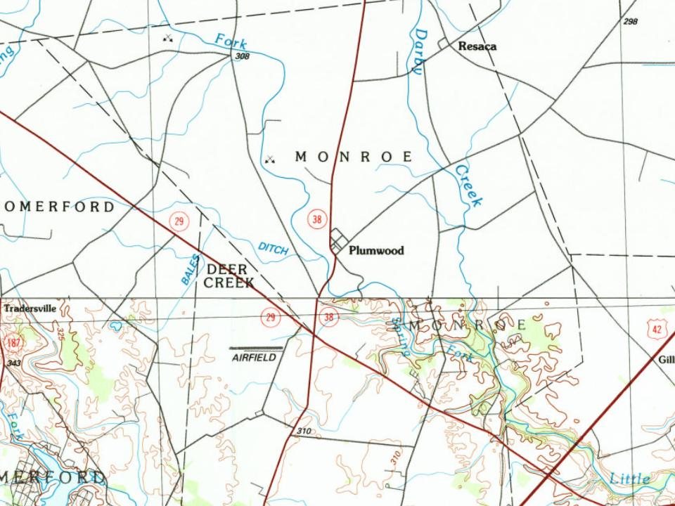
Plumwood was originally laid out on December 23, 1895, by Charles F. Sanford. The community was originally named Sanford, but the name was later changed. As of 1915, the community was one of the largest trade posts in the county, with three large general stores, a blacksmith, six threshing outfits, three hay baling outfits, and the population was 200.
Passages that mention Plumwood, cut from the printed page as they were published.
History of Madison County, Ohio1915 · page 181Read the page →
Read the text
Plumwood was platted on December 23, 1895, by Charles F. Sanford. It first bore the name of Sanford in honor of the owner, but this was later changed to Plumwood. The business carried on by this town exceeds any in the northwestern part of the county. It has an estimated population of two hundred people. There are three general stores, owned, respectively, by S. A. Hillman, Dan Peterman and C. W. Peters, and all do a very nice business. Elsworth Grewell is the village blacksmith. Plumwood is a great center for threshing outfits, and the following have their headquarters there: James Stockwell, three steam outfits; Ed Stockwell, one, and Fred Glass, two
Text read by machine from the scan; it may contain errors.
History of Madison County Ohio1915 · page 181Read the page →
Read the text
Plumwood was platted on December 23, 1895, by Charles F. Sanford. It first bore the name of Sanford in honor of the owner, but this was later changed to Plumwood. The business carried on by this town exceeds any in the northwestern part of the county. It has an estimated population of two hundred people. There are three general stores, owned, respectively, by S. A. Hillman, Dan Peterman and C. W. Peters, and all do a very nice business. Elsworth Grewell is the village blacksmith. Plum- ‘ wood is a great center for threshing outfits, and the following have their headquarters there: James Stockwell, three steam outfits; Ed Stockwell, one, and Fred Glass, two
Text read by machine from the scan; it may contain errors.
History of Madison County, Ohio1915 · page 289Read the page →
Read the text
This church is at the head of a circuit that includes the following stations: Lafayette, Summerford, Gillivan and Plumwood. Until 1913 the circuit contained only the three points of Lafayette, Summerford and Gillivan, but in 1914, Plumwood was added to the charge.
Text read by machine from the scan; it may contain errors.
History of Madison County Ohio1915 · page 289Read the page →
Read the text
This church Is at the head of a circuit that includes the following stations: Lafayette, Summerford, Gillivan and Plumwood. Until 1913 the circuit contained only the three points of Lafayette, Summerford and Gillivan, but in 1914, Plumwood was added to the charge.
Text read by machine from the scan; it may contain errors.
Scans and text from the Internet Archive. Books published in 1930 or earlier, which are in the public domain.
By decade
No old photos in the archives yet
Weddings on Main Street, storms, parades, school pictures, the old store. If it’s in your family album, it belongs here.
Be the first to add onePhotograph a print flat, in daylight, no flash.
Founding dates: Wikidata, Wikipedia, the U.S. post office records of Blevins & Helbock (CC0) and the Census. Homes by year built: Census ACS 2020–24. National Register of Historic Places: National Park Service (list of May 22, 2026). Old photos, postcards and papers: Wikimedia Commons, the Library of Congress and other public archives, credited on each item’s page. Maps: U.S. Geological Survey historical topographic maps (via Esri) and Sanborn fire-insurance maps (Library of Congress). History text and census tables: Wikipedia (CC BY-SA 4.0). Places that used to be: USGS Geographic Names Information System (2021). How TownRatings grades history →
From Wikipedia, U.S. Geological Survey historical maps and old county and town histories (Internet Archive). Archive images are copied here with their credits and licenses, shown on each photo’s page. Refreshed monthly.