


The story
Read it all →How Pleasant City came to be
From Wikipedia’s history of Pleasant City.
Pleasant City was originally called Point Pleasant, and under the latter name was platted in 1829.
Text from Wikipedia, licensed CC BY-SA 4.0.
Each edition grades its towns against each other only.
Below: maps from 1905 on and the census since 1900.
The Pleasant City post office opened in 1898, the earliest record of the town by name. Two smaller post offices, Rosman's (1815) and Dyson (1850), opened inside today’s town and later closed.
Read from the archive, the National Register and the record. The page puts what stands out first.
The first neighbors to add old photos shape how Pleasant City’s history is told.
Pleasant City’s post office has been open since 1898. Two other post offices opened and closed inside today’s town.
US Post Offices dataset (Blevins & Helbock, CC0). Places and cemeteries from the USGS Geographic Names Information System (2021).
Every edition of the U.S. Geological Survey’s map of Pleasant City. Tap a year, or press play to watch the town change.

U.S. Geological Survey historical topographic maps (public domain), via Esri’s collection of the scans. The red ring marks the center of Pleasant City.
From Wikipedia’s history of Pleasant City.
Pleasant City was originally called Point Pleasant, and under the latter name was platted in 1829.
Text from Wikipedia, licensed CC BY-SA 4.0.
Passages that mention Pleasant City, cut from the printed page as they were published.

What is now known as the Pennsylvania railroad enters the county from the north, in Wheeling township, follows the windings of the chief stream of the county (Wills creek) on down through Liberty, Cambridge, Jackson and Valley townships, leaving the county near Pleasant City, with stations of importance at Pleasant City, then north through Derwent, Byesville, Cambridge, Tyncr. Kimbolton, Birds Run and Guernsey and so on out of this into Tuscarawas county. The objective points of this division of the great Pennsylvania system are Marietta, at the south, and Cleveland, at the north.
Text read by machine from the scan; it may contain errors.
A church publication, styled the Parishiniire, or some similar title, was established at Pleasant City in 1904, by W. F. Birely and Rev. C. F. Floto, but this did not continue very long. The next publication Was the present newspaper founded by the present
Text read by machine from the scan; it may contain errors.Scans and text from the Internet Archive. Books published in 1930 or earlier, which are in the public domain.
Woven from the archive, old maps, post office records, the National Register and the people born here.
 On the mapFirst mapped by the U.S. Geological Survey
Fire insurance maps drew every building, what it was made of and what it was used for, so insurers could price the risk of fire. Pick a year, then a sheet.
 1905Sheet 1 of 2
Sanborn Map Company, via the Library of Congress. Editions published in 1930 or earlier, which are in the public domain.
Between 400 and 1,006 people in every census since 1900.
13 censuses, 1900–2020.
U.S. Census Bureau decennial counts, from the census table on Pleasant City’s Wikipedia page.
Nobody well known was born in Pleasant City itself, so here are the best known from just nearby.


The Pleasant City post office opened in 1898, the earliest record of the town by name (U.S. post office records).
What the archives can’t tell you, neighbors can.
Founding dates: Wikidata, Wikipedia, the U.S. post office records of Blevins & Helbock (CC0) and the Census. Homes by year built: Census ACS 2020–24. National Register of Historic Places: National Park Service (list of May 22, 2026). Old photos, postcards and papers: Wikimedia Commons, the Library of Congress and other public archives, credited on each item’s page. Maps: U.S. Geological Survey historical topographic maps (via Esri) and Sanborn fire-insurance maps (Library of Congress). History text and census tables: Wikipedia (CC BY-SA 4.0). Places that used to be: USGS Geographic Names Information System (2021). How TownRatings grades history →
From Wikimedia Commons (4), Wikipedia, U.S. Geological Survey historical maps, U.S. Census counts (via Wikipedia), the US Post Offices dataset (Blevins & Helbock), the USGS Geographic Names Information System, Sanborn fire insurance maps (Library of Congress) and old county and town histories (Internet Archive). Archive images are copied here with their credits and licenses, shown on each photo’s page. Refreshed monthly.
 2015
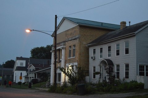 2015
 2015
 2004