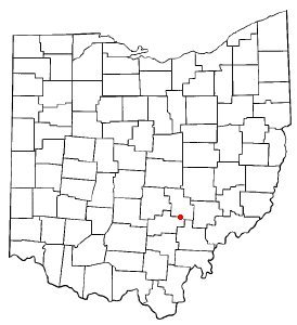
New Straitsville was founded in 1870 as a coal mining town by the New Straitsville Mining Company. The town grew quickly and by 1880 its population exceeded 4,000. Coal mining terminated in 1884 when a labor dispute at the mine ended with a group of miners sending a burning coal car into the mine, igniting the coal. The heat from the fire was so great that residents could draw hot water directly from wells to brew coffee. The fire in the New Straitsville mine burns to this day. New Straitsville is also famous for its annual "Moonshine Festival" on Memorial Day Weekend.
Every edition of the U.S. Geological Survey’s map of New Straitsville. Tap a year, or press play to watch the town change.
1911New Lexington sheet · 1:62,500
U.S. Geological Survey historical topographic maps (public domain), via Esri’s collection of the scans. The red ring marks the center of New Straitsville.
From the old history books
What they wrote about New Straitsville in 1883
Passages that mention New Straitsville, cut from the printed page as they were published.
1883 history perry county, ohio1883 · page 190Read the page →
Read the text
The building of the Straitsville branch of the Hocking Valley railroad, and the establishment of the town of New Straitsville, were the causes which led to the organization of the township of Coal. New Straitsville was laid out in 1870, by the Straitsville Mining Company, and at once began to grow with a rapidity that no other new mining town in this section of the State had equaled. Large coal companies were organized, and the shipping of coal engaged in on a large scale. Coal-works, stores, shops, dwellings, and c hurches grew
Text read by machine from the scan; it may contain errors.
1883 history perry county, ohio1883 · page 191Read the page →
Read the text
as the “Harbaugh Meeting House,” at an early day. It was a regular appointment in the Ohio Conference, and was, for many years, a strong and influential congregation. The Harbaugh church stood in what is now the suburbs of New Straitsville. After the town was laid out, the congregation decided to build within the town limits, and the old ‘Meeting House” was abandoned and torn down.
Text read by machine from the scan; it may contain errors.
Scans and text from the Internet Archive. Books published in 1930 or earlier, which are in the public domain.
Timeline
New Straitsville, 1870 to 1911
Woven from the archive, old maps, post office records, the National Register and the people born here.
Fire insurance maps drew every building, what it was made of and what it was used for, so insurers could price the risk of fire. Pick a year, then a sheet.
Founding dates: Wikidata, Wikipedia, the U.S. post office records of Blevins & Helbock (CC0) and the Census. Homes by year built: Census ACS 2020–24. National Register of Historic Places: National Park Service (list of May 22, 2026). Old photos, postcards and papers: Wikimedia Commons, the Library of Congress and other public archives, credited on each item’s page. Maps: U.S. Geological Survey historical topographic maps (via Esri) and Sanborn fire-insurance maps (Library of Congress). History text and census tables: Wikipedia (CC BY-SA 4.0). Places that used to be: USGS Geographic Names Information System (2021). How TownRatings grades history →
From Wikimedia Commons (6), the National Register of Historic Places (1), Wikipedia, Wikidata and Wikipedia for famous people, U.S. Geological Survey historical maps, U.S. Census counts (via Wikipedia), the US Post Offices dataset (Blevins & Helbock), the USGS Geographic Names Information System, Sanborn fire insurance maps (Library of Congress) and old county and town histories (Internet Archive). Archive images are copied here with their credits and licenses, shown on each photo’s page. Refreshed monthly.


 2013
 2013
 2013
 2013
 2013
 2004

