Lost post offices, old corners, places now gone and burying grounds
Three other post offices opened and closed inside today’s town.
Robertson
1833–1834
Jumbo
1883–1901
Jump
1892–1901
18301930today
Hamlets and corners on the map
JumboJumpTip and Jo's Trailer ParkWalton
Gone or out of use
Graystone SchoolschoolHarmony SchoolschoolJumbo Post Officepost officeJump Post Officepost officeLawrence SchoolschoolOpossum SchoolschoolRed SchoolschoolRice SchoolschoolRoberts Schoolschool
3cemeteries and burying grounds inside McDonald Township
FairviewMcArthurOld Fairview
US Post Offices dataset (Blevins & Helbock, CC0). Places and cemeteries from the USGS Geographic Names Information System (2021).
On the map
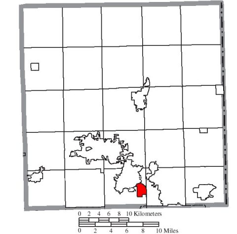
McDonald Township on the map, 1913 to 1982
Every edition of the U.S. Geological Survey’s map of McDonald Township. Tap a year, or press play to watch the town change.
1913Alger sheet · 1:62,500
U.S. Geological Survey historical topographic maps (public domain), via Esri’s collection of the scans. The red ring marks the center of McDonald Township.
Passages that mention McDonald Township, cut from the printed page as they were published.
The history of Hardin county, Ohio1883 · page 705Read the page →
Read the text
^ There is not now nor ever has been a grist mill in McDonald Township, and, in the first settling of the country, the people here had to go about twenty miles to Cherokee or West Liberty in Logan County to purchase grain and obtain their grinding. A great share of the milling was done from this section at Moot’s Mill, twenty-eight miles distant, on Mad River The first saw mill erected in this vicinity was by Jacob Kimberlin, some time prior to 1840; it was located above the village of Round Head, on the Scioto River near the McDonald Township line. Another early saw mill,
Text read by machine from the scan; it may contain errors.
The history of Hardin county, Ohio1883 · page 293Read the page →
Read the text
In 1818, Peter C. McArthur, in company with Daniel Campbell, came from Boss County to the headwaters of the Scioto Biver, and built a ca!)in on land now owned by Bobert Beed, in McDonald Township, Hardin County, Ohio. They remained a short time and then returned to Boss County with the intention of bringing out their families; but rumors of an expected Indian outbreak reaching their ears, they concluded to give up the idea for the present and remain in the older settlement. Early in 1822, the whole McArthur family came to the newly erected county of Hardin and settled
Text read by machine from the scan; it may contain errors.
Scans and text from the Internet Archive. Books published in 1930 or earlier, which are in the public domain.
Timeline
McDonald Township, 1833 to 1913
Woven from the archive, old maps, post office records, the National Register and the people born here.
Founding dates: Wikidata, Wikipedia, the U.S. post office records of Blevins & Helbock (CC0) and the Census. Homes by year built: Census ACS 2020–24. National Register of Historic Places: National Park Service (list of May 22, 2026). Old photos, postcards and papers: Wikimedia Commons, the Library of Congress and other public archives, credited on each item’s page. Maps: U.S. Geological Survey historical topographic maps (via Esri) and Sanborn fire-insurance maps (Library of Congress). History text and census tables: Wikipedia (CC BY-SA 4.0). Places that used to be: USGS Geographic Names Information System (2021). How TownRatings grades history →
From Wikimedia Commons (4), Wikipedia, U.S. Geological Survey historical maps, U.S. Census counts (via Wikipedia), the US Post Offices dataset (Blevins & Helbock), the USGS Geographic Names Information System and old county and town histories (Internet Archive). Archive images are copied here with their credits and licenses, shown on each photo’s page. Refreshed monthly.


 2015
 2010
 2010
 2004