Mantua Township dates to 1898, and 2 of its places are on the National Register
More historic than 50% of U.S. towns · #659 of 993 in Ohio. What drives it
Most of Mantua Township was built recently: 7% of its homes predate 1940 and the median home dates from 1976. 2 places in town are on the National Register, among them a historic district with 5 buildings. Below: 2 old photos and papers, maps from 1906 on, and the census since 1880.
Founding year: Wikipedia. First post office: 1850.The full story ↓
History grade
What drives Mantua Township’s History grade
On its age, its old homes and the National Register, Mantua Township is more historic than 50% of U.S. towns, #659 of 993 in Ohio. Its National Register listings hold the grade up; its age pulls it down.
B−
HistoryA character grade: shown, never part of Mantua Township’s overall grade.
Ohio towns list about as much on the Register as the country (a typical Ohio town has 2.9 per 10,000 residents, the U.S. 2.4), so Mantua Township’s 13.0 sits above most of its state (77% of Ohio towns have fewer) while its 6 historic buildings outnumber those of 72% of U.S. towns.
NoteThe founding year comes from Wikipedia alone; no second source gives 1898.
How sure. Graded on any two of the three inputs instead, the letter would range from C to B. The pre-1940 share is a Census survey estimate (±4.7 points).
Founding year: Wikipedia (other dates in Quick answers). Homes: Census ACS 2020–24. National Register: National Park Service, May 2026 list; each listing counted once (boundary changes and added documentation belong to their listing), and a historic district counts its contributing buildings. How TownRatings grades history →
What stands out about Mantua Township’s past
Read from the archive, the National Register and the record. The page puts what stands out first.
Lost post offices, old corners, places now gone and burying grounds
Three other post offices opened and closed inside today’s town.
Mantua Centre
1850–1863
Julia
1893–1904
Silo
1899–1904
18501940today
Hamlets and corners on the map
Mantua CenterMantua CornersSilo
Gone or out of use
Julia Post Officepost officeMud MillslocaleSilo Post Officepost office
3cemeteries and burying grounds inside Mantua Township
EastlawnPioneer TrailWestlawn
US Post Offices dataset (Blevins & Helbock, CC0). Places and cemeteries from the USGS Geographic Names Information System (2021).
On the map
Mantua Township on the map, 1906 to 1994
Every edition of the U.S. Geological Survey’s map of Mantua Township. Tap a year, or press play to watch the town change.
1906Chagrin Falls sheet · 1:62,500
U.S. Geological Survey historical topographic maps (public domain), via Esri’s collection of the scans. The red ring marks the center of Mantua Township.
The first settlers came to Mantua Township in 1798. The area that eventually became the village of Mantua was owned by the Tappan family of Ravenna, Ohio. The town was laid out in the 1840s as Mantua Station, a stop on the Cleveland and Mahoning Valley Railroad. It was incorporated as Mantua in 1898. Like the township, the village is named after the Italian city of Mantua, in honor of Napoleon, who had captured it in early 1797 at the end of the Siege of Mantua.
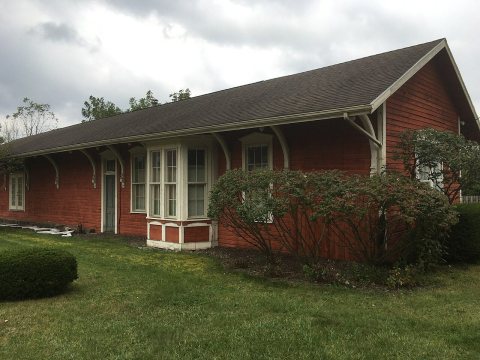
Mantua includes three properties on the National Register of Historic Places: the Horace L. Hine House, the Mantua Station Brick Commercial District, and the William H. Crafts House.
Passages that mention Mantua Township, cut from the printed page as they were published.
History of Portage County, Ohio1885 · page 229Read the page →
Read the text
The first settlement within the bounds of what is now Portage County was made in the fall of 1798, in Mantua Township, on Lot 24, by Abram S. Honev, who erected a log cabin, made a clearing, and put out a small crop of wheat' which was harvested the following season by his brother-in-law, Ruf us Edwards, who owned the land, but who had sent Honey in advance to prepare the way. A man by the name of Peter French is said to have been at the point
Text read by machine from the scan; it may contain errors.
History of Portage County, Ohio1885 · page 285Read the page →
Read the text
In 1805 Amzi Atwater siirveyed a road from his place in Mantua Township, along the south line of Hiram Township to Garrett's Mills in Nelson, and in 1806 another was cut out running westward to Aurora. About the same time a road was cut through Windham Township to Braceville, running thence to Warren, and is now known as the State Road. In 1808 Alva Day, of Deerfield Township, and Charles Chittenden, and Cromwell and Walter Dickinson, of Randolph Township, cut out and bridged the road from old Portage to the Seventeenth Range, west of Medina. In 1809 Erastus Carter, of Ravenna,
Text read by machine from the scan; it may contain errors.
Scans and text from the Internet Archive. Books published in 1930 or earlier, which are in the public domain.
Timeline
Mantua Township, 1814 to 1988
Woven from the archive, old maps, post office records, the National Register and the people born here.
Nothing in the archives for these yearsWeddings on Main Street, storms, parades, school pictures, the old store. If it’s in your family album, it belongs here.
Nothing in the archives for these yearsWeddings on Main Street, storms, parades, school pictures, the old store. If it’s in your family album, it belongs here.
In 1898, according to Wikipedia’s history of the town. Mantua Township’s post office opened in 1850, and the census of 1880 counted 215 people here.
How does Mantua Township rank for history?
Mantua Township is more historic than 50% of U.S. towns, #659 of 993 in Ohio. The History grade combines the town’s founding era, the share of homes built before 1940 and its National Register listings. It’s a character grade, so it isn’t part of the overall grade. How it works.
What is on the National Register in Mantua Township?
Two places: the Mantua Center School (listed 2013) and the Mantua Center District (2023).
How old are the homes in Mantua Township?
7% of Mantua Township’s homes were built before 1940 (Census estimate, ±4.7 points), against a typical 15% for an Ohio town; the median home was built in 1976.
Founding dates: Wikidata, Wikipedia, the U.S. post office records of Blevins & Helbock (CC0) and the Census. Homes by year built: Census ACS 2020–24. National Register of Historic Places: National Park Service (list of May 22, 2026). Old photos, postcards and papers: Wikimedia Commons, the Library of Congress and other public archives, credited on each item’s page. Maps: U.S. Geological Survey historical topographic maps (via Esri) and Sanborn fire-insurance maps (Library of Congress). History text and census tables: Wikipedia (CC BY-SA 4.0). Places that used to be: USGS Geographic Names Information System (2021).
From Wikimedia Commons (12), the National Register of Historic Places (2), Wikipedia, Wikidata and Wikipedia for famous people, U.S. Geological Survey historical maps, U.S. Census counts (via Wikipedia), the US Post Offices dataset (Blevins & Helbock), the USGS Geographic Names Information System and old county and town histories (Internet Archive). Archive images are copied here with their credits and licenses, shown on each photo’s page. Refreshed monthly.


 2019
 2019
 2019
 2015
 2015
 2015
 2014
 2008
 2008
 2004

