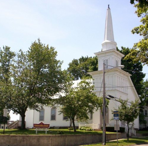
Lexington dates to 1812, and 1 of its places is on the National Register
More historic than 66% of U.S. towns · #470 of 993 in Ohio. What drives it
Most of Lexington was built recently: 8% of its homes predate 1940 and the median home dates from 1975. Its Register listing is the First Congregational Church And Lexington School. Below: maps from 1915 on and the census since 1870.
Founding year: Wikidata; Wikipedia’s history section gives the same year. First post office: 1813.The full story ↓
History grade
What drives Lexington’s History grade
On its age, its old homes and the National Register, Lexington is more historic than 66% of U.S. towns, #470 of 993 in Ohio. Its age holds the grade up; its share of homes from before 1940 pulls it down.
B+
HistoryA character grade: shown, never part of Lexington’s overall grade.
Ohio towns list about as much on the Register as the country (a typical Ohio town has 2.9 per 10,000 residents, the U.S. 2.4), so Lexington’s 4.2 sits near the middle of its state (62% of Ohio towns have fewer) while its 2 historic buildings outnumber those of 60% of U.S. towns.
How sure. Graded on any two of the three inputs instead, the letter would range from B− to B+. The pre-1940 share is a Census survey estimate (±5.4 points). Two sources give 1812.
Founding year: Wikidata (other dates in Quick answers). Homes: Census ACS 2020–24. National Register: National Park Service, May 2026 list; each listing counted once (boundary changes and added documentation belong to their listing), and a historic district counts its contributing buildings. How TownRatings grades history →
What stands out about Lexington’s past
Read from the archive, the National Register and the record. The page puts what stands out first.
Lexington was founded by Amariah Watson Jr. in 1812, a land speculator who had purchased wide lands locally in order to sell to other settlers. During the 1800s, Lexington had many taverns, hotels, and grist mills—most of which at one time or another burned to the ground. In the 19th century, leading members of the community were William Cockley Thad and Martin Kell, Les Griebling, Erwin Castor, Sgt. Patrick Gass, and Jacob Cook. The first road constructed through town was what is now State Route 97, and the second was what is now Lexington-Ontario Road.
Passages that mention Lexington, cut from the printed page as they were published.
A centennial biographical history of Richland county, Ohio1901 · page 65Read the page →
Read the text
Lexington has always been noted for the culture and social standing of its people. The village is beautifully situated upon an elevation of gentle slope and the Clear Fork of the Mohican laves its eastern boundary. The town was named for historic Lexington, where the first battle for political freedom on the American continent was fought April 19, 1775 — a battle that put an end to the long dispute between the colonies and Great Britain and inaugurated the war of the Revolution. Lexington was laid out in 181 2, on land owned by Amariah Watson, who built the first house — a log cabin — in
Text read by machine from the scan; it may contain errors.
History of Richland County, Ohio1880 · page 602Read the page →
Read the text
county ; and this trail was established some time before the township was settled. Soon after the first settlement, a second road was cut from the vicinity of Lexington toward Bellville. The first public-house in the township was opened at a very early day, hy Thomas Laughlin, on the State road, about six miles south of Mansfield, near the center of the township, and
Text read by machine from the scan; it may contain errors.
History of Richland County, Ohio, from 1808 to 1908. Also biographical sketches of prominent citizens of the county1908 · page 1169Read the page →
Read the text
schools, the little temple of learning in which he began his studies being a log schoolhouse. The advantages which he received were somewhat better as the years went on and after he left the army he benefited by a course of instruction in the Lexington Seminary at Lexington, Ohio. He was but a youth when in response to the country's call his patriotic spirit was aroused and he joined the army, enlisting as a member of Company C, One Hundred and Sixty-third Ohio Volunteer Infantry, under Captain Cockley, of Lexington, Ohio. He did active duty with the Eastern Army under Grant in
Text read by machine from the scan; it may contain errors.
county ; and this trail was established some time before the township was settled. Soon after the first settlement, a second road was cut from the vicinity of Lexington toward Bellyille. The first public-house in fhe township was opened at a very early day, by Thomas Laughlin, on the State road, about six miles south of Mansfield, near the center of the township, and
Text read by machine from the scan; it may contain errors.
Scans and text from the Internet Archive. Books published in 1930 or earlier, which are in the public domain.
In 1812, according to Wikidata and Wikipedia’s history of the town. Lexington’s post office opened in 1813, and the census of 1870 counted 482 people here.
How does Lexington rank for history?
Lexington is more historic than 66% of U.S. towns, #470 of 993 in Ohio. The History grade combines the town’s founding era, the share of homes built before 1940 and its National Register listings. It’s a character grade, so it isn’t part of the overall grade. How it works.
What is on the National Register in Lexington?
One place: the First Congregational Church And Lexington School (listed 1979).
How old are the homes in Lexington?
8% of Lexington’s homes were built before 1940 (Census estimate, ±5.4 points), against a typical 15% for an Ohio town; the median home was built in 1975.
Founding dates: Wikidata, Wikipedia, the U.S. post office records of Blevins & Helbock (CC0) and the Census. Homes by year built: Census ACS 2020–24. National Register of Historic Places: National Park Service (list of May 22, 2026). Old photos, postcards and papers: Wikimedia Commons, the Library of Congress and other public archives, credited on each item’s page. Maps: U.S. Geological Survey historical topographic maps (via Esri) and Sanborn fire-insurance maps (Library of Congress). History text and census tables: Wikipedia (CC BY-SA 4.0). Places that used to be: USGS Geographic Names Information System (2021).
From Wikimedia Commons (6), the National Register of Historic Places (1), Wikipedia, Wikidata and Wikipedia for famous people, U.S. Geological Survey historical maps, U.S. Census counts (via Wikipedia), the US Post Offices dataset (Blevins & Helbock), the USGS Geographic Names Information System and old county and town histories (Internet Archive). Archive images are copied here with their credits and licenses, shown on each photo’s page. Refreshed monthly.
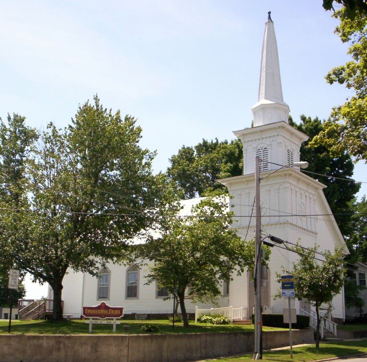


 2007
 2007
 2007
 2007
 2007
 2004