The Lewisburg post office opened in 1845, the earliest record of the town by name. Two smaller post offices, Lewisburgh (1824) and Euphemia (1845), opened inside today’s town and later closed.
First census: 355 in 18502020 census: 1,745181 years
How historic is Lewisburg?
A
More historic than 86% of U.S. towns, on its age, its old homes and the National Register.
Founding year: the first Lewisburg post office (Blevins & Helbock, CC0).The full story ↓
History grade
What drives Lewisburg’s History grade
On its age, its old homes and the National Register, Lewisburg is more historic than 86% of U.S. towns. All 3 inputs are above most U.S. towns; its share of homes from before 1940 ranks highest and its National Register listings lowest.
A
HistoryA character grade: shown, never part of Lewisburg’s overall grade.
Ohio towns list about as much on the Register as the country (a typical Ohio town has 2.9 per 10,000 residents, the U.S. 2.4), so Lewisburg’s 5.2 sits near the middle of its state (65% of Ohio towns have fewer) while its 1 listings outnumber those of 51% of U.S. towns.
How sure. Graded on any two of the three inputs instead, the letter would range from B+ to A. The pre-1940 share is a Census survey estimate (±5.4 points). The founding year is the first post office, not a stated founding date.
Founding year: the first post office (other dates in Quick answers). Homes: Census ACS 2020–24. National Register: National Park Service, May 2026 list; each listing counted once (boundary changes and added documentation belong to their listing), and a historic district counts its contributing buildings. How TownRatings grades history →
What stands out about Lewisburg’s past
Read from the archive, the National Register and the record. The page puts what stands out first.
Lost post offices, old corners and places now gone
Lewisburg’s post office has been open since 1845. Two other post offices opened and closed inside today’s town.
Lewisburgh
1824–1845
Euphemia
1845–1911
Lewisburg
1845–today
18201920today
Hamlets and corners on the map
Euphemia
Gone or out of use
Euphemia Post Officepost office
US Post Offices dataset (Blevins & Helbock, CC0). Places and cemeteries from the USGS Geographic Names Information System (2021).
Every building
Lewisburg, building by building, 1895–1920
Fire insurance maps drew every building, what it was made of and what it was used for, so insurers could price the risk of fire. Pick a year, then a sheet.
Lewisburg was founded soon after Harrison Township was organized in 1816.
In 1833, Lewisburg contained one Lutheran church, four stores, two taverns, two physicians, one botanical practitioner, two merchant mills, forty dwelling houses, and about 200 inhabitants.
The community was named for Lewisburg, Virginia (now in West Virginia). In about 1836, pioneer John Mumma founded the community of Euphemia, named for his wife, to the north of Lewisburg on the National Road. The villages officially merged on April 4, 1916, and the combined community retained the name of Lewisburg.
was a farmer, he invested in a tobacco warehouse at Lewisburg and finally moved to Lewisburg, where he became engaged in the buying and packing of leaf tobacco for the market and now employs fifty people. He has forty acres of land, part of which is in the town of Lewisburg and owns a residence and other property in Lewisburg. He is a shareholder of the telephone company, and the electric light company and is president and a director in the former company and director in the latter.
Text read by machine from the scan; it may contain errors.
was rebuilt and has long since been known as the old Turner mill. Henry Horn also built a saw-mill, still-house and tannery. Being interested in the organization of a town, he made a plat consisting of twenty-eight lots and on September 7. 1818, he laid out the town of Lewisburg, naming it after an old town in Virginia. The first church was erected in 1820, on the spot where Roselawn cemetery is now located. It was a log church and the logs were hewn by Mr. Beard. The pioneer settlers came from miles around to the “raising,” accompanied by their wives and daughters. Reverend Espech
Text read by machine from the scan; it may contain errors.
Scans and text from the Internet Archive. Books published in 1930 or earlier, which are in the public domain.
Timeline
Lewisburg, 1824 to 1965
Woven from the archive, old maps, post office records, the National Register and the people born here.
Nothing in the archives for these yearsWeddings on Main Street, storms, parades, school pictures, the old store. If it’s in your family album, it belongs here.
The Lewisburg post office opened in 1845, the earliest record of the town by name (U.S. post office records).
How does Lewisburg rank for history?
Lewisburg is more historic than 86% of U.S. towns. The History grade combines the town’s founding era, the share of homes built before 1940 and its National Register listings. It’s a character grade, so it isn’t part of the overall grade. How it works.
What is on the National Register in Lewisburg?
One place: the Euphemia Inn and Tavern (listed 2024).
How old are the homes in Lewisburg?
32% of Lewisburg’s homes were built before 1940 (Census estimate, ±5.4 points), against a typical 15% for an Ohio town; the median home was built in 1959.
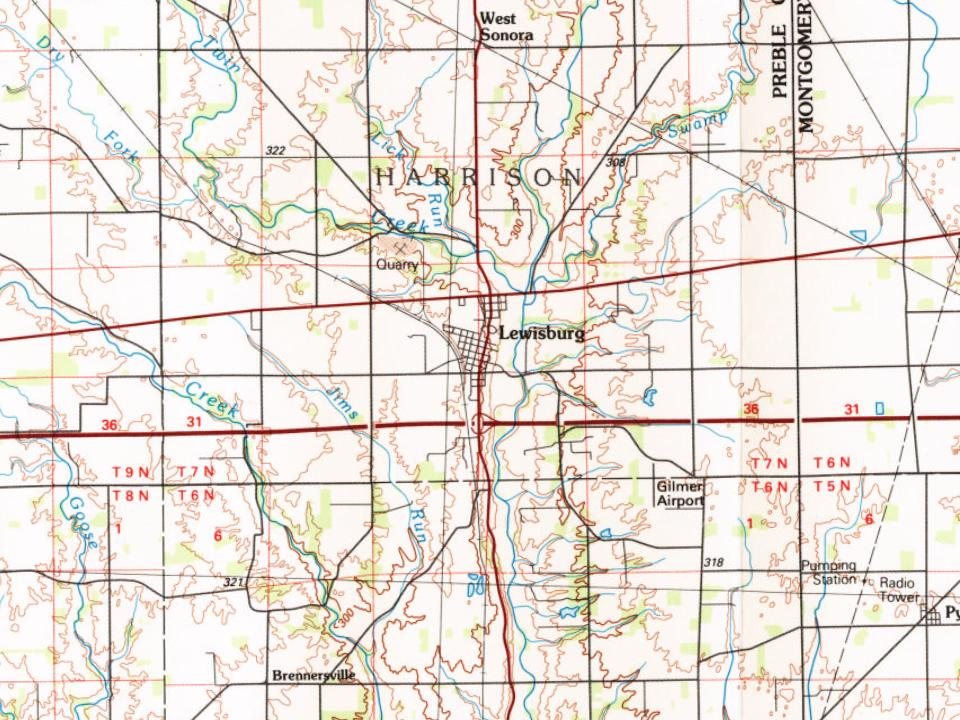
Founding dates: Wikidata, Wikipedia, the U.S. post office records of Blevins & Helbock (CC0) and the Census. Homes by year built: Census ACS 2020–24. National Register of Historic Places: National Park Service (list of May 22, 2026). Old photos, postcards and papers: Wikimedia Commons, the Library of Congress and other public archives, credited on each item’s page. Maps: U.S. Geological Survey historical topographic maps (via Esri) and Sanborn fire-insurance maps (Library of Congress). History text and census tables: Wikipedia (CC BY-SA 4.0). Places that used to be: USGS Geographic Names Information System (2021).
From Wikimedia Commons (6), the National Register of Historic Places (1), Wikipedia, Wikidata and Wikipedia for famous people, U.S. Geological Survey historical maps, U.S. Census counts (via Wikipedia), the US Post Offices dataset (Blevins & Helbock), the USGS Geographic Names Information System, Sanborn fire insurance maps (Library of Congress) and old county and town histories (Internet Archive). Archive images are copied here with their credits and licenses, shown on each photo’s page. Refreshed monthly.


 2018
 2018
 2015
 2004